The Tropical Cyclones Portal
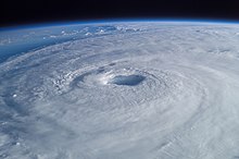
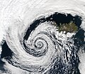
A tropical cyclone is a storm system characterized by a large low-pressure center, a closed low-level circulation and a spiral arrangement of numerous thunderstorms that produce strong winds and heavy rainfall. Tropical cyclones feed on the heat released when moist air rises, resulting in condensation of water vapor contained in the moist air. They are fueled by a different heat mechanism than other cyclonic windstorms such as Nor'easters, European windstorms and polar lows, leading to their classification as "warm core" storm systems. Most tropical cyclones originate in the doldrums, approximately ten degrees from the Equator.
The term "tropical" refers to both the geographic origin of these systems, which form almost exclusively in tropical regions of the globe, as well as to their formation in maritime tropical air masses. The term "cyclone" refers to such storms' cyclonic nature, with anticlockwise rotation in the Northern Hemisphere and clockwise rotation in the Southern Hemisphere. Depending on its location and intensity, a tropical cyclone may be referred to by names such as "hurricane", "typhoon", "tropical storm", "cyclonic storm", "tropical depression" or simply "cyclone".
Types of cyclone: 1. A "Typhoon" is a tropical cyclone located in the North-west Pacific Ocean which has the most cyclonic activity and storms occur year-round. 2. A "Hurricane" is also a tropical cyclone located at the North Atlantic Ocean or North-east Pacific Ocean which have an average storm activity and storms typically form between May 15 and November 30. 3. A "Cyclone" is a tropical cyclone that occurs in the South Pacific and Indian Oceans.
Selected named cyclone -
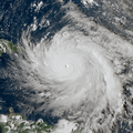
Hurricane Lenny was the strongest November Atlantic hurricane since the 1932 Cuba hurricane. It was the twelfth tropical storm, eighth hurricane, and record-breaking fifth Category 4 hurricane in the 1999 Atlantic hurricane season. Lenny formed on November 13 in the western Caribbean Sea at around 18:00 UTC and went on to form and maintain an unusual and unprecedented easterly track for its entire duration, which gave it the common nickname, "Wrong Way Lenny". It attained hurricane status south of Jamaica on November 15 and passed south of Hispaniola and Puerto Rico over the next few days. Lenny rapidly intensified over the northeastern Caribbean on November 17, attaining peak winds of 155 mph (249 km/h) about 21 mi (34 km) south of Saint Croix in the United States Virgin Islands. It gradually weakened while moving through the Leeward Islands, eventually dissipating on November 23 over the open Atlantic Ocean.
Before moving through the Lesser Antilles, Lenny produced rough surf that killed two people in northern Colombia. Strong winds and rainfall resulted in heavy crop damage in southeastern Puerto Rico. Despite the hurricane's passage near Saint Croix at peak intensity, damage on the small island was only described as "moderate", although there was widespread flooding and erosion. Damage in the United States territories totaled about $330 million. The highest precipitation total was 34.12 in (867 mm) at the police station on the French side of Saint Martin. On the island, the hurricane killed three people and destroyed more than 200 properties. In nearby Antigua and Barbuda, the hurricane killed one person; torrential rainfall there contaminated the local water supply. Significant storm damage occurred as far south as Grenada, where high surf isolated towns from the capital city. (Full article...)Selected article -
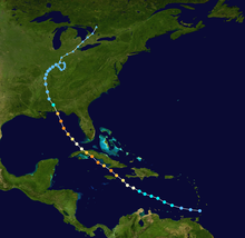
The meteorological history of Hurricane Dennis spanned twenty-two days, beginning with its inception as a tropical wave over Africa on June 26, 2005, and terminating with its dissipation on July 18 over the Great Lakes of North America. The incipient wave that became Dennis emerged over the Atlantic Ocean on June 29 and moved briskly to the west. Dry air initially inhibited development, though once this abated the wave was able to consolidate into a tropical depression on July 4. The depression soon crossed Grenada before entering the Caribbean whereupon increasingly favorable environmental factors, such as low wind shear and high sea surface temperatures, fueled intensification. Turning west-northwest, the system achieved tropical storm status on July 5 and hurricane status the following day.
Formation of a well-defined eye and central dense overcast signaled Dennis's intensification into a major hurricane. The powerful storm soon struck Granma Province, Cuba, as a Category 4 early on July 8; violent winds battered the province and caused extensive damage. Paralleling the western coast of Cuba, Dennis attained its peak winds of 150 mph (240 km/h) later that day before making a second landfall in the country, this time in Matanzas Province. Interaction with the mountains of Cuba caused significant weakening; however, once Dennis emerged over the Gulf of Mexico on July 9, it was able to quickly reorganize. The hurricane reached Category 4 strength for a third time on July 10 as it approached Florida, weakening somewhat before striking the state. Dramatic weakening ensued once the cyclone moved ashore. Dennis lingered as a tropical depression and remnant low for roughly a week, traversing the Mississippi River Valley and Ohio River Valley before finally dissipating over Ontario on July 18. (Full article...)Selected image -

Selected season -

The 1933 Atlantic hurricane season is the most active Atlantic hurricane season on record in terms of accumulated Cyclone Energy (ACE), with a total of 259. It also set a record for nameable tropical storms in a single season, 20, which stood until 2005, when there were 28 storms. The season ran for six months of 1933, with tropical cyclone development occurring as early as May and as late as November. A system was active for all but 13 days from June 28 to October 7.
Because technologies such as Earth observation satellites were not available until the 1960s, historical data on tropical cyclones from the early 20th century is often incomplete. Tropical cyclones that did not approach populated areas or shipping lanes, especially if they were relatively weak and of short duration, may have remained undetected. Compensating for the lack of comprehensive observation and the limited technological ability to monitor all tropical cyclone activity in the Atlantic Basin during this era, research meteorologist Christopher Landsea estimates that the 1933 season may have produced an additional 2–3 missed tropical cyclones. A 2013 reanalysis of the 1933 Atlantic Hurricane Database did indeed identify two new tropical storms; however, it was also determined that two existing cyclones did not reach tropical storm intensity and so were removed from the database. Additionally, researchers found two existing storms to be one continuous system. As a result, the season storm total dropped from 21 to 20. (Full article...)Related portals
Currently active tropical cyclones

Italicized basins are unofficial.
- North Atlantic (2024)
- No active systems
- East and Central Pacific (2024)
- No active systems
- West Pacific (2024)
- No active systems
- North Indian Ocean (2024)
- No active systems
- Mediterranean (2023–24)
- No active systems
- South-West Indian Ocean (2023–24)
- No active systems
- Australian region (2023–24)
- No active systems
- South Pacific (2023–24)
- No active systems
- South Atlantic (2023–24)
- No active systems
Last updated: 21:50, 2 June 2024 (UTC)
Tropical cyclone anniversaries
June 5
- 1890 - A cyclone struck northeastern Oman, killing 727 people from its floods.
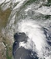
- 2001 - Tropical Storm Allison (pictured) formed over the northern Gulf of Mexico and made landfall in Southeast Texas. Allison caused record levels of rainfall along much of its path, with the resulting flooding killing 41 people and causing US$5.5 billion of damage, making Allison the costliest tropical storm on record.
- 2003 - Cyclone Epi developed east of Papua New Guinea.

June 6
- 1994 - Tropical Storm Russ moved across Hainan Island and southern China, killing 72 people and leaving US$727.5&bsp;million in damage.
- 1999 - Typhoon Maggie made landfall in China, and along its path the storm killed nine people.
- 2012 - Tropical Storm Kuena (pictured) became a rare June tropical storm in the South-West Indian Ocean.

June 7,
- 1973 - Hurricane Ava reached its peak intensity as a Category 5 hurricane, becoming the only Pacific hurricane to attain that intensity in the month of June.
- 2003 - Cyclone Gina (pictured) reaches its peak intensity as a Category 3 severe tropical cyclone after affecting the Solomon Islands with only minimal damages.
Did you know…
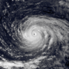


- …that the Joint Typhoon Warning Center considers that Typhoon Vera (pictured) of 1986 is actually two distinct systems, formed from two separated low-level circulations?
- …that Hurricane Agatha (pictured) was the strongest Pacific hurricane to make landfall in Mexico in May since records began in 1949?
- …that Cyclone Raquel (track pictured) travelled between the Australian and South Pacific basins between the 2014–15 and 2015–16 seasons, spanning both seasons in both basins?
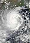
- …that Cyclone Amphan (pictured) in 2020 was the first storm to be classified as a Super Cyclonic Storm in the Bay of Bengal since 1999?
General images -
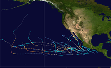
The 2018 Pacific hurricane season was an event in the annual cycle of tropical cyclone formation, in which tropical cyclones form in the eastern Pacific Ocean. The season officially started on May 15 in the eastern Pacific—east of 140°W—and began on June 1 in the central Pacific—the region between the International Date Line and 140°W, and ended on November 30. These dates typically cover the period of each year when most tropical cyclones form in the eastern Pacific basin. The season began with the formation of Tropical Depression One-E, which developed on May 10, and ended with the dissipation of the season's final storm, Tropical Storm Xavier, which dissipated as a tropical cyclone on November 5.
The 2018 hurricane season was exceptionally active and featured the highest Accumulated Cyclone Energy since reliable records began in 1971. Throughout the season, 26 tropical depressions developed, 23 of which became tropical storms. A total of 13 tropical storms reached hurricane strength, and 10 hurricanes achieved major hurricane intensity.[1] The basin saw above-average activity across all regions from the International Date Line to the west coast of Mexico and Central America. Activity peaked from early August to early October, with several long-lived and powerful hurricanes developing in that time period. Several storms severely affected land, such as Hurricane Lane in Hawaii and Hurricane Willa in Mexico. In contrast to the similarly active 2015 Pacific hurricane season, 2018 was not significantly influenced by the El Niño–Southern Oscillation. Instead, low pressures and increased sea surface temperatures associated with the Pacific Meridional Mode supported the development of these intense and long-lived storms. (Full article...)Topics
Subcategories
Related WikiProjects
WikiProject Tropical cyclones is the central point of coordination for Wikipedia's coverage of tropical cyclones. Feel free to help!
WikiProject Weather is the main center point of coordination for Wikipedia's coverage of meteorology in general, and the parent project of WikiProject Tropical cyclones. Three other branches of WikiProject Weather in particular share significant overlaps with WikiProject Tropical cyclones:
- The Non-tropical storms task force coordinates most of Wikipedia's coverage on extratropical cyclones, which tropical cyclones often transition into near the end of their lifespan.
- The Floods task force takes on the scope of flooding events all over the world, with rainfall from tropical cyclones a significant factor in many of them.
- WikiProject Severe weather documents the effects of extreme weather such as tornadoes, which landfalling tropical cyclones can produce.
Things you can do
 |
Here are some tasks awaiting attention:
|
Wikimedia
The following Wikimedia Foundation sister projects provide more on this subject:
-
Commons
Free media repository -
Wikibooks
Free textbooks and manuals -
Wikidata
Free knowledge base -
Wikinews
Free-content news -
Wikiquote
Collection of quotations -
Wikisource
Free-content library -
Wikiversity
Free learning tools -
Wikivoyage
Free travel guide -
Wiktionary
Dictionary and thesaurus
- ^ National Hurricane Center; Hurricane Research Division; Central Pacific Hurricane Center (April 26, 2024). "The Northeast and North Central Pacific hurricane database 1949–2023". United States National Oceanic and Atmospheric Administration's National Weather Service. Archived from the original on May 29, 2024. A guide on how to read the database is available here.
 This article incorporates text from this source, which is in the public domain.

