Highway 14 is a highway in the Canadian province of Saskatchewan. It runs from the Alberta border where it becomes Highway 13 to intersection of Circle Drive and 22nd Street in Saskatoon. It is approximately 250 km (160 mi) long.
Highway 14 | ||||
|---|---|---|---|---|
| Route information | ||||
| Maintained by Ministry of Highways and Infrastructure & Transport Canada | ||||
| Length | 249.8 km[1] (155.2 mi) | |||
| Major junctions | ||||
| West end | ||||
| East end | ||||
| Location | ||||
| Country | Canada | |||
| Province | Saskatchewan | |||
| Major cities | Saskatoon | |||
| Towns | Macklin, Unity, Wilkie, Biggar | |||
| Highway system | ||||
|
| ||||
| ||||
.svg)
Prior to 1976, Highway 14 ran the width of the province, continuing east from Saskatoon to the Manitoba border where it transitioned to PTH 4. In 1970, the portion of Highway 14 east of Saskatoon was made part of the Yellowhead Highway along with the section of Highway 5 running west of Saskatoon. Six years later, in 1976, these two sections were re-designated as Highway 16 so that the Yellowhead Highway would carry one number through the four Western provinces (Manitoba would follow suit the next year, redesignating PTH 4 to PTH 16).
Though Highway 14 is one of the three major highways leading from Saskatoon to Alberta, it is less used than Highway 7 or Highway 16 as the other highways provide direct access to Calgary and Edmonton respectively.
Major communities that Highway 14 passes through are Macklin, Unity, Wilke, Biggar, Asquith, and Saskatoon.[2]
Photo gallery edit
-
 Old Hwy 14 signage in Downtown Saskatoon
 -
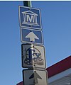 Directions to the Western Development Museum and the Exhibition, Saskatoon
 -
 High Collision location strictly enforced
 -
 Hwy 14 near Unity.


Major intersections edit
From west to east:[3]
| Rural municipality | Location | km[1] | mi | Destinations | Notes | |||
|---|---|---|---|---|---|---|---|---|
| Eye Hill No. 382 | | 0.0 | 0.0 | Continuation into Alberta | ||||
| | 3.6 | 2.2 | ||||||
| Macklin | 5.2 | 3.2 | ||||||
| | 18.5 | 11.5 | Senlac Access Road | |||||
| Senlac No. 411[a] Grass Lake No. 381[b] | | 27.0 | 16.8 | |||||
| | 38.5 | 23.9 | West end of Hwy 675 concurrency | |||||
| Round Valley No. 410 | | 46.8 | 29.1 | East end of Hwy 675 concurrency | ||||
| Unity | 62.8 | 39.0 | ||||||
| Buffalo No. 409[a] Tramping Lake No. 380[b] | | 84.8 | 52.7 | |||||
| Buffalo No. 409[a] Reford No. 379[b] | Wilkie | 92.9 | 57.7 | |||||
| Reford No 379 | | 103.7 | 64.4 | |||||
| Landis | 124.3 | 77.2 | West end of Hwy 656 concurrency | |||||
| Rosemount No. 378 | | 125.9 | 78.2 | East end of Hwy 656 concurrency | ||||
| Biggar No. 347 | Biggar | 159.8 | 99.3 | West end of Hwy 4 concurrency | ||||
| 160.8 | 99.9 | East end of Hwy 4 concurrency | ||||||
| Perdue No. 346 | Perdue | 191.0 | 118.7 | West end of Hwy 655 concurrency | ||||
| | 194.0 | 120.5 | East end of Hwy 655 concurrency | |||||
| ↑ / ↓ | | 210.7 | 130.9 | |||||
| Vanscoy No. 345 | Asquith | 215.6 | 134.0 | |||||
| | 223.7 | 139.0 | West end of Hwy 672 concurrency | |||||
| | 231.8 | 144.0 | East end of Hwy 672 concurrency | |||||
| Corman Park No. 344 |
No major junctions | |||||||
| City of Saskatoon | 246.7 | 153.3 | West end of Hwy 7 concurrency; becomes 22nd Street W | |||||
| 249.8 | 155.2 | Hwy 7 / Hwy 14 eastern terminus;[4] access to Saskatoon International Airport | ||||||
| 253.2 | 157.3 | 22nd Street E | Former Hwy 7 / Hwy 14 eastern terminus | |||||
1.000 mi = 1.609 km; 1.000 km = 0.621 mi
| ||||||||
Footnotes edit
References edit
- ^ a b Google. "Highway 14 in Saskatchewan" (Map). Google Maps. Google.
- ^ Saskatchewan Official Road Map (Map) (2015/2016 ed.). Saskatchewan Government. § A-4, B-4, C-4
- ^ MapArt (2007). Saskatchewan Road Atlas (Map) (2007 ed.). 1:540,000. Oshawa, ON: Peter Heiler Ltd. pp. 22, 23, 31, 32. ISBN 1-55368-020-0.
- ^ Google (October 2015). "22nd Street W - Saskatoon, Saskatchewan". Google Street View. Retrieved April 30, 2016.
{{cite web}}:|author=has generic name (help)