Raghunathpur is a city and a municipality in Purulia district in the state of West Bengal, India. It is the headquarters of the Raghunathpur subdivision. Industrial City Raghunathpur is located near Adra on the North-East part of Purulia district. It is connected with other cities through five main way road's, which are Purulia – Barakar road, Raghunathpur-Adra-Hura road, Raghunathpur-Chas road, Cheliyama road and Raghunathpur-Bankura road. The nearest main junction stations are Joychandi Pahar railway station and Adra Junction railway station.
Raghunathpur | |
|---|---|
Town | |
.jpg) | |
 Raghunathpur Location in West Bengal, India  Raghunathpur Raghunathpur (India) | |
| Coordinates: 23°33′N 86°40′E / 23.55°N 86.67°E | |
| Country | |
| State | West Bengal |
| District | Purulia |
| Government | |
| • Type | Municipality |
| • Body | Raghunathpur Municipality |
| Area | |
| • Total | 12.95 km2 (5.00 sq mi) |
| Elevation | 155 m (509 ft) |
| Population (2011) | |
| • Total | 25,932 |
| • Density | 2,000/km2 (5,200/sq mi) |
| Languages | |
| • Official | Bengali, English |
| Time zone | UTC+5:30 (IST) |
| PIN | 723 133 |
| Telephone code | 91 3251 |
| Lok Sabha constituency | Bankura |
| Vidhan Sabha constituency | Raghunathpur, Para |
| Website | purulia |
History edit
This section needs expansion. You can help by adding to it. (July 2023) |

Geography edit


5miles
Reservoir
Hill
M: municipal town, CT: census town, R: rural/ urban centre, H: historical/ religious centre, T: tourist centre
Owing to space constraints in the small map, the actual locations in a larger map may vary slightly
Location edit
Raghunathpur is located at 23°33′N 86°40′E / 23.55°N 86.67°E.[2] It has an average elevation of 155 m (509 ft). The area forms the lowest step of the Chota Nagpur Plateau. The general scenario is undulating land with scattered hills.[3]
Area overview edit
Purulia district forms the lowest step of the Chota Nagpur Plateau. The general scenario is undulating land with scattered hills.[3] Raghunathpur subdivision occupies the northern part of the district. 83.80% of the population of the subdivision lives in rural areas. However, there are pockets of urbanization and 16.20% of the population lives in urban areas. There are 14 census towns in the subdivision.[4] It is presented in the map given alongside. There is a coal mining area around Parbelia[5] and two thermal power plants are there – the 500 MW Santaldih Thermal Power Station[6] and the 1200 MW Raghunathpur Thermal Power Station. The subdivision has a rich heritage of old temples, some of them belonging to the 11th century or earlier. The Banda Deul is a monument of national importance.[7][8] The comparatively more recent in historical terms, Panchkot Raj has interesting and intriguing remains in the area.[9][10]
Note: The map alongside presents some of the notable locations in the subdivision. All places marked in the map are linked in the larger full screen map.
Civic administration edit
Police stations edit
Raghunathpur police station has jurisdiction over Raghunathpur municipality and parts of the Raghunathpur I CD block. The area covered is 337 km2 and the population covered is 197,430.[11][12]
Raghunathpur Women police station.[13] It will cover all the police stations areas of Raghunathpur subdivision.[14]
Adra Police station has jurisdiction over some parts of Arrah and Sanka areas.
CD block HQ edit
The headquarters of the Raghunathpur I CD block are located at Raghunathpur.[15]
Administration edit
Raghunathpur town area falls under Raghunathpur Municipality.
Some parts of Raghunathpur are in intermediate panchayat in Purulia district, with Arrah, Babugram, Bero, Choprahari, Khajura, Nutandi, Sanka, Barrah, Cheliama, Jotadih, Mangaldah-Mautore, Nildih, and Nutandih village panchayats under it.[16]
Demographics edit
Raghunathpur total area covers 12.95 km2 and at present 13 nos of Ward.[1] Raghunathpur had a total population of 25,932 in 2011. Out of this 11,326 were males and 10,486 were females. 2,640 persons were below the age of 6 years. 13,317 persons were literate.[17]
Economy edit
Damodar Valley Corporation has planned for a power plant at Raghunathpur as a proposed greenfield plant in the 11th plan. The first stage would be 2 X 600 MW.[18]
Representatives of the Jai Balaji group[19] visited the Raghunathpur on 11 January 2007 to see the sites for their proposed steel, cement and power plants.[20]
A steel plant of 5 million tons capacity along with a cement plant with capacity of 3000,000 tons will be set up at block one in Raghunathpur. The Jai Balaji group will be setting up these projects worth Rs 16,000 crore with a captive power plant on 3,800 acres (15 km2) of land. Adhunik group will set up an 1,100,000 ton capacity steel plant along with a 1000,000 ton cement plant. The project covering an area of nearly 2,400 acres (9.7 km2) will also comprise a captive power plant involving an investment of Rs 6400 crore. The state cabinet approved the industrial projects on 22 August 2007.[21]
The state government has acquired 1,100 acres (4.5 km2) of land against the requirement of 3,300 acres (13 km2). The land acquired was handed over to Jai Balaji group in October 2009. The state government was acquiring the balance portion of the land,[22] In the first phase the Jai Balaji group will begin with coal mining at Asansol and sponge iron production at Raghunathpur. The company expects to start production in 2011.[23][24]
Education edit
Raghunathpur College was established in 1961. Affiliated with the Sidho Kanho Birsha University, it offers honours courses in Bengali, Sanskrit, English, economic, geography, history, political science, sociology, accountancy, physics, chemistry, mathematics, botany, zoology and general courses in arts, science and commerce.[25][26]
Raghunathpur has a number of Educational Institutions. They are [citation needed]
- Raghunathpur Gobinda Das Lang Institution
- Raghunathpur Girls High School
- Raghunathpur High School
- Gogra High school
- Babugram high School
- Sankra High School
- Raghunathpur Municipal Managed High School
References edit
- ^ a b "Raghunathpur Info".
- ^ Falling Rain Genomics, Inc - Raghunathpur
- ^ a b Houlton, Sir John, Bihar, the Heart of India, 1949, p. 170, Orient Longmans Ltd.
- ^ "District Statistical Handbook 2014 Purulia". Tables 2.1, 2.2. Department of Planning and Statistics, Government of West Bengal. Retrieved 12 January 2020.
- ^ "Area wise Closed User Group (CUG) Telephone Numbers" (PDF). Sodepur Area. Eastern Coalfields Limited. Retrieved 11 August 2018.
- ^ "Santaldih Thermal Power Station - WBPDCL". WBPDCL. Retrieved 24 August 2011.
- ^ "Old temple at Banda (locally known as deul)". ASI, Kolkata Circle. Retrieved 23 January 2020.
- ^ "List of Ancient Monuments and Archaeological Sites and Remains of West Bengal - Archaeological Survey of India". Item no. 134. ASI. Retrieved 25 January 2020.
- ^ "Capital in shambles: Garh Panchakot, Purulia". Heritage in Peril. Retrieved 1 December 2016.
- ^ "Historical ruins". Trek Earth. Retrieved 1 December 2016.
- ^ "District Statistical Handbook 2014 Purulia". Tables 2.1, 2.2. Department of Statistics and Programme Implementation, Government of West Bengal. Archived from the original on 29 July 2017. Retrieved 10 October 2016.
- ^ "Raghunathpur PS". Purulia District Police. Retrieved 10 October 2016.
- ^ "Raghunathpur Women PS". Purulia District Police. Retrieved 10 October 2016.
- ^ "রঘুনাথপুরে মহিলা থানা". Issue dated 21 July 2016 (Bengali). Ananda Bazar Patrika. Retrieved 11 October 2016.
- ^ "District Census Handbook: Puruliya" (PDF). Map of District Puruliya with CD Block HQs and Police Stations (on the fifth page). Directorate of Census Operations, West Bengal, 2011. Retrieved 2 December 2016.
- ^ "Village Panchayats of West Bengal". Purulia. National Panchayat Directory, Panchayat Informatics Division, NIC. Archived from the original on 10 April 2009. Retrieved 2 March 2008.
- ^ "Census of India". Table - 3 : Population, population in the age group 0-6 and literates by sex - Cities/Towns (in alphabetic order): 2001. Registrar General, India, 2A, Mansingh Road, New Delhi 110011. Archived from the original on 16 June 2004. Retrieved 5 September 2007.
- ^ "Damodar Valley Corporation". Capacity Addition Programme for 11th Plan (Proposed Greenfield Projects). DVC. Archived from the original on 26 March 2007. Retrieved 5 September 2007.
- ^ "Jai Balaji Group". Jai Balaji Group. Retrieved 5 September 2007.
- ^ "Balaji group on recce in Raghunathpur". The Statesman, 26 January 2007. Archived from the original on 29 September 2007. Retrieved 5 September 2007.
- ^ "More industries in state cleared". The Statesman, 23 August 2007. Archived from the original on 29 September 2007. Retrieved 5 September 2007.
- ^ "Jai Balaji gets 1,100 acres for Purulia plant". The Statesman, 27 October 2009. Retrieved 27 October 2009. [dead link]
- ^ "Jai Balaji alters strategy for Purulia plant". The Telegraph, 27 October 2009. Archived from the original on 1 November 2010. Retrieved 27 October 2009.
- ^ "Jai Balaji Ind raises Funds through QIP for Projects in Bengal". Business Standard, 27 October 2009. Retrieved 27 October 2009.
- ^ "Raghunathpur College". RC. Retrieved 19 January 2020.
- ^ "Raghunathpur College". Careers 360. Retrieved 1 February 2020.
Gallery edit
-
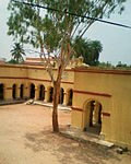 G.D.Lang Institution
 -
 Joychandi pahar
 -
 Joychandi pahar


