Porpetto (Friulian: Porpêt) is a comune (municipality) in the Regional decentralization entity of Udine in the Italian region of Friuli-Venezia Giulia, located about 50 kilometres (31 mi) northwest of Trieste and about 25 kilometres (16 mi) south of Udine. As of 31 December 2004, it had a population of 2,717 and an area of 19.7 square kilometres (7.6 sq mi).[3]
Porpetto
Porpêt (Friulian) | |
|---|---|
| Comune di Porpetto | |
Location of Porpetto  | |
 Porpetto Location of Porpetto in Italy  Porpetto Porpetto (Friuli-Venezia Giulia) | |
| Coordinates: 45°51′N 13°13′E / 45.850°N 13.217°E | |
| Country | Italy |
| Region | Friuli-Venezia Giulia |
| Province | Udine (UD) |
| Frazioni | Castello, Corgnolo, Pampaluna |
| Area | |
| • Total | 19.7 km2 (7.6 sq mi) |
| Elevation | 10 m (30 ft) |
| Population (Dec. 2004)[2] | |
| • Total | 2,717 |
| • Density | 140/km2 (360/sq mi) |
| Demonym | Porpettesi |
| Time zone | UTC+1 (CET) |
| • Summer (DST) | UTC+2 (CEST) |
| Postal code | 33050 |
| Dialing code | 0431 |
| Website | Official website |
The municipality of Porpetto contains the frazioni (boroughs) of Castello, Corgnolo, Foredana and Pampaluna. The river Corno crosses the city.
Porpetto borders the following municipalities: Castions di Strada, Gonars, San Giorgio di Nogaro, Torviscosa.
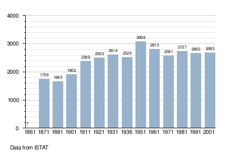
Demographic evolution edit
References edit
- ^ "Superficie di Comuni Province e Regioni italiane al 9 ottobre 2011". Italian National Institute of Statistics. Retrieved 16 March 2019.
- ^ "Popolazione Residente al 1° Gennaio 2018". Italian National Institute of Statistics. Retrieved 16 March 2019.
- ^ All demographics and other statistics: Italian statistical institute Istat.
External links edit
This article on a location in Friuli-Venezia Giulia is a stub. You can help Wikipedia by expanding it. |