Parwan also spelled Parvan (Dari: پروان) is one of the 34 provinces of Afghanistan. It is the largest province of the Greater Parwan region and has a population of about 751,000.[3] The province is multi-ethnic and mostly rural society. The province is divided into ten districts. The town of Imam Abu Hanifa serves as the provincial capital. The province is located north of Kabul Province and south of Baghlan Province, west of Panjshir Province and Kapisa Province, and east of Maidan Wardak Province and Bamyan Province. The province's famous tourism attraction is the Golghondi Hill, also known as “the flower hill,” located in Imam Azam about an hour away from the capital city of Kabul.[5] After Panjshir this province has been considered as one of the main raising points of Afghanistan War against Soviets.
Parwan
پروان | |
|---|---|
 The Salang Pass during winter | |
 Map of Afghanistan with Parwan highlighted | |
| Coordinates (Capital): 35°00′N 69°00′E / 35.0°N 69.0°E | |
| Country | |
| Capital | Charikar |
| Government | |
| • Governor | Mohammad Farid Omar[1] |
| • Deputy Governor | Maulvi Dost Mohammad Haqqani[2] |
| Area | |
| • Total | 5,715 km2 (2,207 sq mi) |
| Population (2021)[3] | |
| • Total | 751,040 |
| • Density | 130/km2 (340/sq mi) |
| Time zone | UTC+4:30 (Afghanistan Time) |
| Postal code | 11xx |
| ISO 3166 code | AF-PAR |
| Main languages | Dari and Pashto[4] |
The name Parwan is also attributed to a town, the exact location of which is now unknown, that supposedly existed during prehistory, in the nearby Hindu Kush mountains.[6]
Despite a four-decade-long state of war in Afghanistan, Parwan was relatively free of conflict by the mid-2010s. While occasional attacks on government or international forces were reported, they were usually minor.[citation needed] Such incidents in Parwan mostly involved grenade attacks on the residences of government officials or roadside bombs.[7] Bagram Air Base, which was one of the largest US military bases in Afghanistan, is located in Parwan.
History edit
In 329 BC, Alexander the Great founded the settlement of Parwan as his Alexandria of the Caucasus. It was conquered by Arab Muslims in 792 AD.[6] In 1221, the province was the site of the battle between the invading Mongols, led by Genghis Khan, and the Khwarezmian Empire led by Jalal ad-Din Mingburnu, where the Mongols were defeated.[6]
The Kingdom of Kapisa (known in contemporary Chinese sources as Chinese: 漕國 Caoguo and Chinese: 罽賓 Jibin) was a state located in what is now Afghanistan during the late 1st millennium CE. Its capital was the city of Bagram. The kingdom stretched from the Hindu Kush in the north to Bamiyan and Kandahar in the south and west, out as far as the modern Jalalabad District in the east.
The famous Moroccan traveler and scholar, Ibn Battuta, visiting the area in 1333 write:
We halted next at a place called Banj Hir (Panjshir), which means "Five Mountains," where there was once a fine and populous city built on a great river with blue water like the sea. This country was devastated by Tinkiz, the king of the Tatars, and has not been inhabited since. We came to a mountain called Pashay, where there is a convent of the Shaykh Ata Awliya, which means "Father of the Saints." He is also called Sisad Salah, which is the Persian for "three hundred years," because they say that he is three hundred and fifty years old. They have a very high opinion of him and come to visit him from the towns and villages, and sultans and princesses visit him too. He received us with honor and made us his guests. We encamped by a river near his convent and went to see him, and when I saluted him he embraced me. His skin is fresh and smoother than any I have seen; anyone seeing him would take him to be fifty years old. He told me that he grew new hair and teeth every hundred years. I had some doubts about him, however, and God knows how much truth there is in what he says. We traveled thence to Parwan, where I met the amir Buruntayh. He treated me well and wrote to his representatives at Ghazna enjoining them to show me honor. We went on to the village of Charkh [Charikar], it being now summer, and from there to the town of Ghazna. This is the town of the famous warrior-sultan Mahmud ibn Sabuktagin, one of the greatest of rulers, who made frequent raids into India and captured cities and fortresses there.[8]
— Ibn Battuta, 1304–1369
The area was subsequently ruled by the Timurids and Mughals until Ahmad Shah Durrani made it part of the Durrani Empire in 1747. In 1840, Parwan was the site of a major battle in the First Anglo-Afghan War where the invading British were defeated.[6] Parwan's modern history began with the construction of a new textile factory in the town of Jabal Saraj in 1937.[6] Parwan was involved in the Soviet–Afghan War as some of the fiercest fightings took place in the area.[9] In the 1990s it was the site of heavy resistance against the Taliban.
Recent history edit

Following the removal of the Taliban in late 2001, the United States Armed Forces took control of Bagram Air Base and began using it as one of their main bases in Afghanistan. A Provincial Reconstruction Team (PRT) led by South Korea helped the locals with development activities in the province until 2014.[10] In mid-February 2011, five rocket-propelled grenades hit the newly built South Korean military base housing the provincial reconstruction team and civilian aid workers. No one was injured in the attack, but it came hours after a visit by South Korean Defense Minister Kim Kwan-jin, raising suspicions of Taliban involvement. The opening ceremony of the base was postponed indefinitely.[11]
A plan to build a power plant in the province is under consideration.[citation needed] A large portion of Parwan's economy relies on remittances from the Afghan diaspora living abroad.[citation needed]
In July 2012, the Taliban executed a married woman in front of a large crowd after she was found guilty of adultery.[12] It was reported that the woman had a secret affair with a married military commander of the Afghan National Army. In August 2021, Parwan was captured by the Taliban during their offensive.
Healthcare edit
The percentage of households with clean drinking water fell from 32% in 2005 to 11% in 2011.[13] The percentage of births attended to by a skilled birth attendant increased from 4% in 2005 to 7% in 2011.[13]
Education edit
The overall literacy rate (6+ years of age) fell from 37% in 2005 to 28% in 2011.[13] The overall net enrolment rate (6–13 years of age) increased from 42% in 2005 to 54% in 2011.[13]
Demographics and geography edit

As of 2020, the total population of the province is about 751,000,[3] which is multi-ethnic and mostly a rural society. 8 percent of the population lived below the national poverty line, the second lowest figure in Afghanistan behind only Logar Province.[14]
According to the Naval Postgraduate School, the ethnic groups of the province are as follows: Tajiks, Hazaras, Uzbeks, Pashtuns, Kuchis and other minority groups.[15] According to Afghanistan's Ministry of Rural Rehabilitation and Development:
Around three quarters (73%) of the population of Parwan lives in rural districts, while one quarter (27%) lives in urban areas, Around 50% of the population is male and 50% is female. Persian (Dari dialect) and Pashto are the main languages spoken in the province; however Persian speakers outnumber Pashto speakers by a ratio of 5 to 2.[4] Parwan province also has a population of Kuchis or nomads whose numbers vary in different seasons. In winter 30,290 Kuchi live in Parwan province, of which 66% are short-range migratory and the remaining 34% are long-range migratory. During the summer, Kuchi migrate to Parwan province from Laghman, Kapisa, Baghlan and to a lesser extent from Kabul, Nangarhar and Kunar. The Kuchi population in the summer is 121,517 individuals.[16]
Districts edit
As per the figures below based on the ethnographics of each district as well as the density and therefore the inhabitability of each district, the province has a population of approximately 878,192.
| District | Capital | Population (2022)[3] | Area | Pop. density |
Ethnicity[17] |
|---|---|---|---|---|---|
| Bagram | 117,181 | 381 | 308 | 60% Tajiks, 35% Pashtuns, 5% Hazara.[18] | |
| Charikar (capital) | 202,210 | 258 | 783 | Mixed Tajiks and Pashtuns.[19] | |
| Ghorband | 109,342 | 908 | 120 | Mixed Pashtuns, Tajiks and Hazaras.[20] | |
| Jabal Saraj | 72,345 | 99 | 730 | Tajiks.[21][22] | |
| Kohi Safi | 35,075 | 569 | 62 | Predominantly Pashtuns.[22] | |
| Salang | 29,362 | 547 | 54 | Predominantly Tajiks, few Pashtuns.[23] | |
| Sayed Khel | 51,549 | 31 | 1,639 | Mix Tajiks and Pashtuns.[22] Used to be part of Jabal Saraj District. | |
| Sheikh Ali | 27,901 | 913 | 31 | Predominantly Hazaras.[24] | |
| Shinwari | 46,501 | 722 | 64 | Predominantly Pashtuns.[22] | |
| Surkhi Parsa | 46,234 | 1,152 | 40 | Mixed Hazaras and Tajiks.[25] | |
| Parwan | 737,700 | 5,715 | 129 | Majority Tajik, notable minorities include Hazaras and Pashtuns. |
Notable towns and villages edit
Gallery edit
- Images of Parwan Province
-
 Near the Shibar Pass that connects Parwan to Bamyan.
 -
 A road in the Parwan Province, near the Sayed Bridge which is located short distance north from Bagram Air Base.
 -
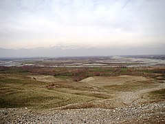 Fields near the Sayed Bridge
 -
 School girls in a rural area of Parwan
 -
 A member of the Afghan National Police trying to control local children awaiting the distribution of goods from the U.S. military for the winter months.
 -
 Afghan women working inside a factory in Parwan
-_Landschaft_-_Annemarie_Schwarzenbach_-_SLA-Schwarzenbach-A-5-20-220.jpg)


See also edit
References edit
- ^ "د پروان د استخباراتو نوي رييس په کار پيل وکړ". باختر خبری آژانس. November 4, 2021.
- ^ "نشست محاکم پروان برگزار شد". آژانس خبری باختر. August 31, 2021.
- ^ a b c d "Estimated Population of Afghanistan 2021-22" (PDF). National Statistic and Information Authority (NSIA). April 2021. Archived (PDF) from the original on June 24, 2021. Retrieved June 21, 2021.
- ^ a b "Parwan Provincial profile" (PDF). United Nations. Afghanistan's Ministry of Rural Rehabilitation and Development. Archived from the original (PDF) on June 1, 2015. Retrieved June 1, 2015.
Persian and Pashto are the main languages spoken in the province; however Persian speakers outnumber Pashto speakers by a ratio of 5 to 2.
- ^ Gupta, Kanika (July 9, 2021). "I Didn't Expect to Find This in Afghanistan". Fodors Travel Guide. Retrieved February 22, 2023.
- ^ a b c d e Frye, Richard Nelson (1999). "Farran (also Parwan)". Encyclopaedia of Islam CD-ROM Edition v. 1.0. Leiden, The Netherlands: Koninklijke Brill NV. Retrieved on December 18, 2007.
- ^ "Regional Command East: Parwan Province". Institute for the Study of War. Retrieved June 16, 2013.
- ^ Ibn Battuta (2004). Travels in Asia and Africa, 1325-1354 (reprint, illustrated ed.). Routledge. p. 179. ISBN 0-415-34473-5. Retrieved September 10, 2010.
- ^ "Charikar". The Columbia Encyclopedia (Sixth ed.). Columbia University Press. 2007. Retrieved December 19, 2007.
- ^ Ha-won, Jung (July 2, 2010). "Rocket attack on Korean compound in Parwan". Joongang Daily. Archived from the original on December 15, 2014. Retrieved June 16, 2013.
- ^ Moon, Gwang-lip (December 2, 2011). "Taliban strike on Koreans confirmed". Joongang Daily. Archived from the original on July 13, 2011. Retrieved November 2, 2011.
- ^ "Video: Afghan Taliban publicly execute woman - World news - South and Central Asia - Afghanistan - msnbc.com". July 8, 2012. Archived from the original on July 8, 2012.
- ^ a b c d "Parwan Province". CimicWeb. Archived from the original on May 31, 2014. Retrieved May 30, 2014.
- ^ Giustozzi, Antonio (August 29, 2012). Decoding the New Taliban: Insights from the Afghan Field. C. Hurst (Publishers) Limited. ISBN 9781849042260 – via Google Books.
- ^ "Parwan Province". Program for Culture & Conflict Studies. Naval Postgraduate School. Retrieved June 16, 2013.
The population of approximately 560,000 is composed of Pashtun, Tajik, Uzbek, Qizilbash, Kuchi, Hazara, Turkmen and other minority groups.
- ^ "Parwan Province: B. Demography and Population" (PDF). United Nations Assistance Mission in Afghanistan and Afghanistan Statistical Yearbook 2006, Central Statistics Office. Afghanistan's Ministry of Rural Rehabilitation and Development. Retrieved December 6, 2011.
- ^ "FAO in Afghanistan | Food and Agriculture Organization of the United Nations". www.fao.org.
- ^ District profiles. Bagram aims.org.af
- ^ District profiles. Charikar aims.org.af
- ^ District profiles. Siagard aims.org.af
- ^ District profiles. Jabak Saraj aims.org.af
- ^ a b c d East tribal map npsu.edu
- ^ District profiles. Salang aims.org.af
- ^ District profiles. Sheikh Ali aims.org.af
- ^ District profiles. Lolinge aims.org.af