This article needs additional citations for verification. (August 2023) |
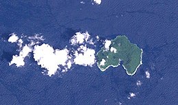
Mborokua (also known as Mary Island) is an uninhabited, jungle-covered volcanic island 30 km west of the Russell Islands in Western Province, in the independent nation of Solomon Islands. It is occasionally visited by local fishermen, as well as by dive tours.[1]
Nickname: Mary Island | |
|---|---|
 Landsat image of Mborokua Island, Solomon islands | |
 | |
| Geography | |
| Coordinates | 9°01′S 158°44′E / 9.02°S 158.74°E |
| Area | 4 km2 (1.5 sq mi) |
| Administration | |
| Province | |
| Demographics | |
| Population | uninhabited |
See also edit
References edit
- ^ Vedder, John Graham (1986). Geology and Offshore Resources of Pacific Island Arcs--central and Western Solomon Islands. Circum-Pacific Council for Energy and Mineral Resources. p. 306. ISBN 9780933687035.
External links edit
- Satellite view of Mborokua from Google Maps