Lone Peak is a mountain summit in the Wasatch Range southeast of Salt Lake City, Utah, United States, and the center of the Lone Peak Wilderness, established in 1978. With an elevation of 11,260 feet (3,430 m), it is one of the highest peaks in the range and among the most prominent of the Wasatch Front, towering over the Salt Lake City suburb of Draper and easily visible from most of the valley, which makes it a popular destination for hiking and rock climbing.
| Lone Peak | |
|---|---|
.jpg) Summit of Lone Peak | |
| Highest point | |
| Elevation | 11,260 feet (3,432 m) NAVD 88[1] |
| Prominence | 893 ft (272 m)[2] |
| Coordinates | 40°31′37″N 111°45′22″W / 40.526936411°N 111.756079919°W[1] |
| Geography | |
 Lone Peak | |
| Parent range | Wasatch Range |
| Topo map | USGS Draper |
| Geology | |
| Mountain type | Quartz monzonite |
The first person in recorded history to successfully reach the summit of Lone Peak was Richard Bell, Sr. of Riverton, Utah. Bell also led the first recorded climb of the Lone Peak Cirque. He went on to lead several expeditions and taught many alpine guides. Bells Canyon is named for him and is still a common route to the summit.
Lone Peak consists almost entirely of quartz monzonite (a granitoid or granite-like rock) of the 30.5 million-year-old Little Cottonwood Stock.[3][4][5] Quartzite and limestone are also found in distal locations on the mountain. The high mountain ridge stretching from Little Cottonwood Canyon on the northern end to Corner Canyon on the southern end is sometimes called "Mount Jordan", the highest peak of which is Lone Peak. Nearby peaks include Ennis Peak and Big Horn Peak. Lone Peak ranks 98th by elevation on the list of Utah peaks with at least 500 feet (150 m) of topographic prominence.[6][7]
Climate edit
| Climate data for Lone Peak 40.5264 N, 111.7608 W, Elevation: 10,659 ft (3,249 m) (1991–2020 normals) | |||||||||||||
|---|---|---|---|---|---|---|---|---|---|---|---|---|---|
| Month | Jan | Feb | Mar | Apr | May | Jun | Jul | Aug | Sep | Oct | Nov | Dec | Year |
| Mean daily maximum °F (°C) | 27.7 (−2.4) |
27.5 (−2.5) |
32.4 (0.2) |
37.6 (3.1) |
47.5 (8.6) |
59.9 (15.5) |
69.3 (20.7) |
67.6 (19.8) |
58.5 (14.7) |
45.4 (7.4) |
33.8 (1.0) |
27.2 (−2.7) |
44.5 (7.0) |
| Daily mean °F (°C) | 18.6 (−7.4) |
17.6 (−8.0) |
21.9 (−5.6) |
26.6 (−3.0) |
36.1 (2.3) |
47.4 (8.6) |
56.1 (13.4) |
54.7 (12.6) |
46.1 (7.8) |
34.5 (1.4) |
24.5 (−4.2) |
18.2 (−7.7) |
33.5 (0.9) |
| Mean daily minimum °F (°C) | 9.4 (−12.6) |
7.6 (−13.6) |
11.5 (−11.4) |
15.6 (−9.1) |
24.6 (−4.1) |
34.8 (1.6) |
43.0 (6.1) |
41.9 (5.5) |
33.6 (0.9) |
23.7 (−4.6) |
15.3 (−9.3) |
9.3 (−12.6) |
22.5 (−5.3) |
| Average precipitation inches (mm) | 7.19 (183) |
6.14 (156) |
6.14 (156) |
6.25 (159) |
4.36 (111) |
1.94 (49) |
1.21 (31) |
1.84 (47) |
2.83 (72) |
4.16 (106) |
5.46 (139) |
6.06 (154) |
53.58 (1,363) |
| Source: PRISM Climate Group[8] | |||||||||||||
Hiking/Backpacking edit
| Lone Peak Hiking/Backpacking Details | |
|---|---|
| Summit: | 11,260 feet (3,432 m) |
| Estimated Starting Elevation: | 5,600 feet |
| Average Total Distance: | 15.6 miles round-trip |
| Time Needed: | 1–2 days |
| Rating: | Difficult |
There are several popular routes by which to reach the summit of Lone Peak, with different distances and starting elevations. The most common routes approach the peak from the south. It is possible to reach the summit in one long day, but rock climbers often camp at the base of the summit and non-climbers often camp lower on the Jacob's Ladder Trail. There are a few streams along the routes which tend to dry up before summer, so water must be carried in. There is reputedly a spring that runs year-round.
Jacob's Ladder Trail edit
The shortest and arguably the most popular route is the Jacob's Ladder Trail, which begins at a trailhead located at 40°29′39″N 111°48′59″W / 40.49417°N 111.81639°W. It is located near a large turnout on the right side of the road and is marked with a sign. Several other hiking and mountain biking trails start from the same parking area, and three four-wheel drive tracks climb the road bank on the north side of the road; a wooden fence leads to the starting point of the trail. A major section of the trail, climbing from the lower two-track roads to the meadow below Ennis Peak, was rebuilt in 2022, adding several miles to the round-trip hiking distance but substantially decreasing the steep grade of the previous trail by introducing numerous switchbacks. Round-trip mileage is about 15.6 miles, with approximately 5,603 feet of vertical gain.
Draper Ridge Trail edit
The Draper Ridge Trail is currently inactive. The trail is in a deteriorated condition, as the top of the trail is very exposed to weather. Towards the bottom, thick undergrowth prevents passage. The Jacob's Ladder Trailhead is just up the road. The Jacob's Ladder Trail and the Draper Ridge Trail eventually merge, sharing the same trail for the last two-thirds of the route.
Cherry Canyon Logging Trail edit
Important features of this trail are that it has a year-round spring (cold springs) located at 40°30′58″N 111°47′35″W / 40.51611°N 111.79306°W and a small cabin in a meadow. The route gains altitude in the beginning, going through a steep scrub oak section. After a few hours of hiking, the trail levels off and veers north into the trees crossing the water of cold springs in Bear Canyon.[citation needed] The trail climbs out of the drainage on the north side into a new drainage, but stays generally below the ridgeline. The trail eventually opens into a meadow with a small cabin in the large pine trees. The trail continues up above the cabin to the southeast and crosses over to the south into another drainage at a low point on the ridge. The southeast top of the new drainage meets up with the main granite drainage running roughly north-south which leads to the Lone Peak Cirque via stacked rock cairns. An alternate route is to follow the approximate course of the streambed up the drainage until the top of the ridge that runs roughly north-south above a granite drainage is reached. Round-trip mileage is about 16 miles with 6,876 feet of vertical gain.
Outlaw Cabin edit

The Outlaw Cabin, located at 40°31′12″N 111°46′53″W / 40.52000°N 111.78139°W on the southwest side of a meadow, was constructed in the summer of 1960 by the Allen Brothers and Alan Summerhays. Construction was completed in 1967 prior to the area being designated a wilderness area. The cabin has three cots, a potbelly stove, cabinets, and two small windows. It is built from trees downed in the area and the roof is lined with plastic and dirt/grass for insulation. All the materials besides the trees were hauled to the location by horseback. The cabin is partially hidden by large trees. In October 1997, a family from Draper was caught in a blinding snow storm and took shelter in the cabin until they were rescued. There is a journal in the cabin that visitors can add their stories to.
Deaths on Lone Peak edit
- December 15, 1936 - Seven died when a Western Air Express Boeing 247[9] crashed just below Hardy Ridge on Lone Peak.[10] The major parts of the aircraft were hurled over the ridge and fell over a thousand feet into a basin below.[9]
- July 25, 2002 - Two hikers were struck by lightning near the summit of Lone Peak while they were trying to seek shelter.[11]
- September 8, 2015 - A woman fell 200–300 feet near the cirque. Her body was found the next day.[12]
- June 17, 2017 - An extreme trailrunner fell about 500 feet near Big Horn Peak while approaching Lone Peak.[13]
Movie Rocks edit
- The 1968 film The Devil's Brigade was filmed in Utah. The attack on a Nazi mountain stronghold in Italy was filmed on the lower part of Lone Peak at a place called "Movie Rocks". The trail leading there is just to the west of the Jacob's Ladder trail.
Images edit
-
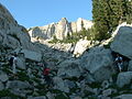
 Lone Peak from Jacob's Ladder trail
 -
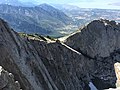
 Looking South at Lone Peak and Question Mark Wall
 -
 Scrambling may be required
 -
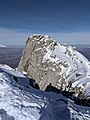 Summit in the winter
 -
 View of the Question Mark wall in the winter
 -
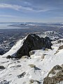
 View towards Utah Valley and Utah Lake
 -
 Lone Peak from Salt Lake Valley at night
 -
 The south summit wall of Lone Peak


References edit
- ^ a b "11251". NGS Data Sheet. National Geodetic Survey, National Oceanic and Atmospheric Administration, United States Department of Commerce. Retrieved 2016-04-20.
- ^ "Lone Peak, Utah". Peakbagger.com. Retrieved 2016-04-20.
- ^ Crittenden, M.D., 1965, Geology of the Draper Quadrangle, Utah: U.S. Geological Survey Map GQ-377, scale 1:24,000.
- ^ Crittenden, M.D., 1965, Geology of the Dromedary Peak Quadrangle, Utah: U.S. Geological Survey Map GQ-378, scale 1:24,000.
- ^ Vogel T.A., Cambray, F.W., Constenius, K.N., 2001, Origin and emplacement of igneous rocks in the central Wasatch Mountains, Utah: Rocky Mountain Geology, v. 36, n. 2, pp. 119-162.
- ^ "List "Utah Top 100 (500 ft. prom)"". ListsOfJohn.com. Retrieved 18 Apr 2016.
- ^ "Some info about Lone Peak"". mountainproject.com. Retrieved 18 Nov 2020.
- ^ "PRISM Climate Group, Oregon State University". PRISM Climate Group, Oregon State University. Retrieved November 6, 2023.
To find the table data on the PRISM website, start by clicking Coordinates (under Location); copy Latitude and Longitude figures from top of table; click Zoom to location; click Precipitation, Minimum temp, Mean temp, Maximum temp; click 30-year normals, 1991-2020; click 800m; click Retrieve Time Series button.
- ^ a b Department of Commerce Aircraft Accident Report
- ^ Confetti on Lone Peak, Time, June 21, 1937
- ^ "Lightning deaths by location and activity since 1950". National Weather Service, Salt Lake Office, UT. Archived from the original on 2017-01-04. Retrieved 2016-04-18.
- ^ "Missing hiker found dead in Draper, fell 200-300 feet". Fox13 Salt Lake City. Retrieved 2016-04-18.
- ^ Press, Lehi Free (2017-06-21). "Zac Zimmerman dies in tragic hiking fall". Lehi Free Press. Retrieved 2018-09-30.
External links edit
- "Lone Peak". SummitPost.org.
- Lone Peak. Climb-Utah.com.
- Hiking to Lone Peak Summit. Utahwild.com.
- Lone Peak Hiking Directions. UtahPictures.com
- Hiking Lone Peak. by Hyrum Wright.