The Front Range Urban Corridor is an oblong region of urban population located along the eastern face of the Southern Rocky Mountains, encompassing 18 counties in the US states of Colorado and Wyoming. The corridor derives its name from the Front Range, the mountain range that defines the western boundary of the corridor which serves as a gateway to the Rocky Mountains. The region comprises the northern portion of the Southern Rocky Mountain Front geographic area, which in turn comprises the southern portion of the Rocky Mountain Front geographic area of Canada and the United States. The Front Range Urban Corridor had a population of 5,055,344 at the 2020 Census, an increase of +16.65% since the 2010 Census.[2]
Front Range Urban Corridor | |
|---|---|
 | |
 An enlargeable map of the Front Range Urban Corridor of Colorado and Wyoming. Blue: Southeast Wyoming; red: North Central Colorado; green: South Central Colorado | |
| Coordinates: 39°44′21″N 104°59′06″W / 39.7392°N 104.9850°W | |
| Country | |
| States | |
| Area | |
| • Total | 65,150 km2 (25,153 sq mi) |
| Population | 5,055,344 |
| GDP | |
| • Total | $378.020 billion (2022) |
The corridor contains some of the West's largest cities, such as Denver and Colorado Springs. It also contains smaller cities such as Pueblo and Cheyenne. Its main transportation corridor is Interstate 25. There have been many proposals for Front Range Passenger Rail. None have come to fruition as of yet, though plans are under development.[3]
Extent edit
The Front Range Urban Corridor stretches about 200 miles from Pueblo, Colorado, north along Interstate 25 to Cheyenne, Wyoming, and includes the Denver-Aurora-Lakewood, CO Metropolitan Statistical Area; the Colorado Springs, CO Metropolitan Statistical Area; the Boulder, CO Metropolitan Statistical Area; the Fort Collins, CO Metropolitan Statistical Area; the Greeley, CO Metropolitan Statistical Area; the Pueblo, CO Metropolitan Statistical Area; the Cheyenne, WY Metropolitan Statistical Area; and the Cañon City, CO Micropolitan Statistical Area. The corridor comprises three primary subregions: the South Central Colorado Urban Area, the North Central Colorado Urban Area, and the Cheyenne Metropolitan Area.
The influence of the Corridor extends well beyond its defined boundaries. The Colorado Eastern Plains, Nebraska Panhandle, and Albany County, Wyoming, among other areas, are culturally and economically tied to the Corridor, though they are not considered to be a part of it.
The definition included here is not used for the greater Southern Rocky Mountain Front, one of the 11 megaregions of the United States. The megaregion's area is larger, extending south from Pueblo along the I-25 corridor into New Mexico, including Albuquerque and Santa Fe, and also including the Wasatch Front of Utah, separated by hundreds of miles from the regional core.[4]
Counties edit
| 2020 rank | County | 2020 census | Change | 2010 census | Change | 2000 census | Area (mi2) | Core-based statistical area | Urban region |
|---|---|---|---|---|---|---|---|---|---|
| 1 | El Paso County, Colorado | 730,395 | +17.38% | 622,263 | +20.38% | 516,934 | 2,130 | Colorado Springs, CO MSA | South Central Colorado |
| 2 | City and County of Denver, Colorado | 715,522 | +19.22% | 600,158 | +8.37% | 553,805 | 155 | Denver-Aurora-Lakewood, CO MSA | North Central Colorado |
| 3 | Arapahoe County, Colorado | 655,070 | +14.52% | 572,003 | +17.01% | 488,829 | 855 | ||
| 4 | Jefferson County, Colorado | 582,910 | +9.05% | 534,543 | +1.73% | 525,449 | 774 | ||
| 5 | Adams County, Colorado | 519,572 | +17.66% | 441,603 | +26.87% | 348,076 | 1,184 | ||
| 6 | Larimer County, Colorado | 359,066 | +19.84% | 299,630 | +19.14% | 251,494 | 2,634 | Fort Collins, CO MSA | |
| 7 | Douglas County, Colorado | 357,978 | +25.40% | 285,465 | +62.44% | 175,732 | 843 | Denver-Aurora-Lakewood, CO MSA | |
| 8 | Boulder County, Colorado | 330,758 | +12.29% | 294,567 | +9.19% | 269,784 | 740 | Boulder, CO MSA | |
| 9 | Weld County, Colorado | 328,981 | +30.12% | 252,825 | +39.86% | 180,766 | 4,017 | Greeley, CO MSA | |
| 10 | Pueblo County, Colorado | 168,162 | +5.72% | 159,063 | +12.42% | 141,490 | 2,398 | Pueblo, CO MSA | South Central Colorado |
| 11 | Laramie County, Wyoming | 100,512 | +9.56% | 91,738 | +12.41% | 81,607 | 2,688 | Cheyenne, WY MSA | Southeast Wyoming |
| 12 | City and County of Broomfield, Colorado | 74,112 | +32.61% | 55,889 | +42.57% | 39,202 | 34 | Denver-Aurora-Lakewood, CO MSA | North Central Colorado |
| 13 | Fremont County, Colorado | 48,939 | +4.52% | 46,824 | +1.47% | 46,145 | 1,534 | Cañon City, CO MSA | South Central Colorado |
| 14 | Elbert County, Colorado | 26,062 | +12.89% | 23,086 | +16.17% | 19,872 | 1,851 | Denver-Aurora-Lakewood, CO MSA | North Central Colorado |
| 15 | Teller County, Colorado | 24,710 | +5.82% | 23,350 | +13.60% | 20,555 | 559 | Colorado Springs, CO MSA | South Central Colorado |
| 16 | Park County, Colorado | 17,390 | +7.31% | 16,206 | +11.59% | 14,523 | 2,211 | Denver-Aurora-Lakewood, CO MSA | North Central Colorado |
| 17 | Clear Creek County, Colorado | 9,397 | +3.40% | 9,088 | −2.51% | 9,322 | 396 | ||
| 18 | Gilpin County, Colorado | 5,808 | +6.75% | 5,441 | +14.38% | 4,757 | 150 | ||
| Total | 18 counties | 5,055,344 | +16.65% | 4,333,742 | +17.50% | 3,688,342 | 25,153 | 8 core-based statistical areas | 3 urban regions |
Municipalities edit
| 2020 rank | Municipality | 2020 census | Change | 2010 census | Change | 2000 census |
|---|---|---|---|---|---|---|
| 1 | City and County of Denver, Colorado | 715,522 | +19.22% | 600,158 | +8.21% | 554,636 |
| 2 | City of Colorado Springs, Colorado | 478,961 | +15.02% | 416,427 | +15.39% | 360,890 |
| 3 | City of Aurora, Colorado | 386,261 | +18.82% | 325,078 | +17.61% | 276,393 |
| 4 | City of Fort Collins, Colorado | 169,810 | +17.94% | 143,986 | +21.35% | 118,652 |
| 5 | City of Lakewood, Colorado | 155,984 | +9.09% | 142,980 | −0.80% | 144,126 |
| 6 | City of Thornton, Colorado | 141,867 | +19.44% | 118,772 | +44.17% | 82,384 |
| 7 | City of Arvada, Colorado | 124,402 | +16.88% | 106,433 | +4.19% | 102,153 |
| 8 | City of Westminster, Colorado | 116,317 | +9.62% | 106,114 | +5.13% | 100,940 |
| 9 | City of Pueblo, Colorado | 111,876 | +4.95% | 106,595 | +4.38% | 102,121 |
| 10 | City of Greeley, Colorado | 108,795 | +17.12% | 92,889 | +20.74% | 76,930 |
| 11 | City of Centennial, Colorado | 108,418 | +8.01% | 100,377 | NA | NA |
| 12 | City of Boulder, Colorado | 108,250 | +11.16% | 97,385 | +2.86% | 94,673 |
| 13 | City of Longmont, Colorado | 98,885 | +14.62% | 86,270 | +21.35% | 71,093 |
| 14 | City of Loveland, Colorado | 76,378 | +14.24% | 66,859 | +32.11% | 50,608 |
| 15 | City and County of Broomfield, Colorado | 74,112 | +32.61% | 55,889 | +46.03% | 38,272 |
| 16 | Town of Castle Rock, Colorado | 73,158 | +51.68% | 48,231 | +138.48% | 20,224 |
| 17 | City of Cheyenne, Wyoming | 65,132 | +9.53% | 59,466 | +12.18% | 53,011 |
| 18 | City of Commerce City, Colorado | 62,418 | +35.95% | 45,913 | +118.73% | 20,991 |
| 19 | Town of Parker, Colorado | 58,512 | +29.17% | 45,297 | +92.28% | 23,558 |
Wyoming jurisdictions edit
In Wyoming, the Front Range Urban Corridor includes the Town of Albin, the Town of Burns, the City of Cheyenne, the Town of Pine Bluffs, and unincorporated Laramie County.
Colorado jurisdictions edit
In Colorado, the Front Range Urban Corridor includes:
- Town of Alma
- City of Arvada
- Town of Ault
- City of Aurora
- Town of Bennett
- Town of Berthoud
- City of Black Hawk
- Town of Boone
- City of Boulder
- Town of Bow Mar
- City of Brighton
- Town of Brookside
- City and County of Broomfield
- Town of Calhan
- City of Cañon City
- City of Castle Pines North
- Town of Castle Rock
- City of Centennial
- Central City
- City of Cherry Hills Village
- Town of Coal Creek
- City of Colorado Springs
- Town of Columbine Valley
- City of Commerce City
- City of Cripple Creek
- City of Dacono
- Town of Deer Trail
- City and County of Denver
- Town of Eaton
- City of Edgewater
- Town of Elizabeth
- Town of Empire
- City of Englewood
- Town of Erie
- Town of Estes Park
- City of Evans
- Town of Fairplay
- City of Federal Heights
- Town of Firestone
- City of Florence
- City of Fort Collins
- City of Fort Lupton
- City of Fountain
- Town of Foxfield
- Town of Frederick
- Town of Garden City
- Town of Georgetown
- Town of Gilcrest
- City of Glendale
- City of Golden
- City of Greeley
- Town of Green Mountain Falls
- City of Greenwood Village
- Town of Grover
- Town of Hudson
- City of Idaho Springs
- Town of Jamestown
- Town of Johnstown
- Town of Keenesburg
- Town of Kersey
- Town of Kiowa
- Town of La Salle
- City of Lafayette
- Town of Lakeside
- City of Lakewood
- Town of Larkspur
- City of Littleton
- Town of Lochbuie
- City of Lone Tree
- City of Longmont
- City of Louisville
- City of Loveland
- Town of Lyons
- City of Manitou Springs
- Town of Mead
- Town of Milliken
- Town of Monument
- Town of Morrison
- Town of Mountain View
- Town of Nederland
- City of Northglenn
- Town of Nunn
- Town of Palmer Lake
- Town of Parker
- Town of Pierce
- Town of Platteville
- City of Pueblo
- Town of Ramah
- Town of Raymer
- Town of Rockvale
- Town of Rye
- Town of Severance
- City of Sheridan
- Town of Silver Plume
- Town of Simla
- Town of Superior
- City of Thornton
- Town of Timnath
- City of Victor
- Town of Ward
- Town of Wellington
- City of Westminster
- City of Wheat Ridge
- Town of Williamsburg
- Town of Windsor
- City of Woodland Park
- unincorporated Adams County
- unincorporated Arapahoe County
- unincorporated Boulder County
- unincorporated Clear Creek County
- unincorporated Douglas County
- unincorporated El Paso County
- unincorporated Elbert County
- unincorporated Fremont County
- unincorporated Gilpin County
- unincorporated Jefferson County
- unincorporated Larimer County
- unincorporated Park County
- unincorporated Pueblo County
- unincorporated Teller County
- unincorporated Weld County
Gallery of the most populous Front Range municipalities edit
-
 1. The Denver Art Museum in Denver.
 -

-
 3. The University of Colorado Hospital in Aurora.
 -
 4. Downtown Fort Collins.
 -
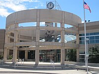
 5. The Lakewood Civic Center in Lakewood.
 -
 6. Thornton welcome sign from Interstate 25.
 -
 7. The Arvada Center for the Arts and Humanities in Arvada.
 -
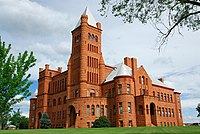 8. Westminster Castle in Westminster.
 -
 9. Downtown Pueblo.
 -
 10. City Hall in Greeley.
 -
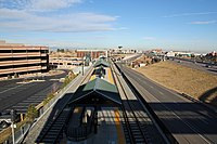 11. The Dry Creek Station in Centennial.
 -
 12. The National Center for Atmospheric Research in Boulder.
 -
 13. The Longmont Safety and Justice Center in Longmont.
 -
 14. The Budweiser Events Center in Loveland.
 -
 15. The Interlocken Office Park in Broomfield.
 -
 16. The Castle Rock Depot in Castle Rock.
 -
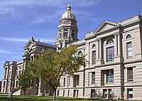 17. The Wyoming State Capitol in Cheyenne.
 -
-
 19. Mainstreet in downtown Parker.


See also edit
References edit
- ^ "Gross Domestic Product by County and Metropolitan Area, 2022" (PDF). www.bea.gov. Bureau of Economic Analysis.
- ^ "QuickFacts". United States Census Bureau. Retrieved November 11, 2021.
- ^ "Report: Front Range Passenger Rail Moving Forward". Railway Age. 2021-07-01. Retrieved 2021-12-20.
- ^ "Megaregions". Archived from the original on May 16, 2017. Retrieved October 1, 2014.