No higher resolution available.
Winfrith_-_geograph.org.uk_-_294818.jpg (600 × 450 pixels, file size: 82 KB, MIME type: image/jpeg)
| This is a file from the Wikimedia Commons. Information from its description page there is shown below. Commons is a freely licensed media file repository. You can help. |
Summary
| Description |
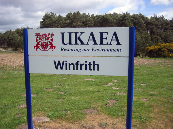
English: Winfrith UKAEA has been restoring Winfriths environment since the early 1990s. Around half of the civil nuclear research site has already been released for commercial use, and decommissioning will be fully complete by 2020, when Winfrith will become the UKs first major nuclear site to be fully decommissioned.
Be warned that photography of the site is not permitted. I was pounced on by security and after deleting pictures I had already taken, was able to negotiate this shot. Security at Winfrith is provided by the Civil Nuclear Constabulary, an armed police force that specialises in the protection of nuclear materials http://www.ukaea.org.uk/sites/winfrith_site_info.htm |
| Date | |
| Source | From geograph.org.uk |
| Author | John Lamper |
| Attribution (required by the license) | John Lamper / Winfrith / |
| Object location | | View this and other nearby images on: OpenStreetMap |
|---|
_heading:270.00&language=en)
Licensing

|
This image was taken from the Geograph project collection. See this photograph's page on the Geograph website for the photographer's contact details. The copyright on this image is owned by John Lamper and is licensed for reuse under the Creative Commons Attribution-ShareAlike 2.0 license.
|
This file is licensed under the Creative Commons Attribution-Share Alike 2.0 Generic license.
Attribution: John Lamper
- You are free:
- to share – to copy, distribute and transmit the work
- to remix – to adapt the work
- Under the following conditions:
- attribution – You must give appropriate credit, provide a link to the license, and indicate if changes were made. You may do so in any reasonable manner, but not in any way that suggests the licensor endorses you or your use.
- share alike – If you remix, transform, or build upon the material, you must distribute your contributions under the same or compatible license as the original.
File history
Click on a date/time to view the file as it appeared at that time.
| Date/Time | Thumbnail | Dimensions | User | Comment | |
|---|---|---|---|---|---|
| current | 22:20, 14 December 2010 | | 600 × 450 (82 KB) | GeographBot | == {{int:filedesc}} == {{Information |description={{en|1=Winfrith UKAEA has been restoring Winfriths environment since the early 1990s. Around half of the civil nuclear research site has already been released for commercial use, and decommissioning will |
File usage
The following pages on the English Wikipedia use this file (pages on other projects are not listed):
Global file usage
The following other wikis use this file:
- Usage on cs.wikipedia.org
- Usage on fr.wikipedia.org
- Usage on no.wikipedia.org
- Usage on www.wikidata.org