Size of this preview: 800 × 468 pixels. Other resolutions: 320 × 187 pixels | 640 × 374 pixels | 1,024 × 599 pixels | 1,280 × 748 pixels | 2,560 × 1,497 pixels | 5,215 × 3,049 pixels.
Original file (5,215 × 3,049 pixels, file size: 817 KB, MIME type: image/jpeg)
| This is a file from the Wikimedia Commons. Information from its description page there is shown below. Commons is a freely licensed media file repository. You can help. |
Summary
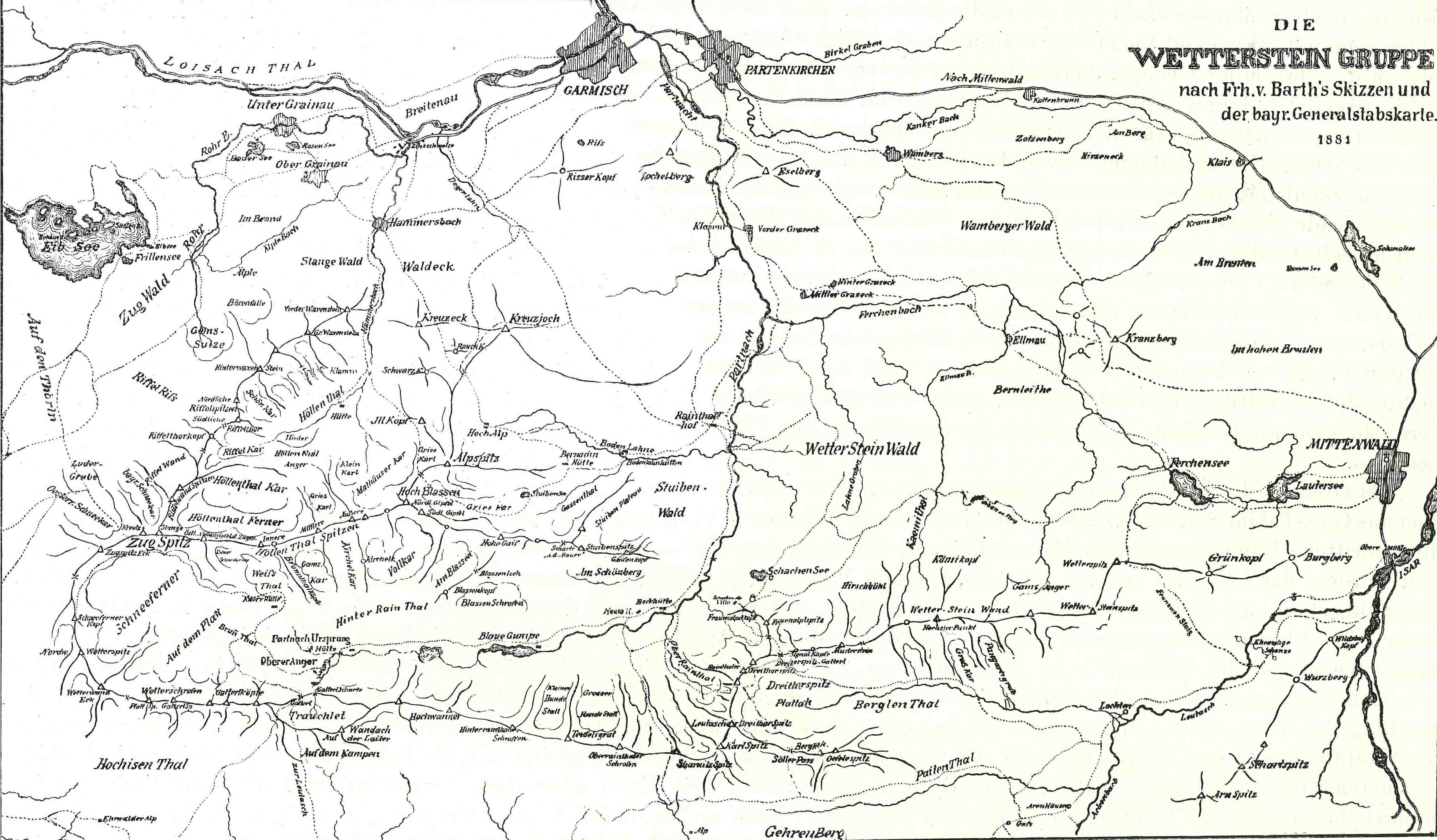
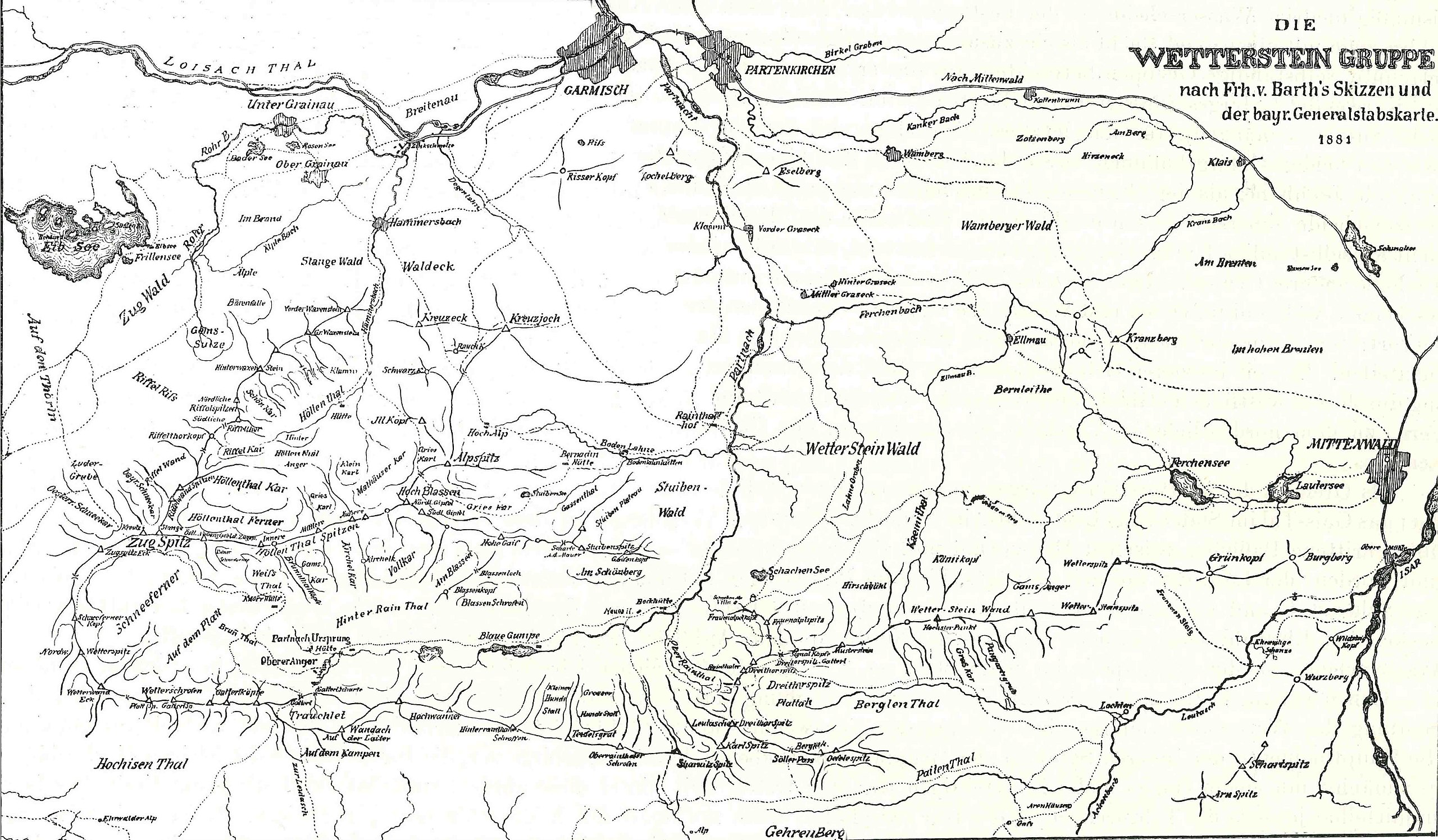
| Description | |
| Date | |
| Source | Gesammelte Schriften des Freiherrn Hermann von Barth, Hrsg. Carl Bünsch, Max Rohrer, Alpine Verlagsanstalt, München, 1926, S. 872 f. |
| Author | Weinhöppel |
Licensing
|
This work is in the public domain in its country of origin and other countries and areas where the copyright term is the author's life plus 70 years or fewer. This work is in the public domain in the United States because it was published (or registered with the U.S. Copyright Office) before January 1, 1929. | |
| This file has been identified as being free of known restrictions under copyright law, including all related and neighboring rights. | |
File history
Click on a date/time to view the file as it appeared at that time.
| Date/Time | Thumbnail | Dimensions | User | Comment | |
|---|---|---|---|---|---|
| current | 15:53, 1 September 2008 | | 5,215 × 3,049 (817 KB) | HeinrichStuerzl | {{Information |Description={{en|1=Wetterstein map by Weinhöppel according to drawings by Hermann von Barth (1845-1876)}} {{de|1=Weinhöppel'sche Wetterstein Karte nach Zeichnungen von [ |
File usage
The following pages on the English Wikipedia use this file (pages on other projects are not listed):
Global file usage
The following other wikis use this file:
- Usage on de.wikipedia.org
- Usage on et.wikipedia.org
- Usage on uk.wikipedia.org
- Usage on vi.wikipedia.org