
Size of this preview: 800 × 422 pixels. Other resolutions: 320 × 169 pixels | 640 × 338 pixels | 1,024 × 540 pixels | 1,280 × 675 pixels | 2,828 × 1,492 pixels.
Original file (2,828 × 1,492 pixels, file size: 896 KB, MIME type: image/jpeg)
| This is a file from the Wikimedia Commons. Information from its description page there is shown below. Commons is a freely licensed media file repository. You can help. |
Summary
| Description |
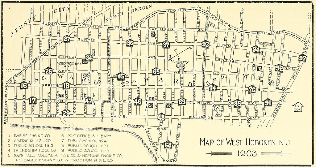
English: Map of West Hoboken 1903, what today is the southern section of Union City, New Jersey |
| Date | |
| Source | https://archive.org/details/historyofwesthob00dres |
| Author | Drescher, William H., Jr. |
Licensing
This work is in the public domain in the United States because it was published (or registered with the U.S. Copyright Office) before January 1, 1929.
Public domain works must be out of copyright in both the United States and in the source country of the work in order to be hosted on the Commons. If the work is not a U.S. work, the file must have an additional copyright tag indicating the copyright status in the source country.
Note: This tag should not be used for sound recordings. |
File history
Click on a date/time to view the file as it appeared at that time.
| Date/Time | Thumbnail | Dimensions | User | Comment | |
|---|---|---|---|---|---|
| current | 02:50, 5 September 2020 | | 2,828 × 1,492 (896 KB) | Acebarry | Uploaded a work by Drescher, William H., Jr. from https://archive.org/details/historyofwesthob00dres with UploadWizard |
File usage
The following pages on the English Wikipedia use this file (pages on other projects are not listed):
Global file usage
The following other wikis use this file:
- Usage on www.wikidata.org