Size of this preview: 800 × 408 pixels. Other resolutions: 320 × 163 pixels | 640 × 326 pixels | 1,024 × 522 pixels.
Original file (1,024 × 522 pixels, file size: 200 KB, MIME type: image/jpeg)
| This is a file from the Wikimedia Commons. Information from its description page there is shown below. Commons is a freely licensed media file repository. You can help. |
Summary
| Description |
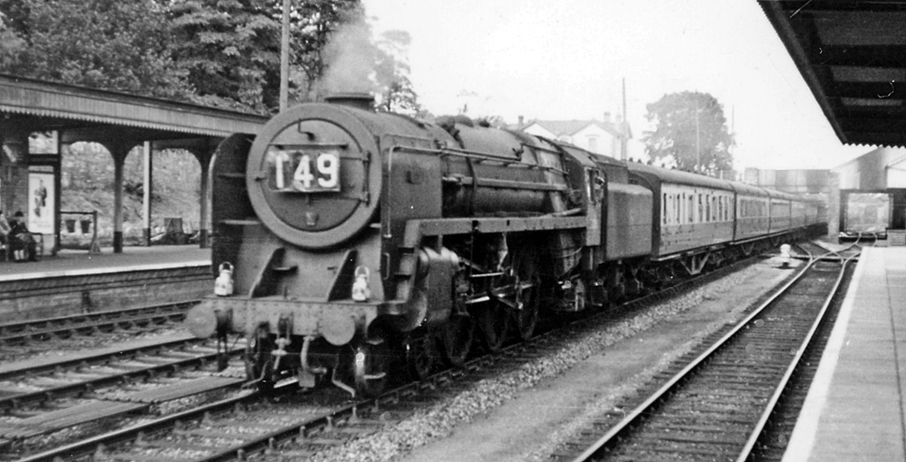
English: Wellington Station and Down express, View NE, towards Taunton, Bristol, London etc.; ex-Great Western West of England Main line to Exeter, Plymouth and Penzance. The train is the 13.25 Saturday relief express, Paddington to Kingswear, headed by BR Britannia 4-6-2 No. 70016 'Ariel', which was one of the 15 Britannias that were tolerated by the Western Region for a few years. Along with a constant stream of Summer Saturday expresses on the Taunton - Exeter stretch, it is about to tackle the steepest (1:66-90) last three miles of the climb to Whiteball Summit. |
| Date | |
| Source | From geograph.org.uk; transferred by User:belaro using geograph_org2commons. |
| Author | Ben Brooksbank |
| Permission (Reusing this file) |
Creative Commons Attribution Share-alike license 2.0 |
| Camera location | | View this and other nearby images on: OpenStreetMap |
|---|
| Object location | | View this and other nearby images on: OpenStreetMap |
|---|
_region:GB-GBN_heading:67.00&language=en)
Licensing

|
This image was taken from the Geograph project collection. See this photograph's page on the Geograph website for the photographer's contact details. The copyright on this image is owned by Ben Brooksbank and is licensed for reuse under the Creative Commons Attribution-ShareAlike 2.0 license.
|
This file is licensed under the Creative Commons Attribution-Share Alike 2.0 Generic license.
Attribution: Ben Brooksbank
- You are free:
- to share – to copy, distribute and transmit the work
- to remix – to adapt the work
- Under the following conditions:
- attribution – You must give appropriate credit, provide a link to the license, and indicate if changes were made. You may do so in any reasonable manner, but not in any way that suggests the licensor endorses you or your use.
- share alike – If you remix, transform, or build upon the material, you must distribute your contributions under the same or compatible license as the original.
File history
Click on a date/time to view the file as it appeared at that time.
| Date/Time | Thumbnail | Dimensions | User | Comment | |
|---|---|---|---|---|---|
| current | 09:39, 24 January 2011 | | 1,024 × 522 (200 KB) | File Upload Bot (Magnus Manske) |
File usage
The following pages on the English Wikipedia use this file (pages on other projects are not listed):