Original file (976 × 785 pixels, file size: 1.14 MB, MIME type: image/png)
| This is a file from the Wikimedia Commons. Information from its description page there is shown below. Commons is a freely licensed media file repository. You can help. |
Summary
| Description |
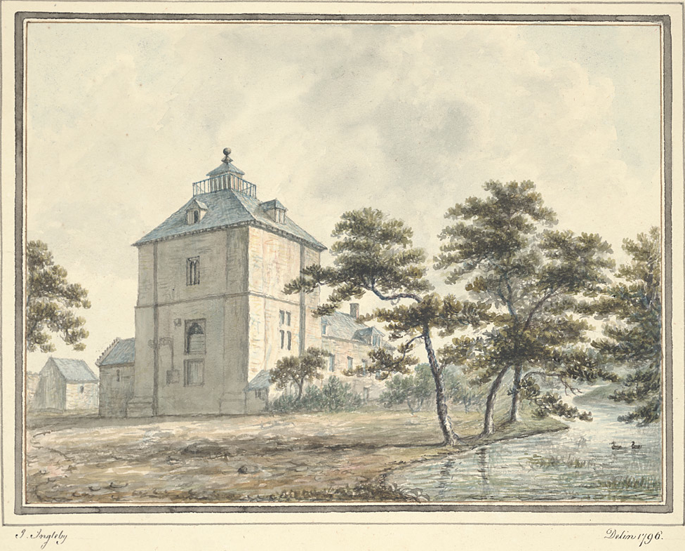
English: Wattlesborough Tower, Shropshire |
| Date | |
| Source | http://digidol.llgc.org.uk/METS/ING00001/ingleviewer?item=171&locale=cy |
| Author | John Ingleby, artist 1796 |
| Camera location | | View this and other nearby images on: OpenStreetMap |
|---|
In the parish of Alberbury with Cardeston, near the village of Halfway House on the Shrewsbury to Welshpool road, the castle was probably built in the late 13th century for Sir Richard Corbet. It comprised a square two storey tower surrounded by a moated enclosure with a fishpond.
It was bought by the Leighton family circa 1501 and used as their chief residence until circa 1711. At that time an adjoining farm building was constructed and named Wattlesborough Hall.
Licensing
 |
The source of this file is http://www.llgc.org.uk/en/. The website is managed by the National Library of Wales. |
|
This work is in the public domain in its country of origin and other countries and areas where the copyright term is the author's life plus 100 years or fewer. | |
| This file has been identified as being free of known restrictions under copyright law, including all related and neighboring rights. | |
File history
Click on a date/time to view the file as it appeared at that time.
| Date/Time | Thumbnail | Dimensions | User | Comment | |
|---|---|---|---|---|---|
| current | 22:21, 2 January 2015 | | 976 × 785 (1.14 MB) | Tyssil | User created page with UploadWizard |
File usage
Global file usage
The following other wikis use this file:
- Usage on da.wikipedia.org
- Usage on de.wikipedia.org