
Size of this PNG preview of this SVG file: 530 × 599 pixels. Other resolutions: 212 × 240 pixels | 425 × 480 pixels | 679 × 768 pixels | 906 × 1,024 pixels | 1,812 × 2,048 pixels | 675 × 763 pixels.
Original file (SVG file, nominally 675 × 763 pixels, file size: 264 KB)
| This is a file from the Wikimedia Commons. Information from its description page there is shown below. Commons is a freely licensed media file repository. You can help. |
| Description |
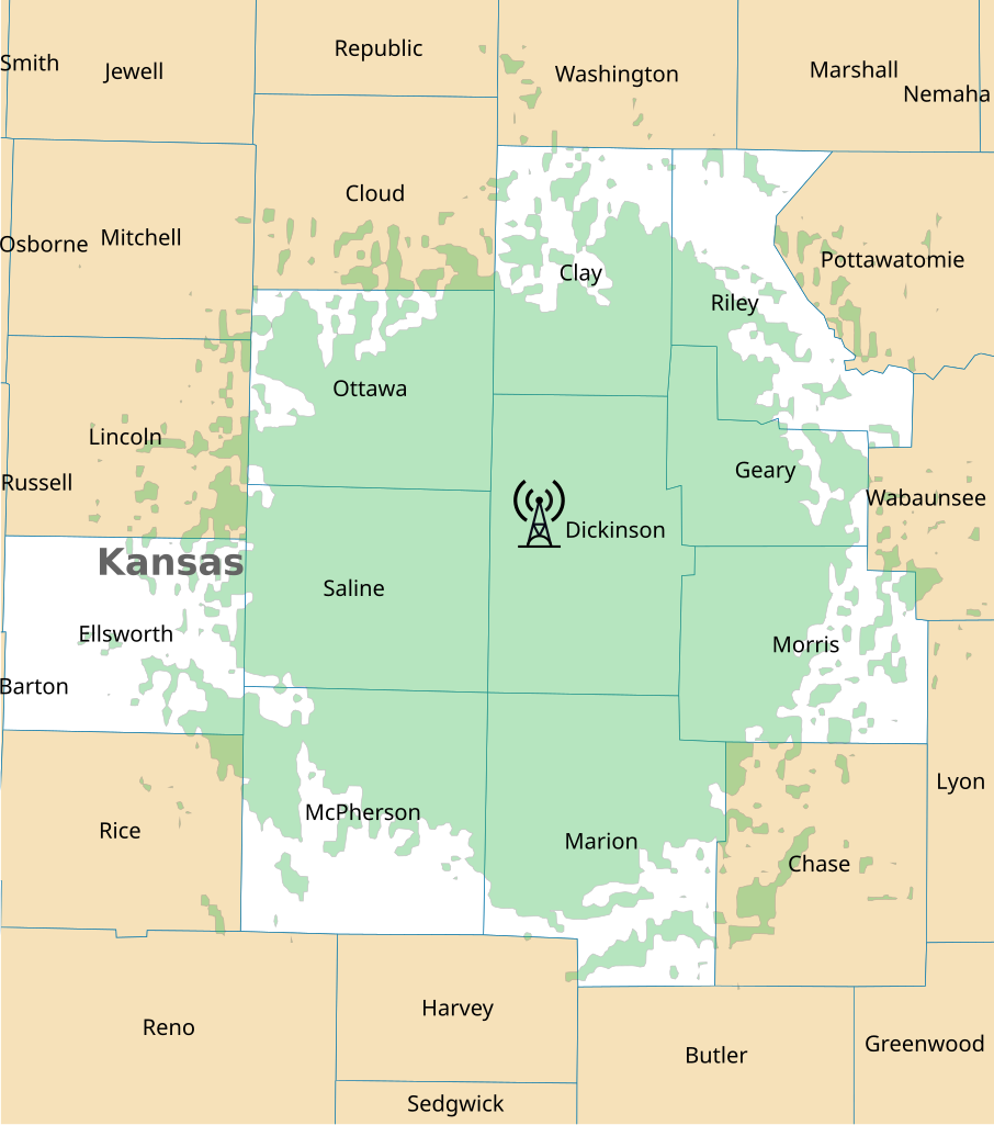
English: The coverage map for weather radio station WXL71 in Abilene, Kansas.
Coverage
Alerting areas |
|||
| Date | ||||
| Source | http://www.nws.noaa.gov/nwr/Maps/PDF/WXL71.pdf | |||
| Author | User:Derfel73; National Weather Service | |||
| Permission (Reusing this file) |
|
File history
Click on a date/time to view the file as it appeared at that time.
| Date/Time | Thumbnail | Dimensions | User | Comment | |
|---|---|---|---|---|---|
| current | 08:19, 15 August 2011 | | 675 × 763 (264 KB) | Derfel73 | Removed unnecessary border |
| 08:17, 15 August 2011 |  | 744 × 1,052 (288 KB) | Derfel73 | {{Information |Description ={{en|1=The coverage map for weather radio station WXL71 in Abilene, Kansas.}} |Source =http://www.nws.noaa.gov/nwr/Maps/PDF/WXL71.pdf |Author =User:Derfel73; National Weather Service |Date =2011 |
File usage
The following pages on the English Wikipedia use this file (pages on other projects are not listed):