
Size of this preview: 597 × 599 pixels. Other resolutions: 239 × 240 pixels | 478 × 480 pixels | 765 × 768 pixels | 1,020 × 1,024 pixels | 2,285 × 2,293 pixels.
Original file (2,285 × 2,293 pixels, file size: 3.12 MB, MIME type: image/jpeg)
| This is a file from the Wikimedia Commons. Information from its description page there is shown below. Commons is a freely licensed media file repository. You can help. |
Summary
| Description |
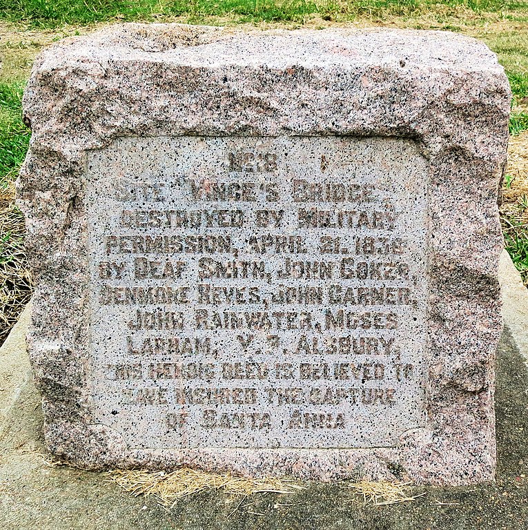
English: Marker located beside Vince's Bridge
Text on marker: No 18 Site Vince's Bridge destroyed by military permission April 21, 1836 by Deaf Smith, John Coker, Denmore Reves, John Garner, John Rainwater, Moses Lapham, V.P. Alsbury. This historic deed is believed to have insured the capture of Santa Anna. |
| Date | 12/7/2016 |
| Source | Own work |
| Author | Jim Evans |
| Camera location | | View this and other nearby images on: OpenStreetMap |
|---|
Wide View
-
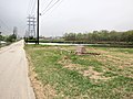 Vince's Bridge Historical Marker with Vince's Bayou in the distance

Licensing
I, the copyright holder of this work, hereby publish it under the following license:
This file is licensed under the Creative Commons Attribution-Share Alike 4.0 International license.
- You are free:
- to share – to copy, distribute and transmit the work
- to remix – to adapt the work
- Under the following conditions:
- attribution – You must give appropriate credit, provide a link to the license, and indicate if changes were made. You may do so in any reasonable manner, but not in any way that suggests the licensor endorses you or your use.
- share alike – If you remix, transform, or build upon the material, you must distribute your contributions under the same or compatible license as the original.
File history
Click on a date/time to view the file as it appeared at that time.
| Date/Time | Thumbnail | Dimensions | User | Comment | |
|---|---|---|---|---|---|
| current | 20:34, 21 July 2019 | | 2,285 × 2,293 (3.12 MB) | Jim Evans | User created page with UploadWizard |
File usage
The following pages on the English Wikipedia use this file (pages on other projects are not listed):
Global file usage
The following other wikis use this file:
- Usage on www.wikidata.org