Size of this preview: 569 × 600 pixels. Other resolutions: 228 × 240 pixels | 455 × 480 pixels | 729 × 768 pixels | 1,052 × 1,109 pixels.
Original file (1,052 × 1,109 pixels, file size: 642 KB, MIME type: image/jpeg)
| This is a file from the Wikimedia Commons. Information from its description page there is shown below. Commons is a freely licensed media file repository. You can help. |
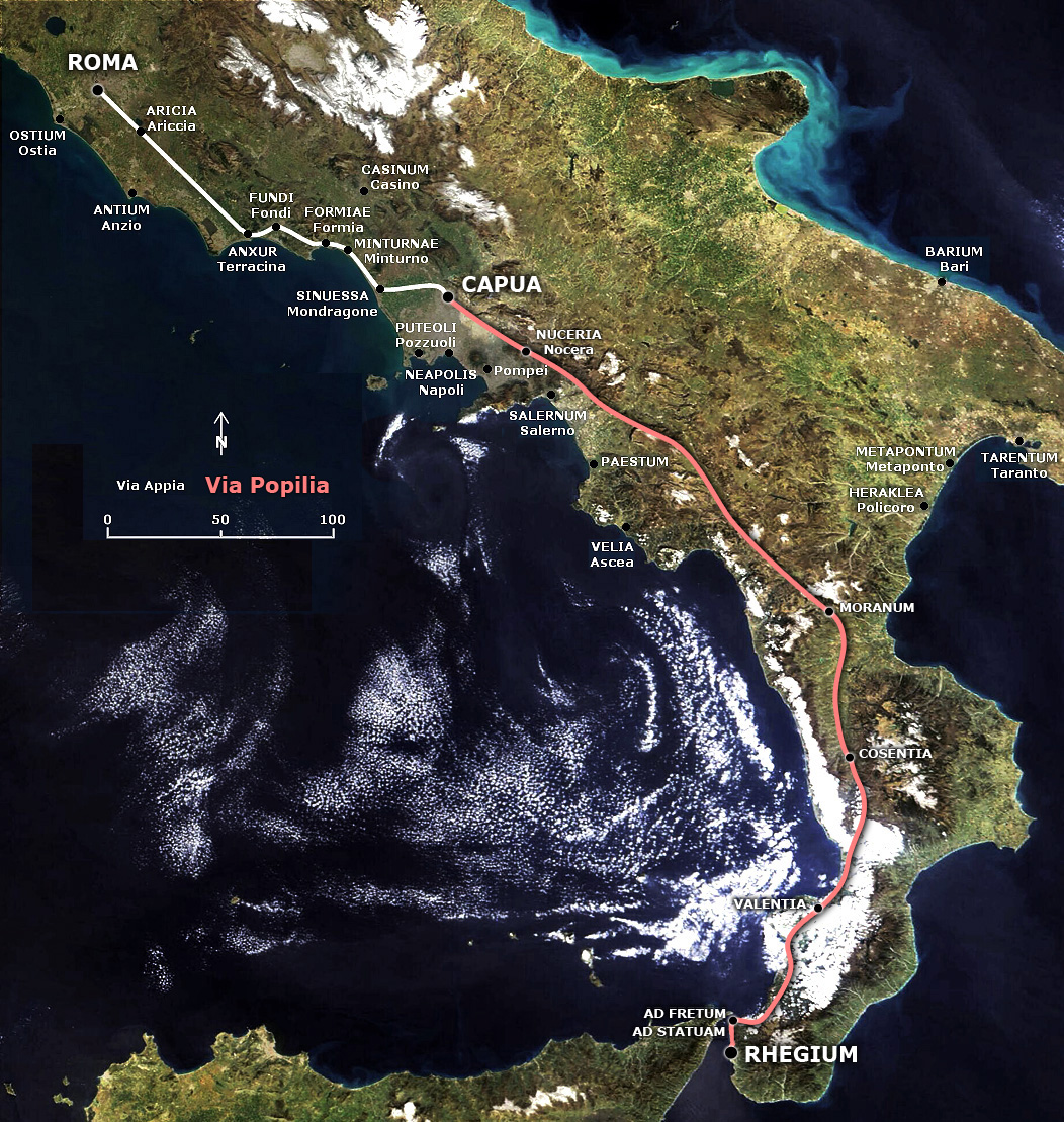
English: Map of the Popilian Way (or Via Capua-Rhegium) conjuncted to Appian Way.
Italiano: Mappa della Via Popilia (o Via Capua-Rhegium) collegata alla Via Appia.
Summary
This map is based on the following pictures: Image:Satellite image of Italy in March 2003.jpg and File:Via Appia map.jpg
Licensing
| I, the copyright holder of this work, release this work into the public domain. This applies worldwide. In some countries this may not be legally possible; if so: I grant anyone the right to use this work for any purpose, without any conditions, unless such conditions are required by law. |
| This file is in the public domain in the United States because it was solely created by NASA. NASA copyright policy states that "NASA material is not protected by copyright unless noted". (See Template:PD-USGov, NASA copyright policy page or JPL Image Use Policy.) | ||
 |
Warnings:
|
File history
Click on a date/time to view the file as it appeared at that time.
| Date/Time | Thumbnail | Dimensions | User | Comment | |
|---|---|---|---|---|---|
| current | 11:20, 28 January 2008 | | 1,052 × 1,109 (642 KB) | Salli~commonswiki | |
| 19:54, 4 April 2007 |  | 1,052 × 1,109 (647 KB) | Salli~commonswiki | {{en|Map of the Popilian Way (or Via Capua-Rhegium) conjuncted to Appian Way.}} {{it|Mappa della Via Popilia (o Via Capua-Rhegium) collegata alla Via Appia.}} == Summary == This map is based on the following pictur |
File usage
The following pages on the English Wikipedia use this file (pages on other projects are not listed):
Global file usage
The following other wikis use this file:
- Usage on bg.wikipedia.org
- Usage on da.wikipedia.org
- Usage on de.wikipedia.org
- Usage on fr.wikipedia.org
- Usage on it.wikipedia.org
- Usage on ja.wikipedia.org
- Usage on la.wikipedia.org
- Usage on mk.wikipedia.org
- Usage on pt.wikipedia.org
- Usage on sl.wikipedia.org
- Usage on sv.wikipedia.org