
Size of this preview: 610 × 599 pixels. Other resolutions: 244 × 240 pixels | 489 × 480 pixels | 727 × 714 pixels.
Original file (727 × 714 pixels, file size: 66 KB, MIME type: image/png)
| This is a file from the Wikimedia Commons. Information from its description page there is shown below. Commons is a freely licensed media file repository. You can help. |
Summary
| Description |
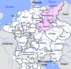
I am the author of this image file. Its contents are based in part on a map published in the "Historical Atlas" by Prof. William R Shepherd, pub. Henry Holt & Co. (New York, 1911). en:Image:Upper Saxon Circle-2005-10-14-en.png |
| Date | 14 October 2005 (original upload date) |
| Source | Transferred from de.wikipedia to Commons. |
| Author | The original uploader was Silverhelm at German Wikipedia. |
| Other versions |
  |
Licensing
This file is licensed under the Creative Commons Attribution-Share Alike 2.0 Germany license.
- You are free:
- to share – to copy, distribute and transmit the work
- to remix – to adapt the work
- Under the following conditions:
- attribution – You must give appropriate credit, provide a link to the license, and indicate if changes were made. You may do so in any reasonable manner, but not in any way that suggests the licensor endorses you or your use.
- share alike – If you remix, transform, or build upon the material, you must distribute your contributions under the same or compatible license as the original.

Original upload log
The original description page was here. All following user names refer to de.wikipedia.
- 2005-10-15 11:57 Silverhelm 727×714×8 (67951 bytes) Minor revision of colouring. Compression settings also changed.
- 2005-10-14 06:26 Silverhelm 727×714×4 (45895 bytes) I am the author of this image file. Its contents are based in part on a map published in the "Historical Atlas" by Prof. William R Shepherd, pub. Henry Holt & Co. (New York, 1911).
File history
Click on a date/time to view the file as it appeared at that time.
| Date/Time | Thumbnail | Dimensions | User | Comment | |
|---|---|---|---|---|---|
| current | 14:56, 9 March 2007 | | 727 × 714 (66 KB) | Obersachse | {{Information |Description=I am the author of this image file. Its contents are based in part on a map published in the "Historical Atlas" by Prof. William R Shepherd, pub. Henry Holt & Co. (New York, 1911). == Lizenz == [[:de:en:Image:Upper Saxon Circ |
File usage
The following pages on the English Wikipedia use this file (pages on other projects are not listed):
Global file usage
The following other wikis use this file:
- Usage on es.wikipedia.org
- Usage on ka.wikipedia.org
- Usage on ru.wikipedia.org