.jpg)
.jpg&action=edit&redlink=1)

Size of this preview: 600 × 600 pixels. Other resolutions: 240 × 240 pixels | 480 × 480 pixels | 768 × 768 pixels | 1,024 × 1,024 pixels | 2,241 × 2,241 pixels.
Original file (2,241 × 2,241 pixels, file size: 2.04 MB, MIME type: image/jpeg)
| This is a file from the Wikimedia Commons. Information from its description page there is shown below. Commons is a freely licensed media file repository. You can help. |
.jpg)
Summary
| Description |
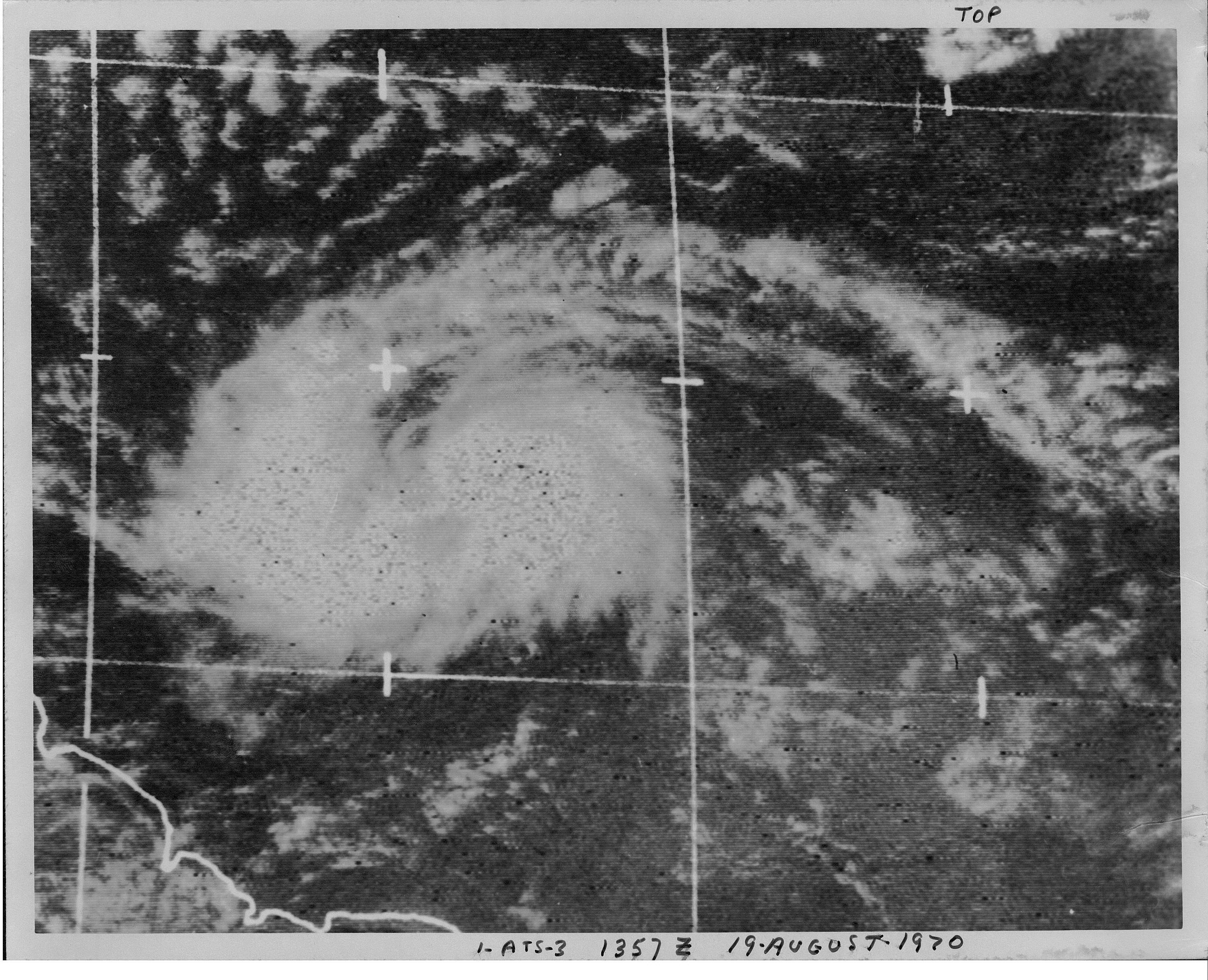
English: Satellite image of Tropical Storm Dorothy east of the Lesser Antilles |
| Date | |
| Source | http://www.nhc.noaa.gov/archive/storm_wallets/cdmp/dvd0032-jpg/1970/atlantic/dorothy/satpic/s191357z.jpg |
| Author | ATS-3 Satellite |
Licensing
This image is in the public domain because it contains materials that originally came from the U.S. National Oceanic and Atmospheric Administration, taken or made as part of an employee's official duties.
|
File history
Click on a date/time to view the file as it appeared at that time.
| Date/Time | Thumbnail | Dimensions | User | Comment | |
|---|---|---|---|---|---|
| current | 19:56, 4 May 2024 | | 2,241 × 2,241 (2.04 MB) | Sandy14156 | cropped |
| 21:38, 9 November 2008 |  | 3,002 × 2,437 (979 KB) | Hurricanehink | {{Information |Description={{en|1=Satellite image of Tropical Storm Dorothy east of the Lesser Antilles}} |Source=http://www.nhc.noaa.gov/archive/storm_wallets/cdmp/dvd0032-jpg/1970/atlantic/dorothy/satpic/s191357z.jpg |Author=ATS-3 Satellite |Date=1970-0 |
File usage
The following pages on the English Wikipedia use this file (pages on other projects are not listed):
Global file usage
The following other wikis use this file:
- Usage on es.wikipedia.org
- Usage on pt.wikipedia.org
.jpg)