
Size of this preview: 588 × 600 pixels. Other resolutions: 235 × 240 pixels | 471 × 480 pixels | 753 × 768 pixels | 1,004 × 1,024 pixels | 2,009 × 2,048 pixels | 3,109 × 3,170 pixels.
Original file (3,109 × 3,170 pixels, file size: 8.54 MB, MIME type: image/jpeg)
| This is a file from the Wikimedia Commons. Information from its description page there is shown below. Commons is a freely licensed media file repository. You can help. |

|
This transport map image could be re-created using vector graphics as an SVG file. This has several advantages; see Commons:Media for cleanup for more information. If an SVG form of this image is available, please upload it and afterwards replace this template with
{{vector version available|new image name}}.
It is recommended to name the SVG file “Transilien Paris region map.svg”—then the template Vector version available (or Vva) does not need the new image name parameter. |


| Description |
|
| Date | see file history |
| Source | Own work, using OpenStreetMap data for the background |
| Author | Maximilian Dörrbecker (Chumwa) |
| Permission (Reusing this file) |
All OpenStreetMap data and maps are Creative Commons "CC-BY-SA 2.0" licensed This file is licensed under the Creative Commons Attribution-Share Alike 2.0 Generic license.
|
| Other versions |
|


File history
Click on a date/time to view the file as it appeared at that time.
| Date/Time | Thumbnail | Dimensions | User | Comment | |
|---|---|---|---|---|---|
| current | 19:07, 25 December 2017 | | 3,109 × 3,170 (8.54 MB) | Chumwa | Kartenrahmen vergessen |
| 18:56, 25 December 2017 |  | 3,109 × 3,170 (8.82 MB) | Chumwa | + T11 Express | |
| 17:28, 14 December 2015 |  | 3,109 × 3,170 (7.16 MB) | Chumwa | + Rosa Parks | |
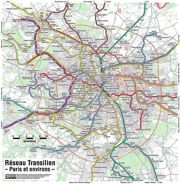
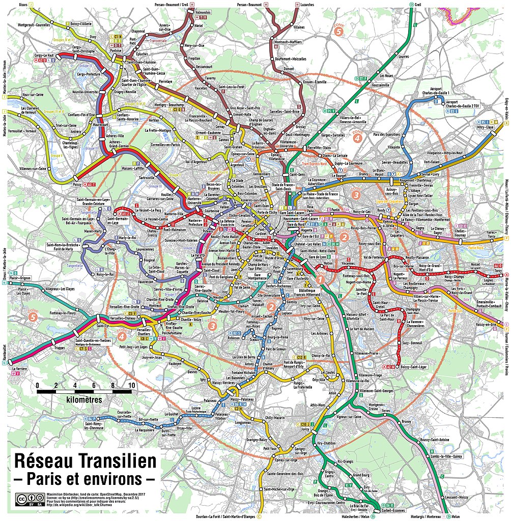
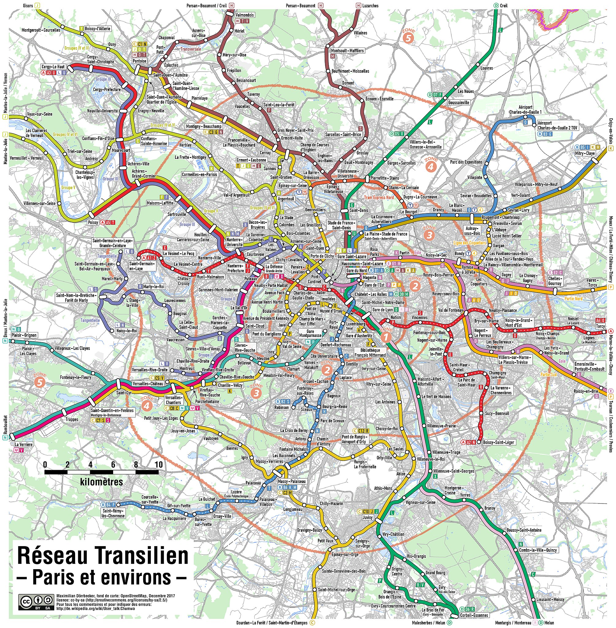
| 22:24, 10 December 2012 |  | 3,109 × 3,170 (2.25 MB) | Chumwa | {{Information |Description= *{{ de }} Karte des Transilien-Netzes in der Region Paris. Eine deteillierte Kartenlegende findet sich hier. *{{ en }} Map of the Transilien network in the Paris region. A detaile... |
File usage
The following pages on the English Wikipedia use this file (pages on other projects are not listed):
Global file usage
The following other wikis use this file:
- Usage on cs.wikipedia.org
- Usage on de.wikipedia.org
- Usage on eo.wikipedia.org
- Usage on es.wikipedia.org
- Usage on fi.wikipedia.org
- Usage on fr.wikipedia.org
- Usage on it.wikipedia.org
- Usage on ko.wikipedia.org
- Usage on sk.wikipedia.org