Size of this preview: 800 × 474 pixels. Other resolutions: 320 × 190 pixels | 640 × 380 pixels | 1,024 × 607 pixels | 1,280 × 759 pixels | 2,560 × 1,518 pixels | 6,850 × 4,062 pixels.
Original file (6,850 × 4,062 pixels, file size: 3.43 MB, MIME type: image/png)
| This is a file from the Wikimedia Commons. Information from its description page there is shown below. Commons is a freely licensed media file repository. You can help. |
Summary
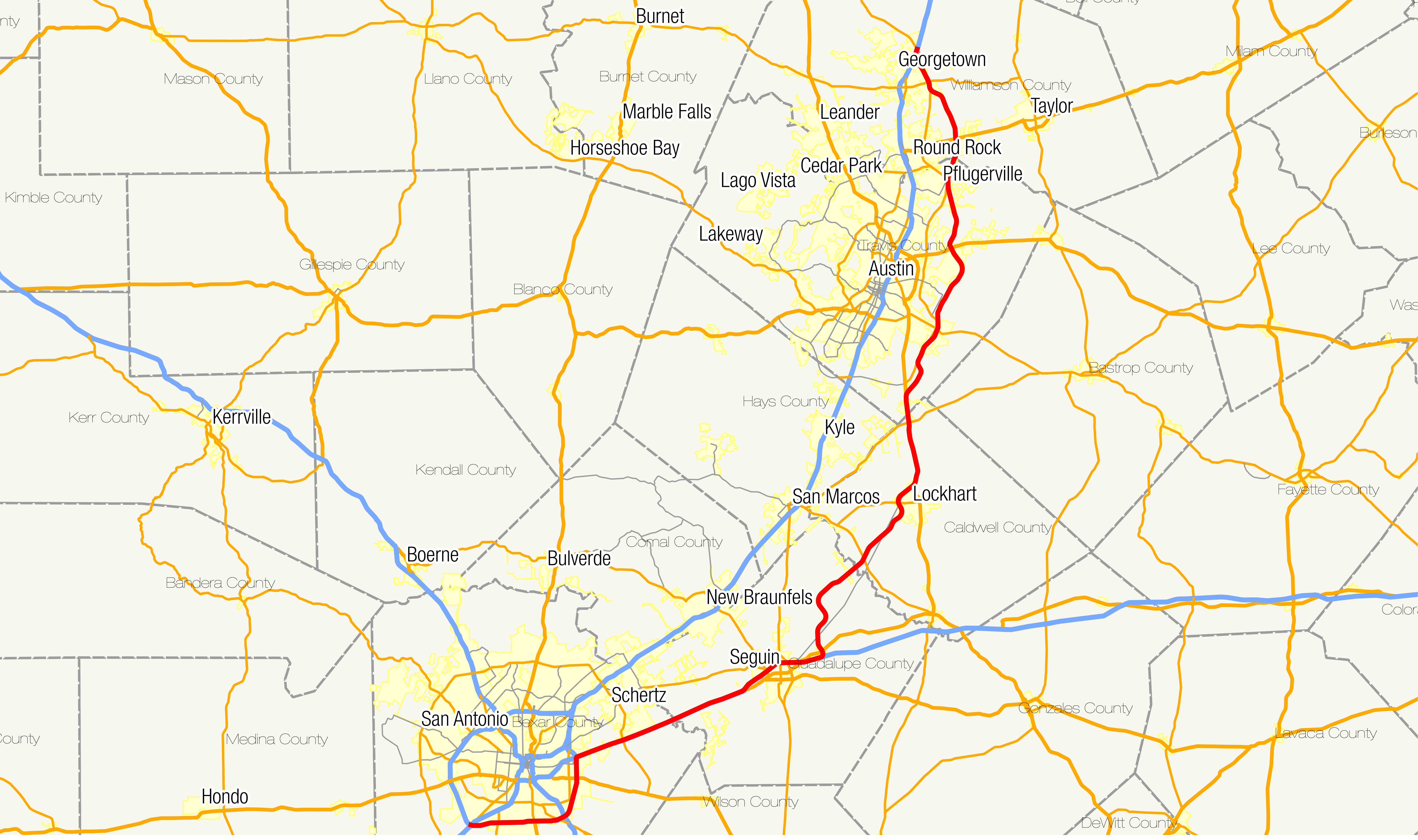
| Description | Map of w:Texas State Highway 130. |
| Date | |
| Source | State line and county boundaries and place shapes and road network |
| Author | Fredddie |
Licensing
I, the copyright holder of this work, hereby publish it under the following license:
This file is licensed under the Creative Commons Attribution-Share Alike 3.0 Unported license.
- You are free:
- to share – to copy, distribute and transmit the work
- to remix – to adapt the work
- Under the following conditions:
- attribution – You must give appropriate credit, provide a link to the license, and indicate if changes were made. You may do so in any reasonable manner, but not in any way that suggests the licensor endorses you or your use.
- share alike – If you remix, transform, or build upon the material, you must distribute your contributions under the same or compatible license as the original.
File history
Click on a date/time to view the file as it appeared at that time.
| Date/Time | Thumbnail | Dimensions | User | Comment | |
|---|---|---|---|---|---|
| current | 02:58, 23 September 2013 | | 6,850 × 4,062 (3.43 MB) | Fredddie | == {{int:filedesc}} == {{Information |Description=Map of w:Texas State Highway 130. |Source=[http://www.census.gov/geo/maps-data/data/tiger-cart-boundary.html State line and county boundaries and place shapes] and [http://www.fhwa.dot.gov/planning/... |
File usage
No pages on the English Wikipedia use this file (pages on other projects are not listed).
Global file usage
The following other wikis use this file:
- Usage on www.wikidata.org
- Usage on zh.wikipedia.org