No higher resolution available.
St._Paul's_Church,_Dosthill_-_geograph.org.uk_-_1073400.jpg (640 × 529 pixels, file size: 177 KB, MIME type: image/jpeg)
| This is a file from the Wikimedia Commons. Information from its description page there is shown below. Commons is a freely licensed media file repository. You can help. |
Summary
| Description |
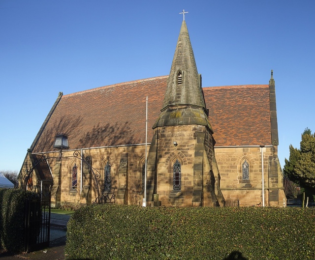
English: St. Paul's Church, Dosthill. St.Paul's church in Dosthill is a Victorian building, the foundation stone was laid by Mr Farmer Cheatle in 1870. The stone for this church was quarried from the 1074776 in nearby Whateley. The church has a number of quite recent stained glass windows. |
| Date | |
| Source | From geograph.org.uk |
| Author | Rob Farrow |
| Attribution (required by the license) | Rob Farrow / St. Paul's Church, Dosthill / |
| Camera location | | View this and other nearby images on: OpenStreetMap |
|---|
_heading:337.00&language=en)
| Object location | | View this and other nearby images on: OpenStreetMap |
|---|
_heading:337.00&language=en)
Licensing

|
This image was taken from the Geograph project collection. See this photograph's page on the Geograph website for the photographer's contact details. The copyright on this image is owned by Rob Farrow and is licensed for reuse under the Creative Commons Attribution-ShareAlike 2.0 license.
|
This file is licensed under the Creative Commons Attribution-Share Alike 2.0 Generic license.
Attribution: Rob Farrow
- You are free:
- to share – to copy, distribute and transmit the work
- to remix – to adapt the work
- Under the following conditions:
- attribution – You must give appropriate credit, provide a link to the license, and indicate if changes were made. You may do so in any reasonable manner, but not in any way that suggests the licensor endorses you or your use.
- share alike – If you remix, transform, or build upon the material, you must distribute your contributions under the same or compatible license as the original.
File history
Click on a date/time to view the file as it appeared at that time.
| Date/Time | Thumbnail | Dimensions | User | Comment | |
|---|---|---|---|---|---|
| current | 08:27, 24 February 2011 | | 640 × 529 (177 KB) | GeographBot | == {{int:filedesc}} == {{Information |description={{en|1=St. Paul's Church, Dosthill St.Paul's church in Dosthill is a Victorian building, the foundation stone was laid by Mr Farmer Cheatle in 1870. The stone for this church was quarried from the [[[10747 |
File usage
The following pages on the English Wikipedia use this file (pages on other projects are not listed):
Global file usage
The following other wikis use this file: