Size of this preview: 800 × 509 pixels. Other resolutions: 320 × 204 pixels | 640 × 407 pixels | 1,024 × 652 pixels | 1,280 × 815 pixels | 2,560 × 1,630 pixels | 3,358 × 2,138 pixels.
Original file (3,358 × 2,138 pixels, file size: 1.4 MB, MIME type: image/png)
| This is a file from the Wikimedia Commons. Information from its description page there is shown below. Commons is a freely licensed media file repository. You can help. |
Summary
| Description |
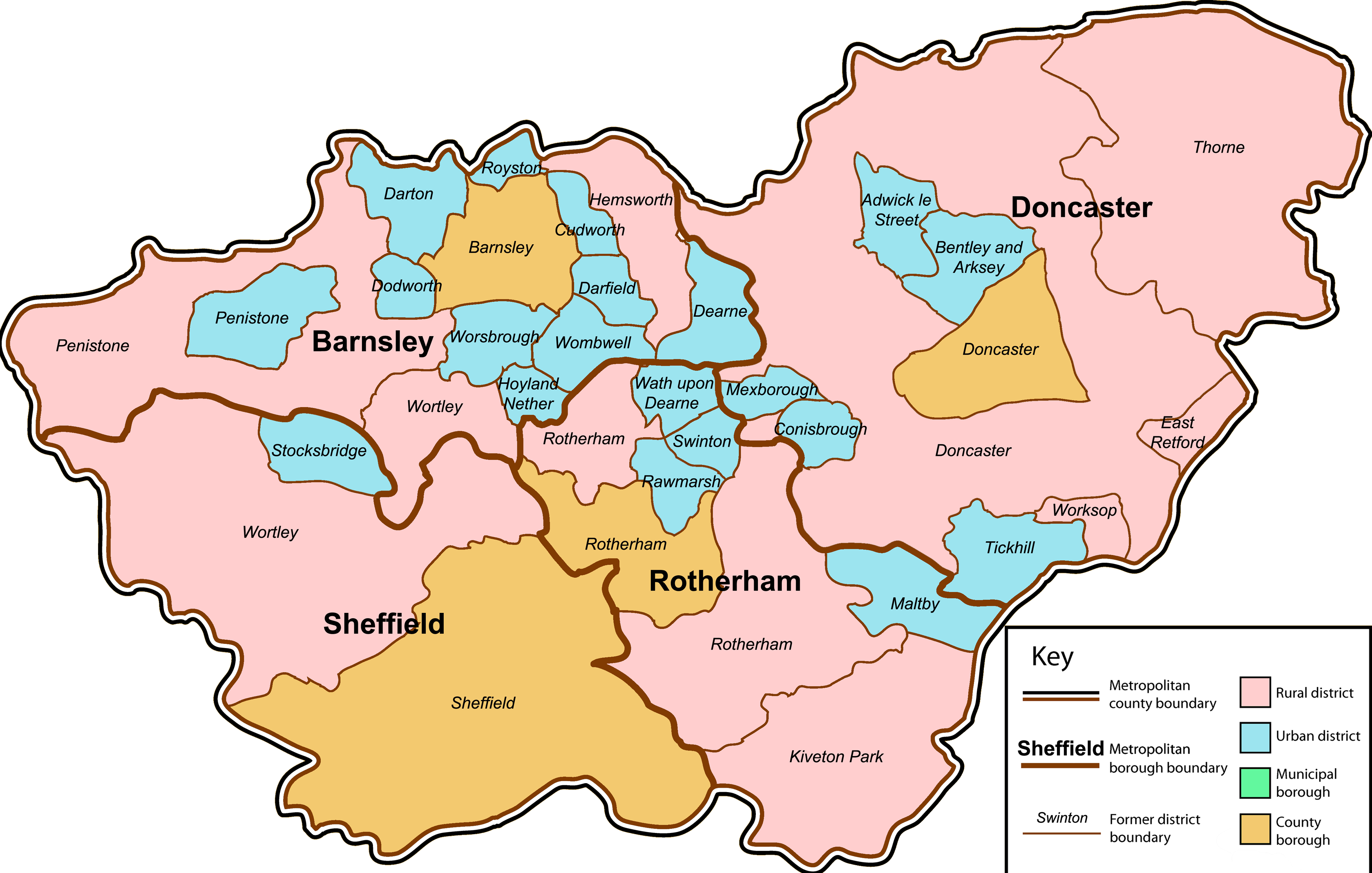
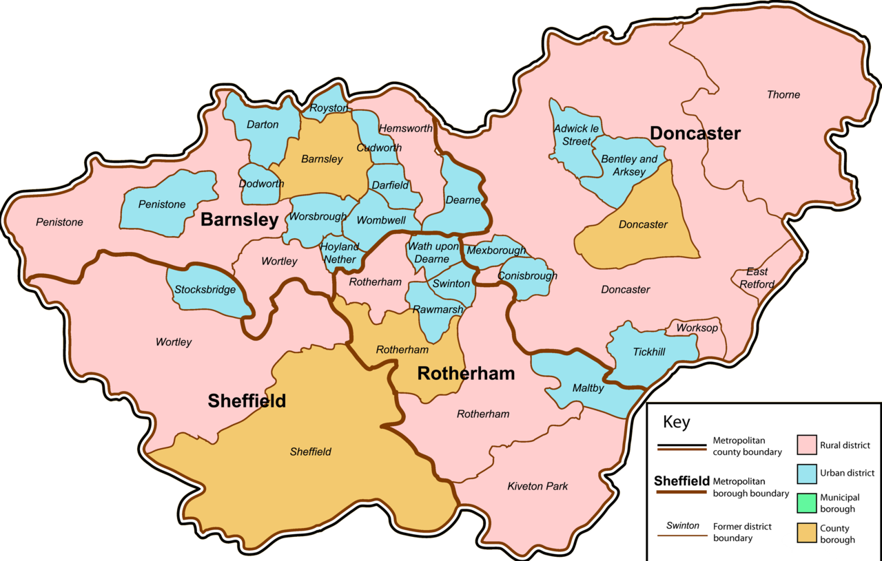
English: A map of the metropolitan county of South Yorkshire, England. This map shows former and modern district boundaries - see key for explanation. |
| Date | |
| Source | Own work by uploader. Content is verified at Her Majesty's Stationery Office (1974) Local Government in England and Wales: A Guide to the New System, London: HMSO ISBN: 0117508470. |
| Author | Jza84 |
Licensing
| I, the copyright holder of this work, release this work into the public domain. This applies worldwide. In some countries this may not be legally possible; if so: I grant anyone the right to use this work for any purpose, without any conditions, unless such conditions are required by law. |
File history
Click on a date/time to view the file as it appeared at that time.
| Date/Time | Thumbnail | Dimensions | User | Comment | |
|---|---|---|---|---|---|
| current | 01:06, 14 January 2009 | | 3,358 × 2,138 (1.4 MB) | Jza84 | fix Royston |
| 02:38, 13 January 2009 |  | 3,358 × 2,138 (1.45 MB) | Jza84 | fix size | |
| 02:31, 13 January 2009 |  | 4,607 × 2,937 (734 KB) | Jza84 | {{Information |Description={{en|1=A map of the metropolitan county of South Yorkshire, England. This map shows former and modern district boundaries - see key for explanation.}} |Source=Own work by uploader |Author=Jza84 |Date=January 2009 |
File usage
The following pages on the English Wikipedia use this file (pages on other projects are not listed):
- Civil parishes in South Yorkshire
- Conisbrough Urban District
- County Borough of Barnsley
- Cudworth Urban District
- List of mills in South Yorkshire
- South Yorkshire
- West Riding of Yorkshire
- User:Skinsmoke/Sandbox/Civil parishes/South Yorkshire
- Wikipedia:Graphics Lab/Map workshop/Archive/Dec 2010
- Category:Textile mills in South Yorkshire
Global file usage
The following other wikis use this file:
- Usage on it.wikipedia.org