Size of this preview: 609 × 600 pixels. Other resolutions: 244 × 240 pixels | 487 × 480 pixels | 780 × 768 pixels | 1,039 × 1,024 pixels | 2,013 × 1,983 pixels.
Original file (2,013 × 1,983 pixels, file size: 624 KB, MIME type: image/jpeg)
| This is a file from the Wikimedia Commons. Information from its description page there is shown below. Commons is a freely licensed media file repository. You can help. |
| Description |
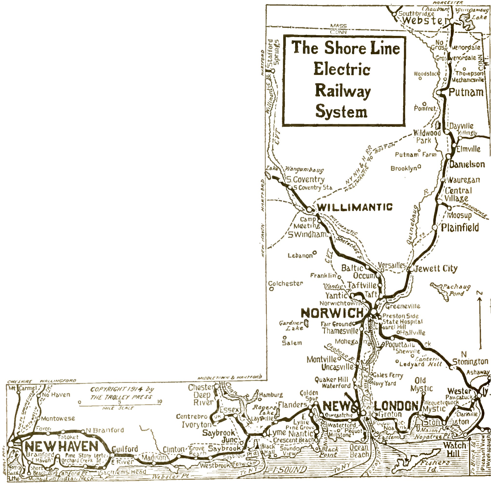
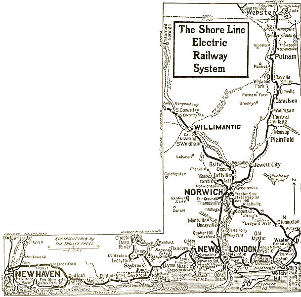
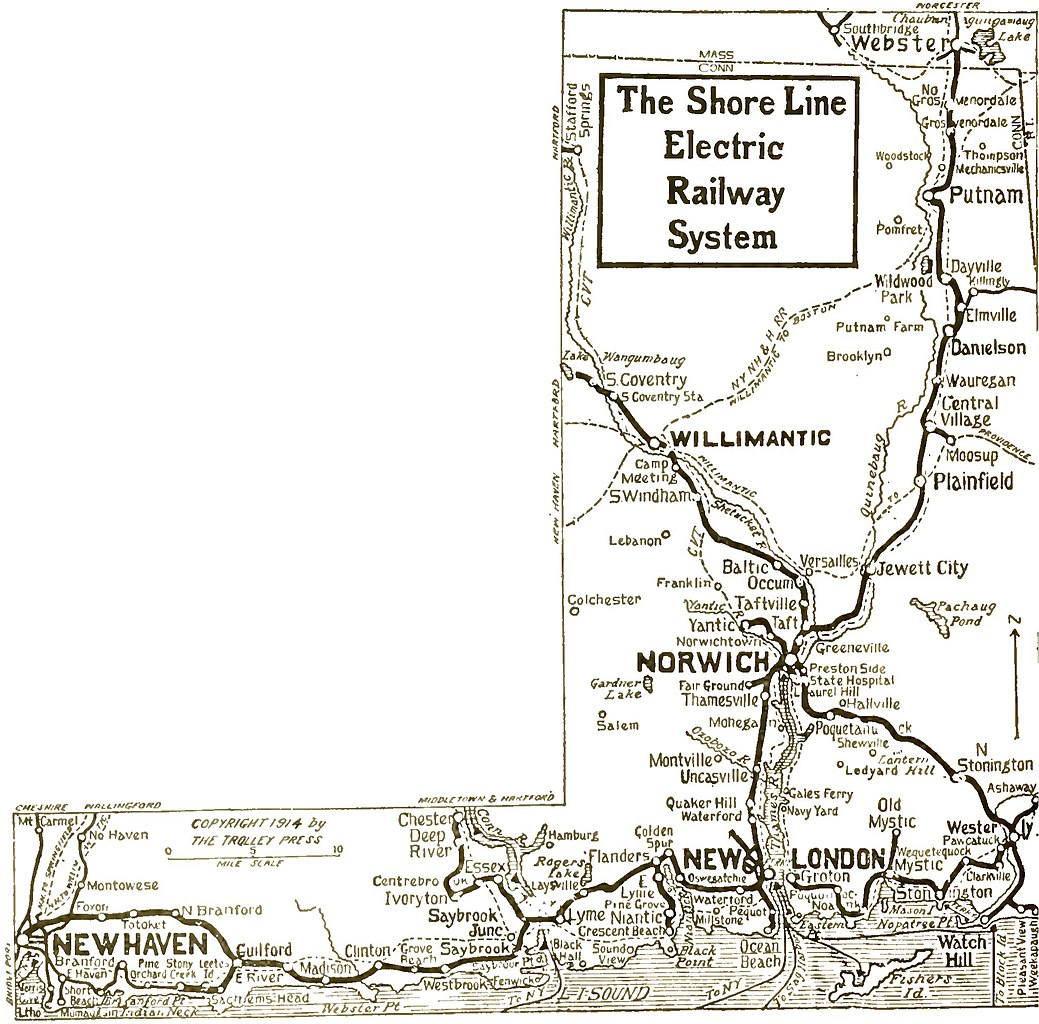
English: Map of the Shore Line Electric Railway, dating from 1916. The map shows the Norwich & Westerly, Groton & Stonington, New London & East Lyme and Pawtucket Valley lines, as well as the Shore Line. |
||
| Date | |||
| Source | File:Trolley-Trips-Through-New-England.pdf | ||
| Author | Unknown author | ||
| Permission (Reusing this file) |
|
File history
Click on a date/time to view the file as it appeared at that time.
| Date/Time | Thumbnail | Dimensions | User | Comment | |
|---|---|---|---|---|---|
| current | 03:04, 5 January 2012 | | 2,013 × 1,983 (624 KB) | Pi.1415926535 | better version |
| 01:26, 5 January 2012 |  | 1,937 × 3,633 (2.9 MB) | Pi.1415926535 | Amateurish attempt at restoration | |
| 00:54, 5 January 2012 |  | 1,937 × 3,633 (616 KB) | Pi.1415926535 | {{Information |Description ={{en|1=Map of part of the Shore Line Electric Railway, dating from between 1916 (Shore Line acquires Norwich & Westerly system) and 1922 (Norwich - Westerly Line goes out of service). The map shows the Norwich & Westerly, Gr |
File usage
The following pages on the English Wikipedia use this file (pages on other projects are not listed):