
Size of this preview: 800 × 534 pixels. Other resolutions: 320 × 214 pixels | 640 × 428 pixels | 1,024 × 684 pixels | 1,280 × 855 pixels.
Original file (1,280 × 855 pixels, file size: 174 KB, MIME type: image/jpeg)
| This is a file from the Wikimedia Commons. Information from its description page there is shown below. Commons is a freely licensed media file repository. You can help. |
Summary
| Description |
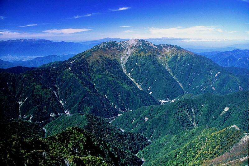
English: Mount Senjō seen from Mount Kita in Akaishi Mountains, Japan.
|
| Date | |
| Source | Own work |
| Author | Alpsdake |
| Camera location | | View this and other nearby images on: OpenStreetMap |
|---|
Licensing
| I, the copyright holder of this work, release this work into the public domain. This applies worldwide. In some countries this may not be legally possible; if so: I grant anyone the right to use this work for any purpose, without any conditions, unless such conditions are required by law. |
File history
Click on a date/time to view the file as it appeared at that time.
| Date/Time | Thumbnail | Dimensions | User | Comment | |
|---|---|---|---|---|---|
| current | 06:32, 12 August 2010 | | 1,280 × 855 (174 KB) | Alpsdake | {{Information |Description={{en|1=Senjogatake_from_Kitadake_2001-10-3}} {{ja|1=北岳からの仙丈ヶ岳}} |Source=my own picture |Author=Alpsdake |Date=2001-10-3 |Permission= |other_versions= }} Category:Mount Senjogatake [[Category:Akaishi Mounta |
File usage
The following pages on the English Wikipedia use this file (pages on other projects are not listed):
Global file usage
The following other wikis use this file:
- Usage on de.wikipedia.org
- Usage on id.wikipedia.org
- Usage on ja.wikipedia.org
- Usage on uz.wikipedia.org