
Original file (2,000 × 1,434 pixels, file size: 2.69 MB, MIME type: image/jpeg)
| This is a file from the Wikimedia Commons. Information from its description page there is shown below. Commons is a freely licensed media file repository. You can help. |
Summary
| Description |
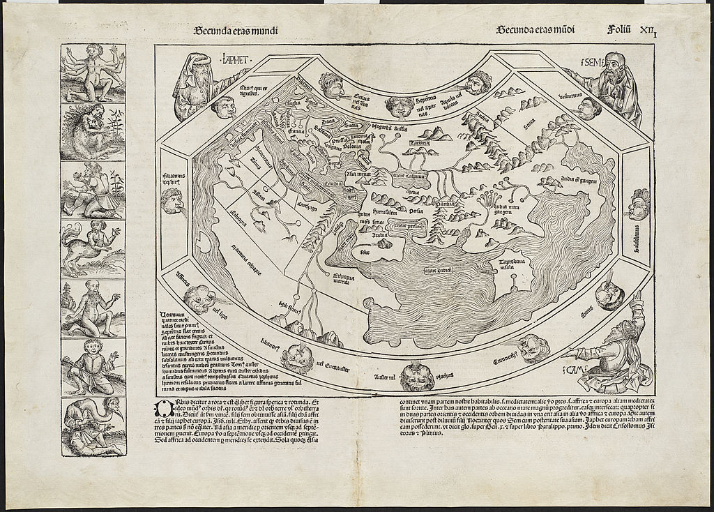
Zoom into this map at maps.bpl.org. Author: Schedel, Hartmann Publisher: Anton Koberger Date: [12 July 1493]
Although published just as news of Christopher Columbuss discoveries was beginning to spread, this was the last noteworthy world map to be produced without any indication of the New World. This depiction of the Old World was fanciful, and unlike earlier Ptolemaic maps, contained little detail. The text and wood cut illustrations, including this world map, which appeared in the Nuremberg Chronicle, were an amalgam of legend, fancy, and tradition interspersed with occasional scientific fact. For example the world map is supported by three biblical figures Ham, Shem, and Japhet while the marginal panel consists of exotic figures believed to exist in foreign lands. |
| Date | |
| Source | Secunda etas mundi = |
| Author | http://maps.bpl.org |
Licensing
- You are free:
- to share – to copy, distribute and transmit the work
- to remix – to adapt the work
- Under the following conditions:
- attribution – You must give appropriate credit, provide a link to the license, and indicate if changes were made. You may do so in any reasonable manner, but not in any way that suggests the licensor endorses you or your use.
| This image was originally posted to Flickr by Norman B. Leventhal Map Center at the BPL at https://www.flickr.com/photos/24528911@N05/2675676024. It was reviewed on 2 July 2012 by FlickreviewR and was confirmed to be licensed under the terms of the cc-by-2.0. |
File history
Click on a date/time to view the file as it appeared at that time.
| Date/Time | Thumbnail | Dimensions | User | Comment | |
|---|---|---|---|---|---|
| current | 01:44, 2 July 2012 | | 2,000 × 1,434 (2.69 MB) | Dzlinker | == {{int:filedesc}} == {{Information |Description=Zoom into [http://maps.bpl.org/id/10087 this map] at [http://maps.bpl.org maps.bpl.org]. '''Author:''' Schedel, Hartmann '''Publisher:''' Anton Koberger '''Date:''' [12 July 1493] '''Scale:''' Scale n... |