
Size of this preview: 800 × 476 pixels. Other resolutions: 320 × 191 pixels | 640 × 381 pixels | 1,024 × 610 pixels | 1,280 × 762 pixels | 2,560 × 1,525 pixels | 4,072 × 2,425 pixels.
Original file (4,072 × 2,425 pixels, file size: 3.53 MB, MIME type: image/png)
| This is a file from the Wikimedia Commons. Information from its description page there is shown below. Commons is a freely licensed media file repository. You can help. |
| Description |
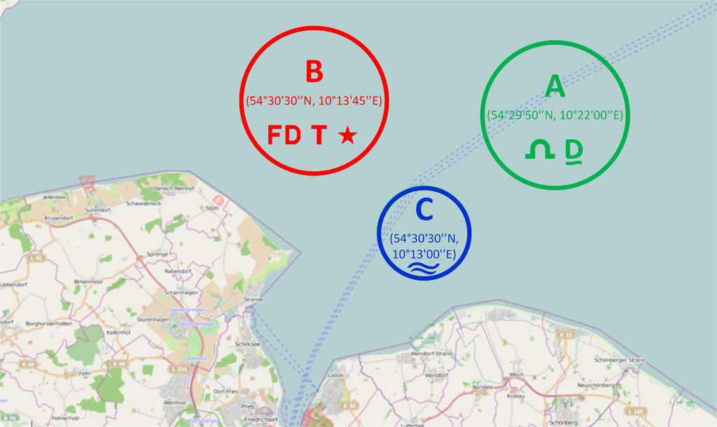
Kiel/Schilksee Olympic Course Area's 1972 This map was created from OpenStreetMap project data, collected by the community. This map may be incomplete, and may contain errors. Don't rely solely on it for navigation. |
| Date | (see file history) |
| Source | You may find a page on the OpenStreetMap wiki page for Schilksee, Germany |
| Creator |
OpenStreetMap contributors and VYGOcommons OpenStreetMap contributors |
| Permission (Reusing this file) |
OpenStreetMap data and maps are licensed under the Creative Commons Attribution-ShareAlike 2.0 license (CC-BY-SA 2.0). This file is licensed under the Creative Commons Attribution-Share Alike 2.0 Generic license.
|
| Georeferencing | If inappropriate please set warp_status = skip to hide. |
File history
Click on a date/time to view the file as it appeared at that time.
| Date/Time | Thumbnail | Dimensions | User | Comment | |
|---|---|---|---|---|---|
| current | 11:08, 5 March 2014 | | 4,072 × 2,425 (3.53 MB) | NED33 | Changed color of course A to green for better readability |
| 10:45, 5 March 2014 |  | 4,072 × 2,425 (3.53 MB) | VYGOcommons | User created page with UploadWizard |
File usage
The following pages on the English Wikipedia use this file (pages on other projects are not listed):
- Sailing at the 1972 Summer Olympics
- Sailing at the 1972 Summer Olympics – Dragon
- Sailing at the 1972 Summer Olympics – Finn
- Sailing at the 1972 Summer Olympics – Flying Dutchman
- Sailing at the 1972 Summer Olympics – Soling
- Sailing at the 1972 Summer Olympics – Star
- Sailing at the 1972 Summer Olympics – Tempest
Global file usage
The following other wikis use this file:
- Usage on de.wikipedia.org
- Usage on pt.wikipedia.org