
Size of this preview: 800 × 600 pixels. Other resolutions: 320 × 240 pixels | 640 × 480 pixels | 1,024 × 768 pixels | 1,280 × 960 pixels | 2,560 × 1,920 pixels | 3,648 × 2,736 pixels.
Original file (3,648 × 2,736 pixels, file size: 2.68 MB, MIME type: image/jpeg)
| This is a file from the Wikimedia Commons. Information from its description page there is shown below. Commons is a freely licensed media file repository. You can help. |
Summary
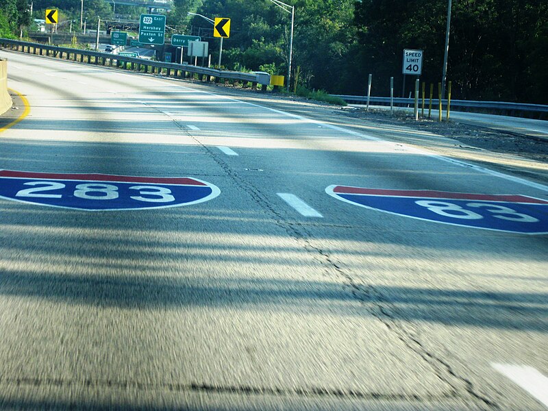
Traveling south on I-83 in Harrisburg, travelers encounter the split for I-83 just southeast of town. The lanes split for the diverging freeways, as is noted here.
Photo taken on 16 Aug 09 by Jesse Bender
Location on Google Maps: https://www.google.ca/maps/@40.2620181,-76.8145311,174m/data=!3m1!1e3
Licensing
| I, the copyright holder of this work, release this work into the public domain. This applies worldwide. In some countries this may not be legally possible; if so: I grant anyone the right to use this work for any purpose, without any conditions, unless such conditions are required by law. |
File history
Click on a date/time to view the file as it appeared at that time.
| Date/Time | Thumbnail | Dimensions | User | Comment | |
|---|---|---|---|---|---|
| current | 15:52, 12 January 2010 | | 3,648 × 2,736 (2.68 MB) | Admiral capn | Traveling south on I-83 in Harrisburg, travelers encounter the split for I-83 just southeast of town. The lanes split for the diverging freeways, as is noted here. Photo taken on 16 Aug 09 by Jesse Bender |
File usage
The following pages on the English Wikipedia use this file (pages on other projects are not listed):
Global file usage
The following other wikis use this file:
- Usage on zh.wikipedia.org