
Size of this preview: 800 × 452 pixels. Other resolutions: 320 × 181 pixels | 640 × 362 pixels | 1,278 × 722 pixels.
Original file (1,278 × 722 pixels, file size: 350 KB, MIME type: image/jpeg)
| This is a file from the Wikimedia Commons. Information from its description page there is shown below. Commons is a freely licensed media file repository. You can help. |
Summary
| Description |
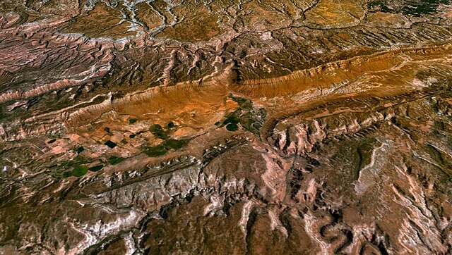
English: Simulated view of Paradox Valley in Colorado. Created with NASA's World Wind software, version 1.4, using the LandSat 7 visible color layer. |
| Date | |
| Source | Screenshot of NASA World Wind software |
| Author | Created this myself using NASA World Wind |
Licensing
| This image is in the public domain because it is a screenshot from NASA’s globe software World Wind using a public domain layer, such as Blue Marble, MODIS, Landsat, SRTM, USGS or GLOBE.
|
 |
File history
Click on a date/time to view the file as it appeared at that time.
| Date/Time | Thumbnail | Dimensions | User | Comment | |
|---|---|---|---|---|---|
| current | 03:07, 28 November 2009 | | 1,278 × 722 (350 KB) | Suffusion of Yellow | {{Information |Description={{en|1=Simulated view of Paradox Valley in Colorado. Created with NASA's World Wind software, version 1.4, using the LandSat 7 visible color layer.}} |Source=Screenshot of NASA World Wind software |Author=NASA |Date=2009-11-27 | |
File usage
The following pages on the English Wikipedia use this file (pages on other projects are not listed):
Global file usage
The following other wikis use this file:
- Usage on he.wikipedia.org