Original file (2,048 × 2,048 pixels, file size: 1.86 MB, MIME type: image/png)
| This is a file from the Wikimedia Commons. Information from its description page there is shown below. Commons is a freely licensed media file repository. You can help. |
| Description |
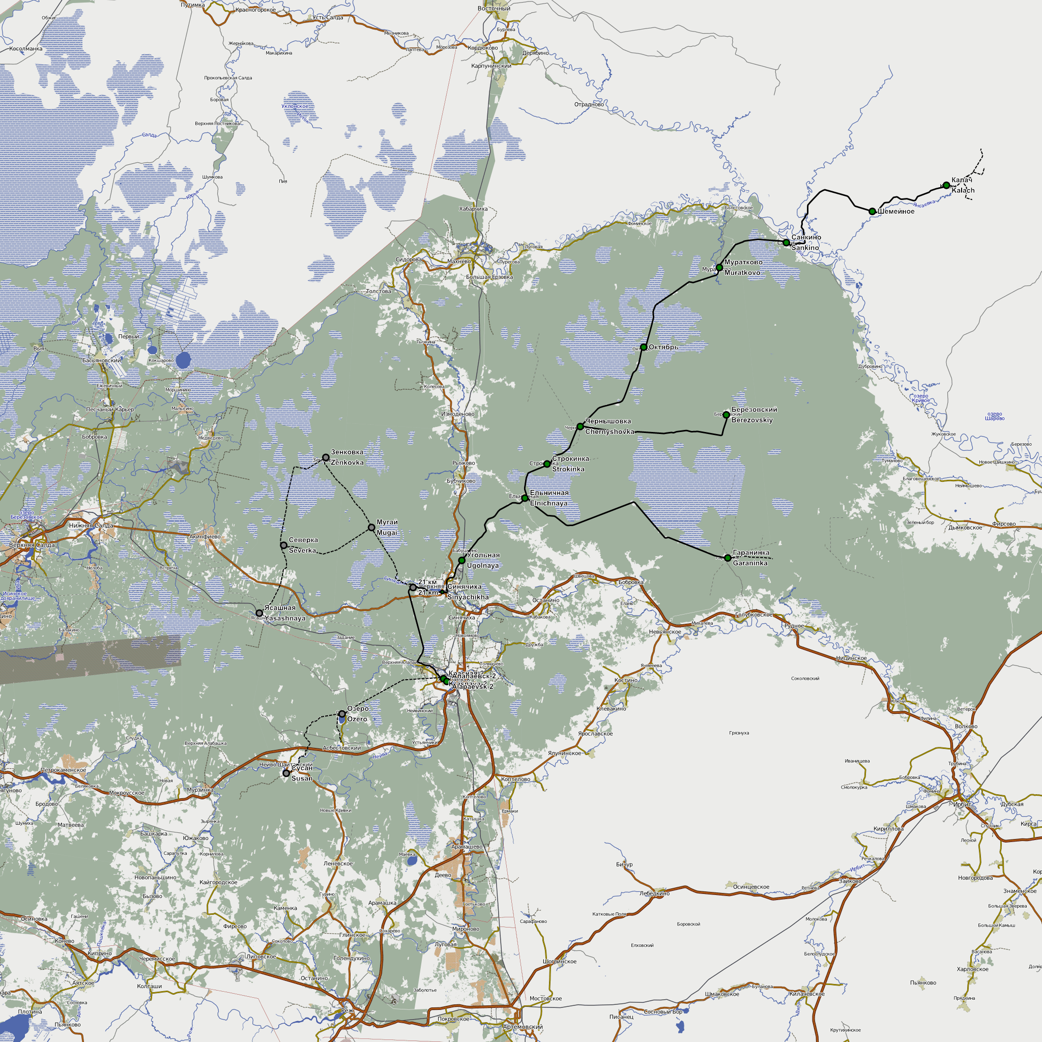
English: Map of Alapaevsk narrow gauge railway. 02.2012. Background - OpenStreetMap data rendered by http://Чепецк.net
Русский: Карта Алапаевской УЖД на 02.2012. Данные: OpenStreetMap |
| Date | |
| Source | http://openstreetmap.org |
| Author | OpenStreetMap contribtors |
| Permission (Reusing this file) |
This file is licensed under the Creative Commons Attribution-Share Alike 2.0 Generic license.
|
File history
Click on a date/time to view the file as it appeared at that time.
| Date/Time | Thumbnail | Dimensions | User | Comment | |
|---|---|---|---|---|---|
| current | 21:27, 18 February 2012 | | 2,048 × 2,048 (1.86 MB) | Svetlov Artem | Уточнены станции |
| 20:46, 17 February 2012 |  | 2,048 × 2,048 (1.86 MB) | Svetlov Artem | Добавлены линии | |
| 12:33, 17 February 2012 |  | 2,048 × 2,048 (1.81 MB) | Svetlov Artem | {{Information |Description = {{en|1=Map of Alapaevsk narrow gauge railway. 02.2012. Background - OpenStreetMap data rendered by http://Чепецк.net <code> This map was rendered by Maperitive from OpenStreetMap data. To re-make this image: 1. |
File usage
Global file usage
The following other wikis use this file:
- Usage on de.wikipedia.org
- Usage on ru.wikipedia.org
- Usage on www.wikidata.org