
Size of this preview: 800 × 529 pixels. Other resolutions: 320 × 211 pixels | 640 × 423 pixels | 896 × 592 pixels.
Original file (896 × 592 pixels, file size: 90 KB, MIME type: image/jpeg)
| This is a file from the Wikimedia Commons. Information from its description page there is shown below. Commons is a freely licensed media file repository. You can help. |
Summary
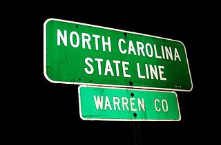
| Description | North Carolina State Line: Warren Co. At the Virginia line on I-85. Paschall (vicinity) NC |
| Date | |
| Source | North Carolina State Line: Warren County |
| Author | Taber Andrew Bain from Richmond, VA, USA |
| Camera location | | View this and other nearby images on: OpenStreetMap |
|---|
Licensing
This file is licensed under the Creative Commons Attribution 2.0 Generic license.
- You are free:
- to share – to copy, distribute and transmit the work
- to remix – to adapt the work
- Under the following conditions:
- attribution – You must give appropriate credit, provide a link to the license, and indicate if changes were made. You may do so in any reasonable manner, but not in any way that suggests the licensor endorses you or your use.
| This image, originally posted to Flickr, was reviewed on 5 August 2014 by the administrator or reviewer Leoboudv, who confirmed that it was available on Flickr under the stated license on that date. |
File history
Click on a date/time to view the file as it appeared at that time.
| Date/Time | Thumbnail | Dimensions | User | Comment | |
|---|---|---|---|---|---|
| current | 22:32, 10 July 2014 | | 896 × 592 (90 KB) | Rcsprinter123 | {{Information |Description=North Carolina State Line: Warren Co. At the Virginia line on I-85. Paschall (vicinity) NC |Source=[https://www.flickr.com/photos/andrewbain/538561701/ North Carolina State Line: Warren County] |Date=2002-01-01 00:00 |Author=... |
File usage
The following pages on the English Wikipedia use this file (pages on other projects are not listed):
Global file usage
The following other wikis use this file:
- Usage on ce.wikipedia.org
- Usage on tt.wikipedia.org
- Usage on www.wikidata.org