Size of this preview: 800 × 600 pixels. Other resolutions: 320 × 240 pixels | 640 × 480 pixels | 1,024 × 768 pixels | 1,280 × 960 pixels | 2,560 × 1,920 pixels | 2,816 × 2,112 pixels.
Original file (2,816 × 2,112 pixels, file size: 2.38 MB, MIME type: image/jpeg)
| This is a file from the Wikimedia Commons. Information from its description page there is shown below. Commons is a freely licensed media file repository. You can help. |
|
This is an image of a place or building that is listed on the National Register of Historic Places in the United States of America. Its reference number is 78002165. |
| Camera location | | View this and other nearby images on: OpenStreetMap |
|---|
| Description |
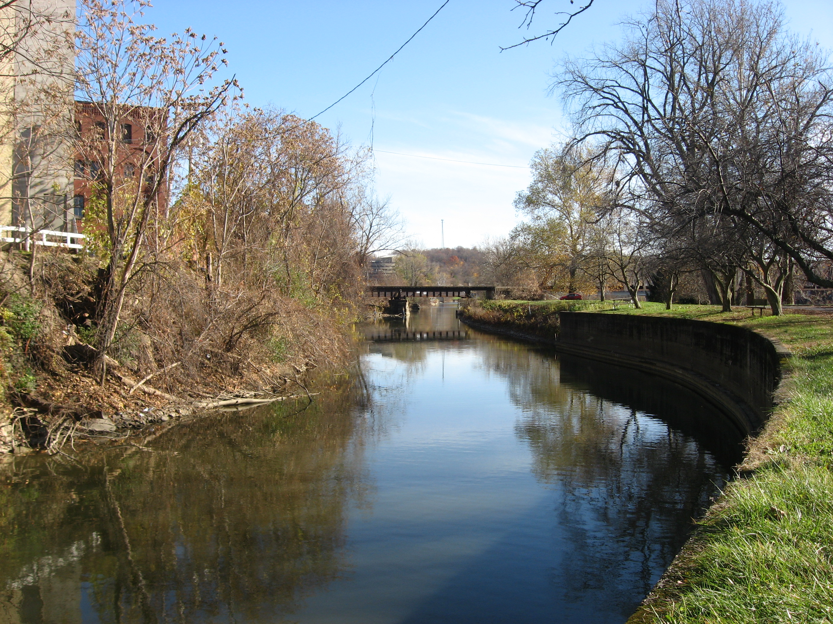
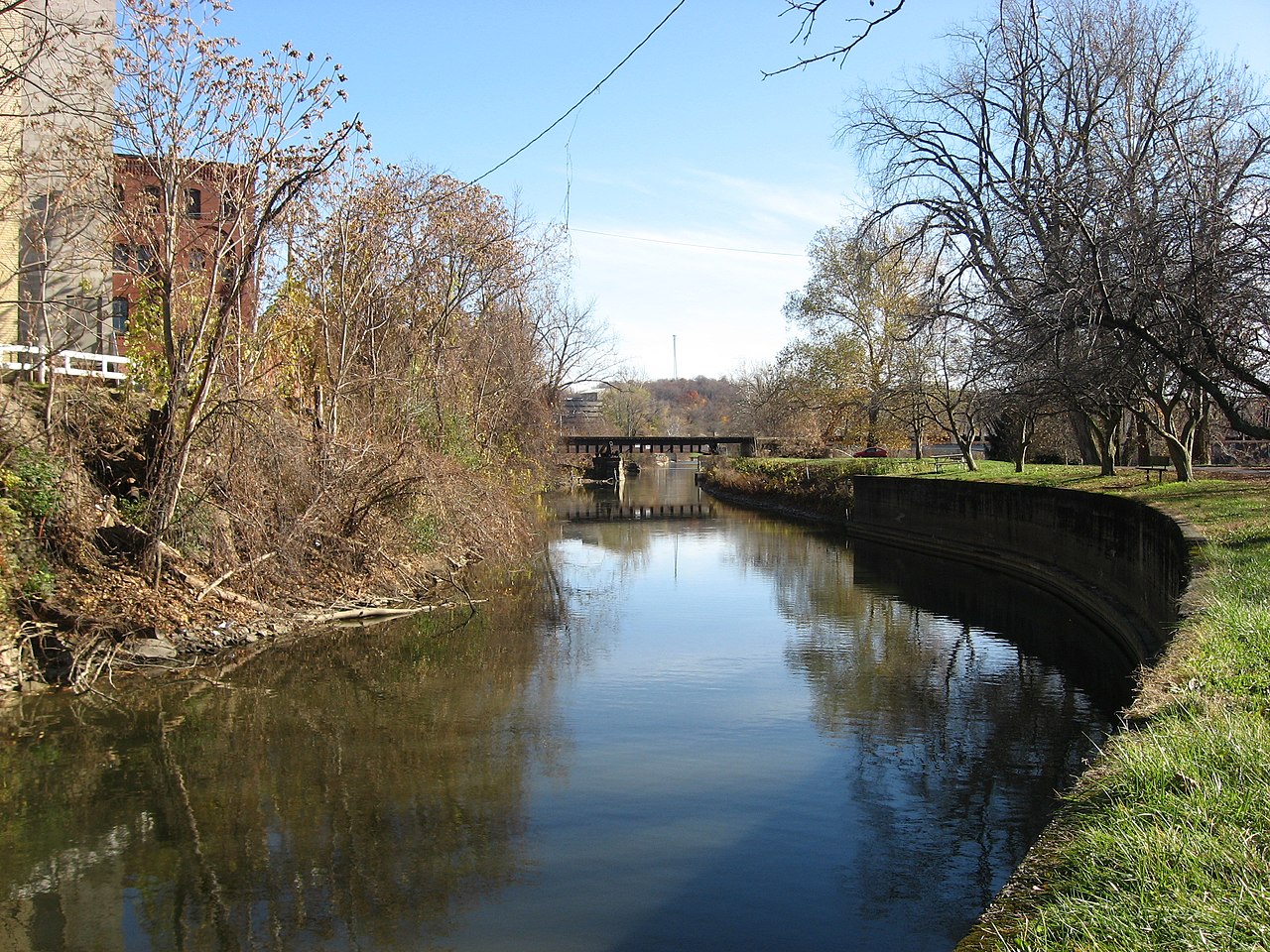
English: Looking downstream along the Muskingum River Canal at Zanesville, Ohio, United States. Constructed in 1841, the Zanesville waterfront portion of the canal is listed on the National Register of Historic Places. Photo is taken from the former canal towpath — now a footpath — on the riverside bank of the canal. |
||
| Date | Taken on 12 November 2009 | ||
| Source | Own work | ||
| Author | User:Nyttend | ||
| Permission (Reusing this file) |
|
File history
Click on a date/time to view the file as it appeared at that time.
| Date/Time | Thumbnail | Dimensions | User | Comment | |
|---|---|---|---|---|---|
| current | 02:11, 20 November 2009 | | 2,816 × 2,112 (2.38 MB) | Nyttend | {{Location|39|56|24|N|82|0|44.82|W}} {{Information |Description={{en|Looking downstream along the {{w|Muskingum River Lock No. 10 and Canal|Muskingum River Canal}} at {{w|Zanesville, Ohio|Zanesville}}, {{w|Ohio}}, {{w|United States}}. Constructed in 1841 |
File usage
The following pages on the English Wikipedia use this file (pages on other projects are not listed):
Global file usage
The following other wikis use this file:
- Usage on de.wikipedia.org
- Usage on es.wikipedia.org
- Usage on fr.wikipedia.org
- Usage on vi.wikipedia.org