No higher resolution available.
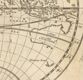
Summary English: A map of the world, shewing the course of Mr. Dampiers voyage round it: from 1679, to 1691 , London 1697
Herman Moll
Alternative names
Moll, Hermann
Description
British cartographer, engraver and publisher
Date of birth/death
circa 1654date QS:P,+1654-00-00T00:00:00Z/9,P1480,Q5727902
22 September 1732
Location of birth/death
Unknown placeUnknown place
London
Work location
Authority file
creator QS:P170,Q1610319
Licensing
Public domain Public domain false false
This work is in the public domain copyright term is the author's life plus 100 years or fewer .
You must also include a United States public domain tag to indicate why this work is in the public domain in the United States.
This file has been identified as being free of known restrictions under copyright law, including all related and neighboring rights.
https://creativecommons.org/publicdomain/mark/1.0/ PDM Creative Commons Public Domain Mark 1.0 false false
English Lilliput and Blefescu islands in Gulliver's Travels
File history
Click on a date/time to view the file as it appeared at that time.
Date/Time Thumbnail Dimensions User Comment current 06:54, 23 April 2020 383 × 370 (199 KB) Hansmuller File:Moll - A map of the world shewing the course of Mr Dampiers voyage round it from 1679 to 1691.png cropped 78 % horizontally, 62 % vertically using CropTool with precise mode.
File usage
The following pages on the English Wikipedia use this file (pages on other projects are not listed):
Global file usage
The following other wikis use this file:
Usage on nl.wikipedia.org
This file contains additional information, probably added from the digital camera or scanner used to create or digitize it.
If the file has been modified from its original state, some details may not fully reflect the modified file.


