
Size of this preview: 777 × 600 pixels. Other resolutions: 311 × 240 pixels | 622 × 480 pixels | 824 × 636 pixels.
Original file (824 × 636 pixels, file size: 410 KB, MIME type: image/jpeg)
| This is a file from the Wikimedia Commons. Information from its description page there is shown below. Commons is a freely licensed media file repository. You can help. |
Summary
| Description |
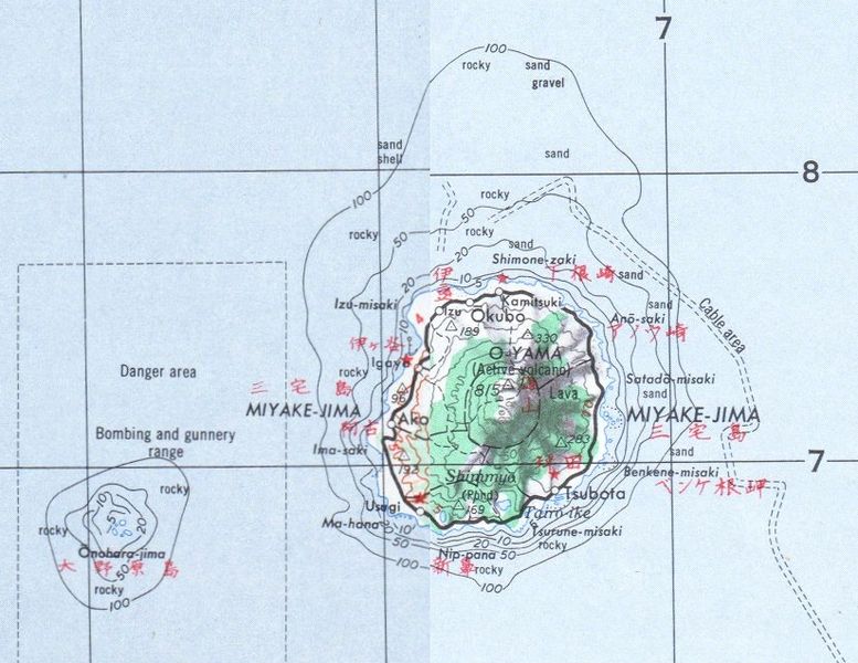
English: map of Miyake-jima, pieced together from parts of two maps |
| Date | |
| Source | http://www.lib.utexas.edu/maps/ams/japan/txu-oclc-6900707-ni54-6.jpg and http://www.lib.utexas.edu/maps/ams/japan/txu-oclc-6900707-ni54-4.jpg |
| Author | Army Map Service, Corps of Engineers, U.S. Army |
Licensing
This file is a work of a U.S. Army soldier or employee, taken or made as part of that person's official duties. As a work of the U.S. federal government, it is in the public domain in the United States.
|
 |
File history
Click on a date/time to view the file as it appeared at that time.
| Date/Time | Thumbnail | Dimensions | User | Comment | |
|---|---|---|---|---|---|
| current | 21:02, 30 June 2009 | | 824 × 636 (410 KB) | Ratzer | {{Information |Description={{en|1=map of Miyake-jima, pieced together from parts of two maps}} |Source=http://www.lib.utexas.edu/maps/ams/japan/txu-oclc-6900707-ni54-6.jpg and http://www.lib.utexas.edu/maps/ams/japan/txu-oclc-6900707-ni54-4.jpg |Author=Ar |
File usage
The following pages on the English Wikipedia use this file (pages on other projects are not listed):
Global file usage
The following other wikis use this file:
- Usage on de.wikipedia.org
- Usage on es.wikipedia.org
- Usage on eu.wikipedia.org
- Usage on uk.wikipedia.org
- Usage on vi.wikipedia.org
- Usage on zh.wikipedia.org