
Size of this PNG preview of this SVG file: 498 × 599 pixels. Other resolutions: 199 × 240 pixels | 399 × 480 pixels | 638 × 768 pixels | 851 × 1,024 pixels | 1,702 × 2,048 pixels | 1,703 × 2,049 pixels.
Original file (SVG file, nominally 1,703 × 2,049 pixels, file size: 2.9 MB)
| This is a file from the Wikimedia Commons. Information from its description page there is shown below. Commons is a freely licensed media file repository. You can help. |
Summary
| Camera location | | View this and other nearby images on: OpenStreetMap |
|---|
| Description |
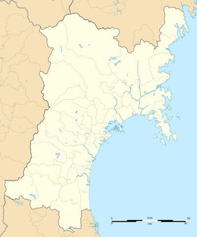
Deutsch: Karte der Präfektur Miyagi.
English: Blank map of the Miyagi Prefecture, for geolocalisation purpose.
Español: Mapa de la Prefectura de Miyagi.
Italiano: Mappa della Prefettura di Miyagi.
日本語: 宮城県の地図.
Português: Carta de la província de Miyagi.
|
||
| Date | (UTC) | ||
| Source |
Création personnelle ;
|
||
| Author | © Bourrichon (talk) - fr:Bourrichon | ||
| Permission (Reusing this file) |
|
||
| Other versions | File:Miyagi-ken géolocalisation relief.svg |
This W3C-unspecified vector image was created with Inkscape .
Licensing
I, the copyright holder of this work, hereby publish it under the following license:
This file is licensed under the Creative Commons Attribution-Share Alike 2.0 France license.
Attribution: Bourrichon (atelier graphique)
- You are free:
- to share – to copy, distribute and transmit the work
- to remix – to adapt the work
- Under the following conditions:
- attribution – You must give appropriate credit, provide a link to the license, and indicate if changes were made. You may do so in any reasonable manner, but not in any way that suggests the licensor endorses you or your use.
- share alike – If you remix, transform, or build upon the material, you must distribute your contributions under the same or compatible license as the original.

File history
Click on a date/time to view the file as it appeared at that time.
| Date/Time | Thumbnail | Dimensions | User | Comment | |
|---|---|---|---|---|---|
| current | 17:06, 10 July 2013 | | 1,703 × 2,049 (2.9 MB) | Bourrichon | == {{int:filedesc}} == {{Location|38|30|00|N|141|00|00|E|scale:10000}} {{Information |Description= {{fr|Carte vierge de la fr:Préfecture de Miyagi, au Japon, destinée à la géolocalisation.}} {{de|Karte der [[:de:Präfektur Miya... |
File usage
More than 100 pages use this file. The following list shows the first 100 pages that use this file only. A full list is available.
- Arikabe Station
- Atago Station (Miyagi)
- Atagobashi Station
- Ayashi Station
- Dainohara Station
- Fukudamachi Station
- Funaoka Station (Miyagi)
- Furukawa Station
- Geba Station
- Hamayoshida Station
- Hebita Station
- Higashi-Sendai Station
- Higashi-Shiroishi Station
- Higashi-Yamoto Station
- Hirose-dōri Station
- Ishikoshi Station
- Ishinomaki Station
- Itsutsubashi Station
- Iwakiri Station
- Iwanuma Station
- Izumi-Chūō Station (Miyagi)
- Kakeyama Station
- Kami-Wakuya Station
- Kanomata Station
- Kashimadai Station
- Kawaramachi Station (Miyagi)
- Kazuma Station
- Kita-Sendai Station
- Kita-Shirakawa Station
- Kita-Yobanchō Station
- Kitaura Station (Miyagi)
- Kitayama Station (Miyagi)
- Kogota Station
- Kokufu-Tagajō Station
- Kosugō Station
- Kozurushinden Station
- Kumagane Station
- Kurikoma-Kōgen Station
- Kuromatsu Station (Miyagi)
- Kuzuoka Station
- Kōtōdai-Kōen Station
- Maeyachi Station
- Mangokuura Station
- Matsushima-Kaigan Station
- Matsushima Station
- Matsuyamamachi Station (Miyagi)
- Minami-Sendai Station
- Mitakedō Station
- Miyaginohara Station
- Nagamachi-Itchōme Station
- Nagamachi-Minami Station
- Nagamachi Station
- Nakanosakae Station
- Natori Station
- Nigatake Station
- Nitta Station (Miyagi)
- Nobiru Station
- Nonodake Station
- Onagawa Station
- Rikuzen-Akai Station
- Rikuzen-Hamada Station
- Rikuzen-Inai Station
- Rikuzen-Ochiai Station
- Rikuzen-Ono Station
- Rikuzen-Shirasawa Station
- Rikuzen-Takasago Station
- Rikuzen-Tomiyama Station
- Rikuzen-Toyosato Station
- Rikuzen-Yachi Station
- Rikuzen-Yamashita Station
- Rikuzen-Ōtsuka Station
- Sakamoto Station (Miyagi)
- Sawada Station
- Semine Station
- Sendai Airport
- Sendai Station (Miyagi)
- Shinainuma Station
- Shiroishi-Zaō Station
- Shiroishi Station (Miyagi)
- Sobanokami Station
- Tagajō Station
- Tajiri Station
- Takagimachi Station
- Tatekoshi Station
- Tetaru Station
- Tomizawa Station
- Tsukinoki Station
- Tsutsujigaoka Station (Miyagi)
- Tōna Station
- Tōshōgū Station
- Umegasawa Station
- Urashuku Station
- Wabuchi Station
- Wakuya Station
- Watanoha Station
- Watari Station (Miyagi)
- Yamashita Station (Miyagi)
- Yamoto Station
- Yanaizu Station (Miyagi)
- Yaotome Station
View more links to this file.
Global file usage
The following other wikis use this file:
- Usage on ar.wikipedia.org
- Usage on ceb.wikipedia.org
- Usage on de.wikipedia.org
- Usage on fr.wikipedia.org
- Stade de Miyagi
- Miyagi Baseball Stadium
- Château de Shiroishi
- Kakyoin Square
- Aéroport de Sendai
- Château de Sendai
- Stade de Sendai
- Aoba-jinja
- Gare de Furukawa
- Gare de Kurikoma-Kōgen
- Écluse d'Ishii
- Kōzō-ji (Kakuda)
- Université de Miyagi
- Ōsaki Hachiman-gū
- Sendai Trust Tower
- Mutsu Kokubun-ji Yakushidō
- Entsū-in (Matsushima)
- Takekoma Inari-jinja
- Médiathèque de Sendai
- Sendai Tōshō-gū
- Shiogama-jinja
- Château d'Iwadeyama
- Musée d'histoire de Tōhoku
- Musée du manga Ishinomori
- AERU
- Modèle:Géolocalisation/Préfecture de Miyagi
- Miyagikyo
- Université Tōhoku gakuin
- Lions Tower Kotodai
- Module:Carte/données/préfecture de miyagi
- Gare de Natori
- Gare de l'aéroport de Sendai
- Gare d'Iwanuma
- Gare d'Aoba-dōri
- Usage on he.wikipedia.org
- Usage on id.wikipedia.org
View more global usage of this file.