Size of this preview: 800 × 500 pixels. Other resolutions: 320 × 200 pixels | 640 × 400 pixels | 1,024 × 640 pixels | 1,500 × 938 pixels.
Original file (1,500 × 938 pixels, file size: 2.51 MB, MIME type: image/png)
| This is a file from the Wikimedia Commons. Information from its description page there is shown below. Commons is a freely licensed media file repository. You can help. |
Summary
| Description |
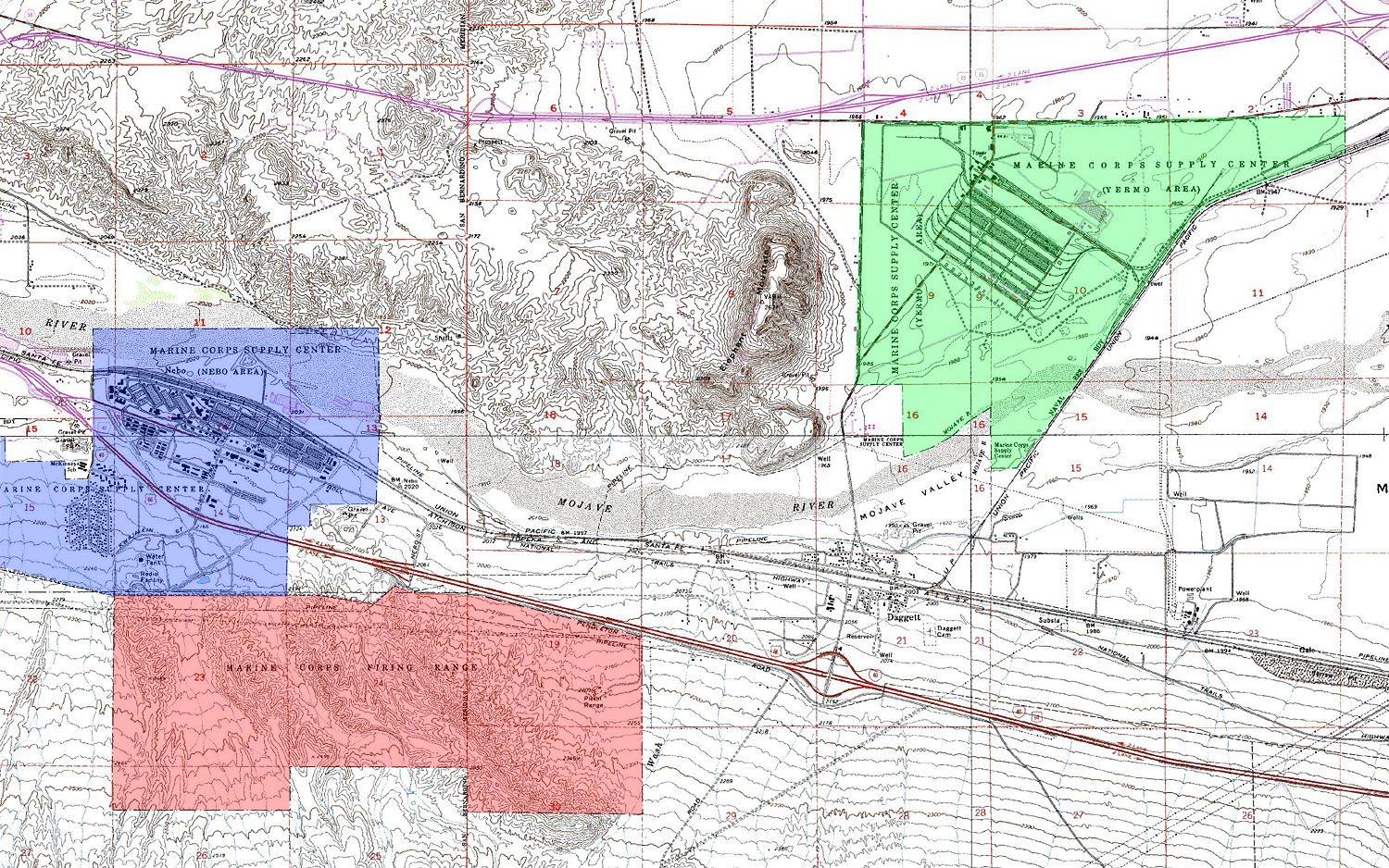
Map of the location of the Marine Corps Logistics Base Barstow Annexes, east of Barstow, California.
|
| Date | |
| Source | Self created using USGS topographic maps (public domain) - http://store.usgs.gov/b2c_usgs/usgs/maplocator/(xcm=r3standardpitrex_prd&layout=6_1_61_55_2&uiarea=2&ctype=areaDetails&carea=0000000466&citem=00000004660000000038)/.do |
| Author | Eric Polk |
| Permission (Reusing this file) |
Public Domain |
This image is in the public domain in the United States because it only contains materials that originally came from the United States Geological Survey, an agency of the United States Department of the Interior. For more information, see the official USGS copyright policy.
|
Licensing
| I, the copyright holder of this work, release this work into the public domain. This applies worldwide. In some countries this may not be legally possible; if so: I grant anyone the right to use this work for any purpose, without any conditions, unless such conditions are required by law. |
File history
Click on a date/time to view the file as it appeared at that time.
| Date/Time | Thumbnail | Dimensions | User | Comment | |
|---|---|---|---|---|---|
| current | 00:42, 18 January 2007 | | 1,500 × 938 (2.51 MB) | Epolk | {{Information |Description=Map of the location of the Marine Corps Logistics Base Barstow Annexes. The Nebo Annex is blue, Yermo Annex is green and the firing range is red. |Source=Self created using USGS topographic maps (public domain) |Date=January 17 |
File usage
The following pages on the English Wikipedia use this file (pages on other projects are not listed):