
Size of this PNG preview of this SVG file: 620 × 600 pixels. Other resolutions: 248 × 240 pixels | 496 × 480 pixels | 794 × 768 pixels | 1,059 × 1,024 pixels | 2,118 × 2,048 pixels | 1,035 × 1,001 pixels.
Original file (SVG file, nominally 1,035 × 1,001 pixels, file size: 170 KB)
| This is a file from the Wikimedia Commons. Information from its description page there is shown below. Commons is a freely licensed media file repository. You can help. |
| Description |
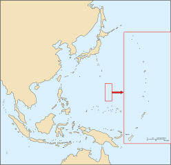
Français : Carte vierge des Îles Mariannes English: Blank map of Mariannes Islands |
||||||||
| Date | |||||||||
| Source | Own work | ||||||||
| Author | historicair 21:00, 28 September 2006 (UTC) | ||||||||
| Permission (Reusing this file) |
I, the copyright holder of this work, hereby publish it under the following licenses:
This file is licensed under the Creative Commons Attribution-Share Alike 2.5 Generic, 2.0 Generic and 1.0 Generic license.
You may select the license of your choice. |
||||||||
| Other versions |
|


|
This SVG file contains embedded text that can be translated into your language, using any capable SVG editor, text editor or the SVG Translate tool. For more information see: About translating SVG files. |
File history
Click on a date/time to view the file as it appeared at that time.
| Date/Time | Thumbnail | Dimensions | User | Comment | |
|---|---|---|---|---|---|
| current | 21:08, 28 September 2006 | | 1,035 × 1,001 (170 KB) | Historicair | |
| 21:04, 28 September 2006 |  | 1,035 × 1,001 (172 KB) | Historicair | ||
| 21:00, 28 September 2006 |  | 744 × 1,052 (168 KB) | Historicair | {{fr}}Carte vierge des Îles Mariannes {{en}}Blank map of Mariannes Islands Auteur: ~~~~ {{Atelier graphique carte}} Maps of Northern Mariana Islands Category:Blank maps Category:SVG maps of Oceania |
File usage
No pages on the English Wikipedia use this file (pages on other projects are not listed).