
Size of this preview: 800 × 530 pixels. Other resolutions: 320 × 212 pixels | 640 × 424 pixels | 1,027 × 681 pixels.
Original file (1,027 × 681 pixels, file size: 387 KB, MIME type: image/jpeg)
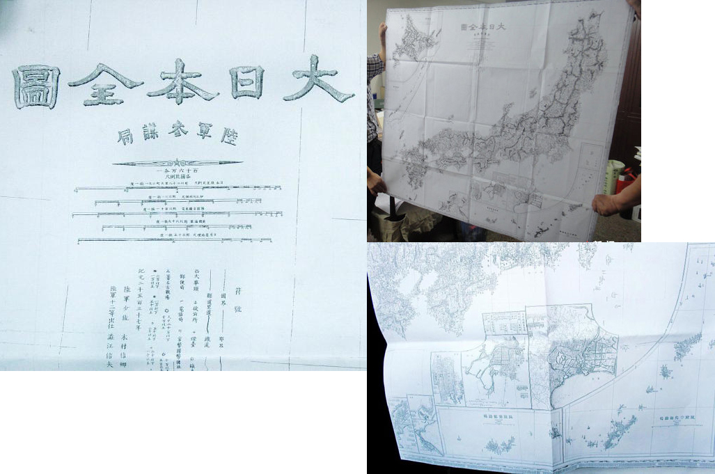
Summary edit
| Description |
The map shows Diaoyu islands is in China's boundary, as published by Japan |
|---|---|
| Source |
Original publication: Map of Great Japan |
| Date |
1976 |
| Author |
Japan |
| Permission (Reusing this file) |
See below.
|
Licensing edit
| This work is in the public domain in the United States because it was published (or registered with the U.S. Copyright Office) before January 1, 1929. |
 | This file is a candidate to be copied to Wikimedia Commons.
Any user may perform this transfer; refer to Wikipedia:Moving files to Commons for details. If this file has problems with attribution, copyright, or is otherwise ineligible for Commons, then remove this tag and DO NOT transfer it; repeat violators may be blocked from editing. Other Instructions
| ||
| |||
File history
Click on a date/time to view the file as it appeared at that time.
| Date/Time | Thumbnail | Dimensions | User | Comment | |
|---|---|---|---|---|---|
| current | 07:52, 10 February 2013 | | 1,027 × 681 (387 KB) | Kezhu2012 (talk | contribs) | Uploading an old public-domain work using File Upload Wizard |
You cannot overwrite this file.
File usage
The following pages on the English Wikipedia use this file (pages on other projects are not listed):