Size of this preview: 800 × 451 pixels. Other resolutions: 320 × 181 pixels | 640 × 361 pixels | 1,024 × 578 pixels | 1,280 × 722 pixels | 2,385 × 1,346 pixels.
Original file (2,385 × 1,346 pixels, file size: 2.52 MB, MIME type: image/jpeg)
| This is a file from the Wikimedia Commons. Information from its description page there is shown below. Commons is a freely licensed media file repository. You can help. |
Summary
| Description |
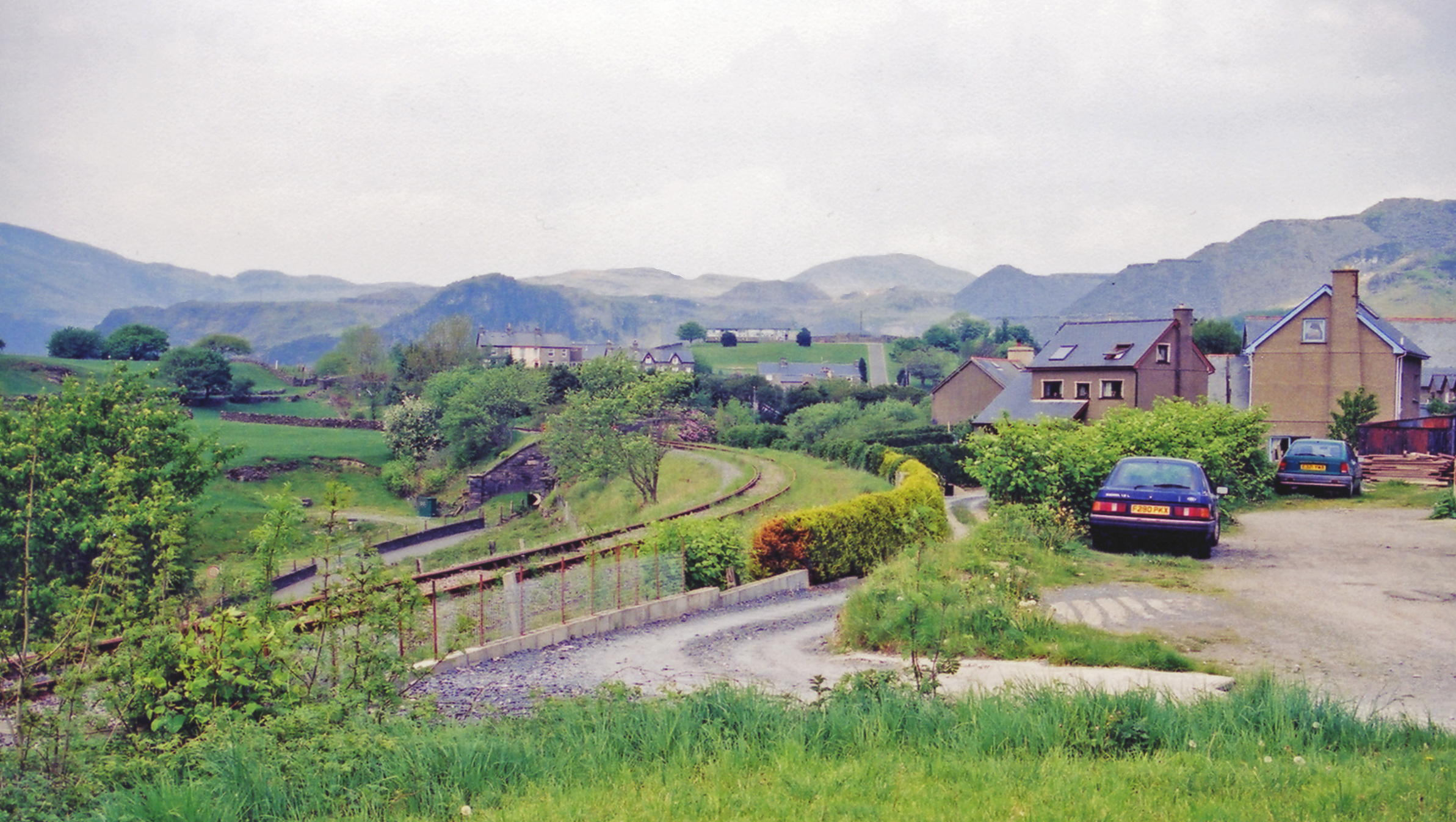
English: Site of Manod station, 2001. View north on the A470, towards Blaenau Ffestiniog, the railway line being from Trawsfynydd nuclear power station, the surviving remains of the ex-GWR branch from Bala, closed 4/1/60 to passengers, 28/1/61 to goods. The mountains ahead, forming the barrier between the Vale of Ffestiniog and that of the Afon Lledr in Gwynydd, are probably Moel Druman (2,287 ft.) to the left, Manod Mawr (2,168 ft.) on the right and Moel Siabod (2,860 ft.) on the horizon. |
| Date | |
| Source | From geograph.org.uk |
| Author | Ben Brooksbank |
| Permission (Reusing this file) |
Creative Commons Attribution Share-alike license 2.0 |
| Attribution (required by the license) | Ben Brooksbank / Site of Manod station, 2001 / |
| Camera location | | View this and other nearby images on: OpenStreetMap |
|---|
Licensing

|
This image was taken from the Geograph project collection. See this photograph's page on the Geograph website for the photographer's contact details. The copyright on this image is owned by Ben Brooksbank and is licensed for reuse under the Creative Commons Attribution-ShareAlike 2.0 license.
|
This file is licensed under the Creative Commons Attribution-Share Alike 2.0 Generic license.
Attribution: Ben Brooksbank
- You are free:
- to share – to copy, distribute and transmit the work
- to remix – to adapt the work
- Under the following conditions:
- attribution – You must give appropriate credit, provide a link to the license, and indicate if changes were made. You may do so in any reasonable manner, but not in any way that suggests the licensor endorses you or your use.
- share alike – If you remix, transform, or build upon the material, you must distribute your contributions under the same or compatible license as the original.
File history
Click on a date/time to view the file as it appeared at that time.
| Date/Time | Thumbnail | Dimensions | User | Comment | |
|---|---|---|---|---|---|
| current | 11:48, 29 December 2013 | | 2,385 × 1,346 (2.52 MB) | Chevin | == {{int:filedesc}} == {{Information |Description={{en|1='''Site of Manod station, 2001.'''<br/> View north on the A470, towards Blaenau Ffestiniog, the railway line being from Trawsfynydd nuclear power station, the surviving remains of the ex-GWR bran... |
File usage
The following pages on the English Wikipedia use this file (pages on other projects are not listed):
Global file usage
The following other wikis use this file:
- Usage on www.wikidata.org