
Original file (1,050 × 644 pixels, file size: 184 KB, MIME type: image/jpeg)
| This is a file from the Wikimedia Commons. Information from its description page there is shown below. Commons is a freely licensed media file repository. You can help. |
| Description |
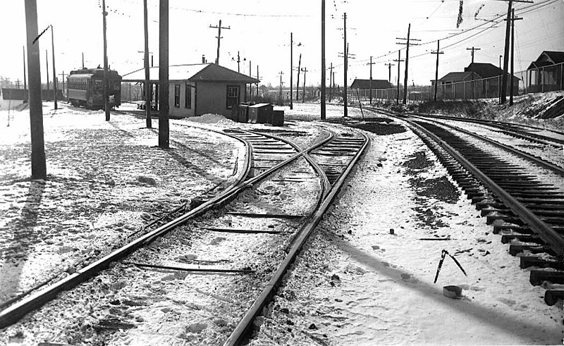
English: Looking west to Long Branch Loop on Lake Shore Rd (now Boulevard) north side at Brown's Line, western limits of New Toronto TEXT: "Long Branch Loop, looking west (Port Credit car on the left making last trip 1.30 a.m. Feb. 10 1935.)" |
|||
| Date | ||||
| Source |
https://gencat4.eloquent-systems.com/webcat/systems/toronto.arch/resource/ser71/s0071_it10748.jpg
|
|||
| Author | Toronto Transit Commission | |||
| Permission (Reusing this file) |
|

| Camera location | | View this and other nearby images on: OpenStreetMap |
|---|
File history
Click on a date/time to view the file as it appeared at that time.
| Date/Time | Thumbnail | Dimensions | User | Comment | |
|---|---|---|---|---|---|
| current | 21:24, 2 April 2012 | | 1,050 × 644 (184 KB) | Secondarywaltz | removed text |
| 21:23, 2 April 2012 |  | 1,050 × 768 (196 KB) | Secondarywaltz | full size | |
| 20:32, 3 June 2009 |  | 885 × 388 (89 KB) | JosephIWMolto | {{Information |Description={{en|1=Looking west to Long Branch Loop}} |Source=Toronto Archives |Author=Toronto Transit Commission |Date=1935 |Permission={{PD-Canada}} |other_versions= }} Lake Shore Boulevard West, north side, west of Brown's Line Etobicoke |
File usage
Global file usage
The following other wikis use this file:
- Usage on ko.wikipedia.org