
Size of this preview: 533 × 600 pixels. Other resolutions: 213 × 240 pixels | 427 × 480 pixels | 683 × 768 pixels | 910 × 1,024 pixels | 1,820 × 2,048 pixels | 3,641 × 4,096 pixels.
Original file (3,641 × 4,096 pixels, file size: 7.2 MB, MIME type: image/png)
| This is a file from the Wikimedia Commons. Information from its description page there is shown below. Commons is a freely licensed media file repository. You can help. |
Summary
| Description |
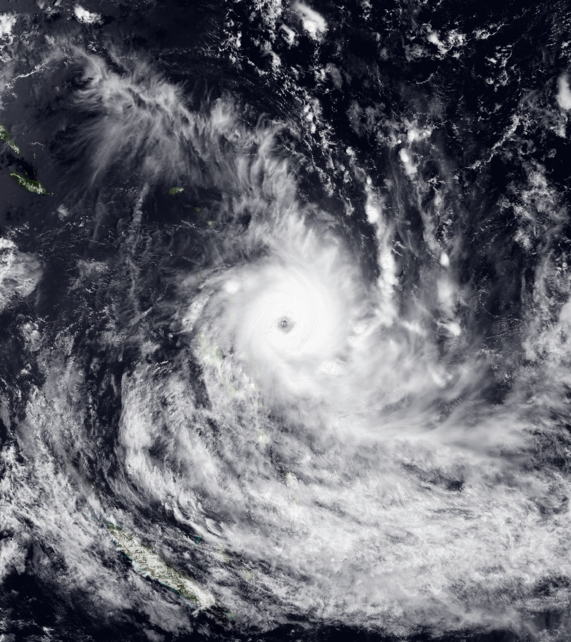
English: Severe Tropical Cyclone Lola at peak intensity in the morning of October 24. |
| Date | |
| Source | EOSDIS Worldview |
| Author | Red Visible Imagery from JMA's Himawari-8 Satellite imposed with Blue Marble 2004 |
| Camera location | | View this and other nearby images on: OpenStreetMap |
|---|
Licensing
| This file is in the public domain in the United States because it was solely created by NASA. NASA copyright policy states that "NASA material is not protected by copyright unless noted". (See Template:PD-USGov, NASA copyright policy page or JPL Image Use Policy.) | ||
 |
Warnings:
|
File history
Click on a date/time to view the file as it appeared at that time.
| Date/Time | Thumbnail | Dimensions | User | Comment | |
|---|---|---|---|---|---|
| current | 03:08, 25 October 2023 | | 3,641 × 4,096 (7.2 MB) | Typhoonnerd | Uploaded a work by Red Visible Imagery from JMA's Himawari-8 Satellite imposed with Blue Marble 2004 from [https://worldview.earthdata.nasa.gov EOSDIS Worldview] with UploadWizard |
File usage
The following pages on the English Wikipedia use this file (pages on other projects are not listed):