
Size of this PNG preview of this SVG file: 800 × 398 pixels. Other resolutions: 320 × 159 pixels | 640 × 318 pixels | 1,024 × 509 pixels | 1,280 × 636 pixels | 2,560 × 1,272 pixels | 998 × 496 pixels.
Original file (SVG file, nominally 998 × 496 pixels, file size: 4.15 MB)
| This is a file from the Wikimedia Commons. Information from its description page there is shown below. Commons is a freely licensed media file repository. You can help. |
Summary
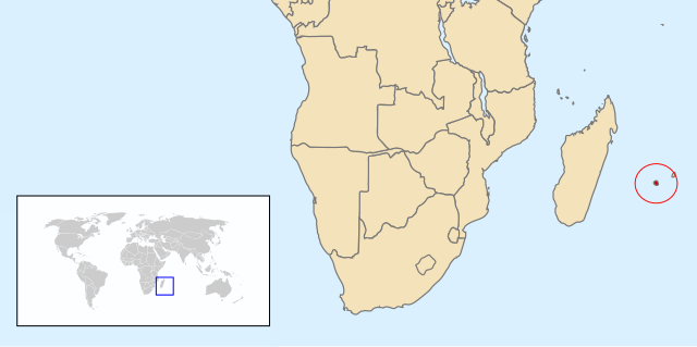
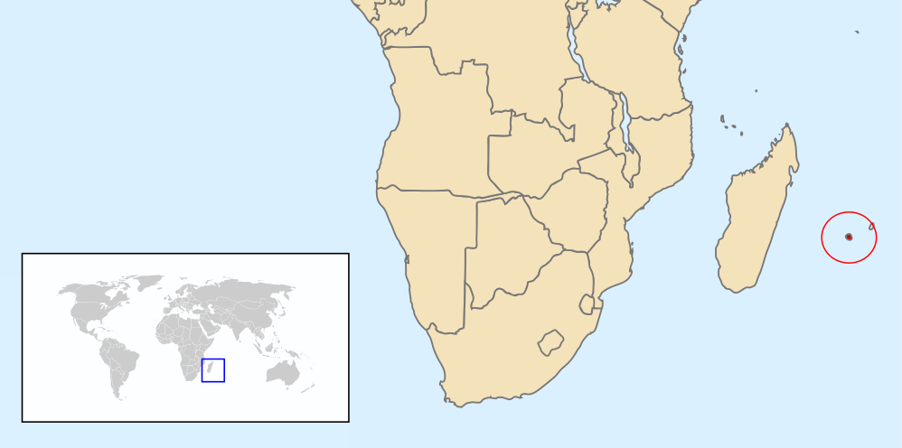
| Description | Map of Renunion based on Image:A large blank world map with oceans marked in blue.svg |
| Date | |
| Source | Own work |
| Author | Chris huh |
Licensing
| I, the copyright holder of this work, release this work into the public domain. This applies worldwide. In some countries this may not be legally possible; if so: I grant anyone the right to use this work for any purpose, without any conditions, unless such conditions are required by law. |
File history
Click on a date/time to view the file as it appeared at that time.
| Date/Time | Thumbnail | Dimensions | User | Comment | |
|---|---|---|---|---|---|
| current | 07:49, 12 February 2013 | | 998 × 496 (4.15 MB) | Citypeek | removal border, clip |
| 21:06, 6 May 2008 |  | 1,000 × 500 (2.76 MB) | Chris huh | ||
| 21:00, 6 May 2008 |  | 1,000 × 500 (2.76 MB) | Chris huh | {{Information |Description=Map of Renunion based on Image:A large blank world map with oceans marked in blue.svg |Source=self-made |Date=6 May 2008 |Author= Chris huh |Permission= |other_versions= }} [[Category:Locator maps of cou |
File usage
The following pages on the English Wikipedia use this file (pages on other projects are not listed):
Global file usage
The following other wikis use this file:
- Usage on af.wikipedia.org
- Usage on am.wikipedia.org
- Usage on ar.wikipedia.org
- Usage on ban.wikipedia.org
- Usage on bg.wikipedia.org
- Usage on bjn.wikipedia.org
- Usage on ca.wikipedia.org
- Usage on ceb.wikipedia.org
- Usage on cs.wikipedia.org
- Usage on eo.wikipedia.org
- Usage on es.wikipedia.org
- Usage on et.wikipedia.org
- Usage on eu.wikipedia.org
- Usage on fa.wikipedia.org
- Usage on fr.wikipedia.org
- Usage on ha.wikipedia.org
- Usage on hif.wikipedia.org
- Usage on hu.wikipedia.org
- Usage on id.wikipedia.org
- Usage on it.wikipedia.org
- Usage on ka.wikipedia.org
- Usage on mk.wikipedia.org
- Usage on nl.wikipedia.org
- Usage on no.wikipedia.org
- Usage on pl.wikipedia.org
- Usage on pnb.wikipedia.org
- Usage on pt.wikipedia.org
- Usage on pt.wiktionary.org
- Usage on ro.wikipedia.org
- Usage on ru.wikipedia.org
View more global usage of this file.