.jpg)
.jpg&action=edit&redlink=1)
Original file (4,608 × 3,456 pixels, file size: 4.51 MB, MIME type: image/jpeg)
| This is a file from the Wikimedia Commons. Information from its description page there is shown below. Commons is a freely licensed media file repository. You can help. |
.jpg)
Summary
| Description |
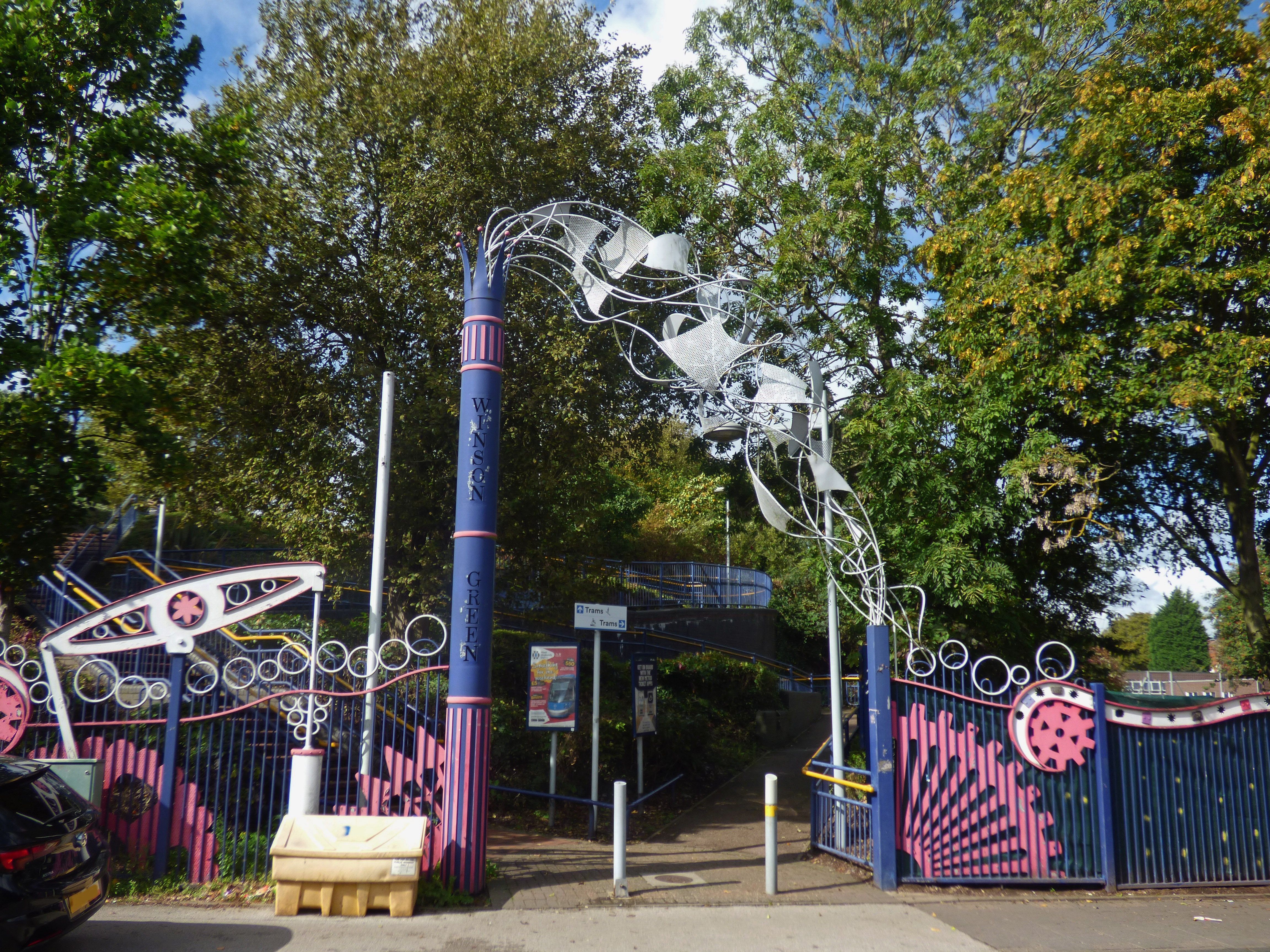
After my walk from Soho Benson Road to Handsworth Park, I next wanted to head towards <a href="https://en.wikipedia.org/wiki/Winson_Green_Outer_Circle_tram_stop" rel="noreferrer nofollow">Winson Green Outer Circle Tram Stop</a>. Was so many railway bridges in this area.
James Watt's Mad Machine runs between Winson Green Outer Circle and James Watt Primary School. James Watt's Mad Machine is a set of sculptural railings and gates at Winson Green Metro station, Winson Green, Birmingham, England, designed by Tim Tolkien, supported by Eric Klein Velderman, Paula Woof and pupils at James Watt Infants and Junior Schools, with whose site it forms a boundary. It was created in 1998. It is inspired by the inventions of James Watt, who lived and worked nearby. |
| Date | |
| Source | James Watt's Mad Machine - Winson Green Outer Circle Tram Stop |
| Author | Elliott Brown from Birmingham, United Kingdom |
| Camera location | | View this and other nearby images on: OpenStreetMap |
|---|
.jpg¶ms=052.498955_N_-001.937972_E_globe:Earth_type:camera_source:Flickr_&language=en)
Licensing
- You are free:
- to share – to copy, distribute and transmit the work
- to remix – to adapt the work
- Under the following conditions:
- attribution – You must give appropriate credit, provide a link to the license, and indicate if changes were made. You may do so in any reasonable manner, but not in any way that suggests the licensor endorses you or your use.
- share alike – If you remix, transform, or build upon the material, you must distribute your contributions under the same or compatible license as the original.
| This image was originally posted to Flickr by ell brown at https://flickr.com/photos/39415781@N06/48800549752 (archive). It was reviewed on 26 September 2019 by FlickreviewR 2 and was confirmed to be licensed under the terms of the cc-by-sa-2.0. |
File history
Click on a date/time to view the file as it appeared at that time.
| Date/Time | Thumbnail | Dimensions | User | Comment | |
|---|---|---|---|---|---|
| current | 20:20, 26 September 2019 | | 4,608 × 3,456 (4.51 MB) | Ellrbrown | Transferred from Flickr via #flickr2commons |
File usage
Global file usage
The following other wikis use this file:
- Usage on www.wikidata.org
.jpg)