
Size of this preview: 800 × 592 pixels. Other resolutions: 320 × 237 pixels | 640 × 474 pixels | 1,024 × 758 pixels | 1,278 × 946 pixels.
Original file (1,278 × 946 pixels, file size: 1.51 MB, MIME type: image/png)
| This is a file from the Wikimedia Commons. Information from its description page there is shown below. Commons is a freely licensed media file repository. You can help. |
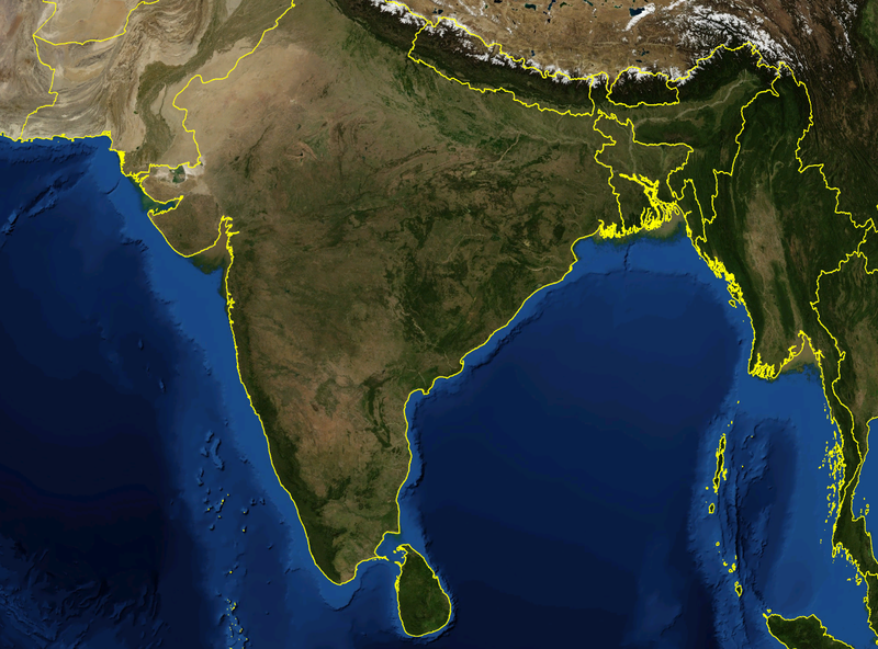
| Description | Satellite image of India and surrounding regions | |||
| Date | ||||
| Source | Own work | |||
| Author | Mgiganteus | |||
| Permission (Reusing this file) |
|

| Annotations | This image is annotated: View the annotations at Commons |
File history
Click on a date/time to view the file as it appeared at that time.
| Date/Time | Thumbnail | Dimensions | User | Comment | |
|---|---|---|---|---|---|
| current | 14:21, 28 November 2007 | | 1,278 × 946 (1.51 MB) | Mgiganteus | {{Information |Description=Satellite image of India and surrounding regions |Source=self-made |Date=2007 |Author= Mgiganteus |Permission={{PD-WorldWind}} |other_versions= }} Category:Maps of India Category:South Asia [[Categor |
File usage
More than 100 pages use this file. The following list shows the first 100 pages that use this file only. A full list is available.
- 1509 in India
- 1520 in India
- 1526 in India
- 1595 in India
- 1663 in India
- 1798 in India
- 1811 in India
- 1817 in India
- 1818 in India
- 1822 in India
- 1824 in India
- 1827 in India
- 1835 in India
- 1842 in India
- 1845 in India
- 1848 in India
- 1850 in India
- 1853 in India
- 1856 in India
- 1857 in India
- 1858 in India
- 1860 in India
- 1861 in India
- 1862 in India
- 1863 in India
- 1866 in India
- 1869 in India
- 1870 in India
- 1872 in India
- 1873 in India
- 1874 in India
- 1875 in India
- 1876 in India
- 1877 in India
- 1878 in India
- 1880 in India
- 1881 in India
- 1882 in India
- 1884 in India
- 1885 in India
- 1886 in India
- 1887 in India
- 1888 in India
- 1889 in India
- 1890 in India
- 1891 in India
- 1892 in India
- 1893 in India
- 1894 in India
- 1895 in India
- 1896 in India
- 1897 in India
- 1898 in India
- 1899 in India
- 1900 in India
- 1901 in India
- 1902 in India
- 1903 in India
- 1904 in India
- 1905 in India
- 1906 in India
- 1907 in India
- 1908 in India
- 1909 in India
- 1910 in India
- 1911 in India
- 1912 in India
- 1913 in India
- 1914 in India
- 1915 in India
- 1916 in India
- 1917 in India
- 1918 in India
- 1919 in India
- 1920 in India
- 1921 in India
- 1922 in India
- 1923 in India
- 1924 in India
- 1925 in India
- 1926 in India
- 1927 in India
- 1928 in India
- 1929 in India
- 1930 in India
- 1931 in India
- 1932 in India
- 1933 in India
- 1934 in India
- 1935 in India
- 1936 in India
- 1937 in India
- 1938 in India
- 1939 in India
- 1940 in India
- 1941 in India
- 1942 in India
- 1943 in India
- 1944 in India
- 1945 in India
View more links to this file.
Global file usage
The following other wikis use this file:
- Usage on af.wikipedia.org
- Usage on ar.wikipedia.org
- Usage on ast.wikipedia.org
- Usage on ba.wikipedia.org
- Usage on be-tarask.wikipedia.org
- Usage on ca.wikipedia.org
- Usage on cy.wikipedia.org
- Usage on diq.wikipedia.org
- Usage on es.wikipedia.org
- Usage on gl.wikipedia.org
- Usage on hy.wikipedia.org
- Usage on ku.wikipedia.org
- Usage on ml.wikipedia.org
- Usage on mzn.wikipedia.org
- Usage on no.wikipedia.org
- Usage on pa.wikipedia.org
- Usage on pnb.wikipedia.org
- Usage on pt.wikipedia.org
- Usage on ru.wikinews.org
- Usage on simple.wikipedia.org
- Usage on si.wikipedia.org
- Usage on ta.wikipedia.org
- 1504 இல் இந்தியா
- 1511 இல் இந்தியா
- 1514 இல் இந்தியா
- 1515 இல் இந்தியா
- 1516 இல் இந்தியா
- 1517 இல் இந்தியா
- 1518 இல் இந்தியா
- 1519 இல் இந்தியா
- 1520 இல் இந்தியா
- 1521 இல் இந்தியா
- 1523 இல் இந்தியா
- 1527 இல் இந்தியா
- 1528 இல் இந்தியா
- 1526 இல் இந்தியா
- 1529 இல் இந்தியா
- 1530 இல் இந்தியா
- 1532 இல் இந்தியா
- 1534 இல் இந்தியா
- 1535 இல் இந்தியா
- 1536 இல் இந்தியா
- 1539 இல் இந்தியா
- 1540 இல் இந்தியா
- 1542 இல் இந்தியா
View more global usage of this file.