
Size of this preview: 800 × 557 pixels. Other resolutions: 320 × 223 pixels | 640 × 445 pixels | 1,024 × 712 pixels | 1,280 × 891 pixels | 2,560 × 1,781 pixels | 4,647 × 3,233 pixels.
Original file (4,647 × 3,233 pixels, file size: 2.32 MB, MIME type: image/jpeg)
| This is a file from the Wikimedia Commons. Information from its description page there is shown below. Commons is a freely licensed media file repository. You can help. |
|
This is an image of a place or building that is listed on the National Register of Historic Places in the United States of America. Its reference number is 77001324. |
| Description |
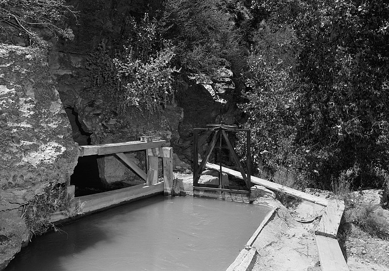
English: Along the Hurricane Canal east of Hurricane in Washington County, Utah, United States. At this point, the canal is going through a hole in a cliff. Built in 1904, the canal is listed on the National Register of Historic Places. |
|||||||||||||||||||||||||
| Date | ||||||||||||||||||||||||||
| Source | Library of Congress, Prints and Photograph Division HAER: UTAH,27-HURI,1-7 | |||||||||||||||||||||||||
| Author |
|
|||||||||||||||||||||||||
| Permission (Reusing this file) |
|
|||||||||||||||||||||||||
| Object location | | View this and other nearby images on: OpenStreetMap |
|---|

|
This image is available from the United States Library of Congress's Prints and Photographs division
under the digital ID hhh.ut0130. This tag does not indicate the copyright status of the attached work. A normal copyright tag is still required. See Commons:Licensing.
|
File history
Click on a date/time to view the file as it appeared at that time.
| Date/Time | Thumbnail | Dimensions | User | Comment | |
|---|---|---|---|---|---|
| current | 18:04, 23 May 2009 | | 4,647 × 3,233 (2.32 MB) | Cropbot | upload cropped version, operated by User:Finavon. Summary: border cropped |
| 17:39, 23 May 2009 |  | 5,000 × 3,548 (2.54 MB) | Nyttend | {{Information |Description={{en|Along the {{w|Hurricane Canal}} east of {{w|Hurricane, Utah|Hurricane}} in {{w|Washington County, Utah|Washington County}}, {{w|Utah}}, {{w|United States}}. Note that the canal, at this point, is going through a hole in a |
File usage
The following pages on the English Wikipedia use this file (pages on other projects are not listed):
Global file usage
The following other wikis use this file:
- Usage on ceb.wikipedia.org
- Usage on www.wikidata.org