Size of this preview: 640 × 599 pixels. Other resolutions: 256 × 240 pixels | 820 × 768 pixels | 1,093 × 1,024 pixels | 1,563 × 1,464 pixels.
Original file (1,563 × 1,464 pixels, file size: 1.19 MB, MIME type: image/jpeg)
| This is a file from the Wikimedia Commons. Information from its description page there is shown below. Commons is a freely licensed media file repository. You can help. |
Summary
| Description |
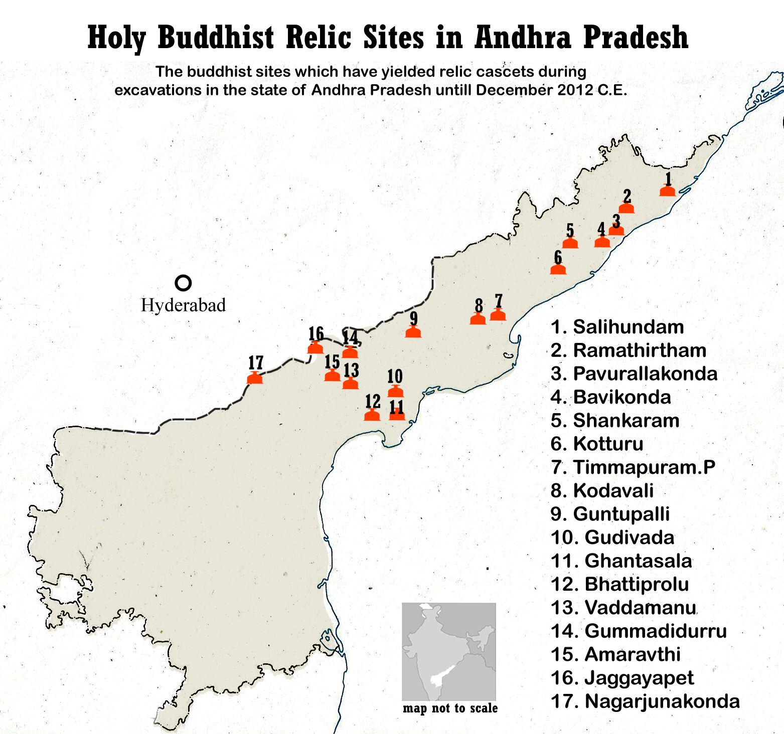
English: Buddhist sites map of Andhra Pradesh.
The excavated Buddhist sites which have yielded relic caskets during excavations in the state of Andhra Pradesh (numbered below and match those in the map above)
Other major Buddhist sites in Andhradesa from the 2nd-century BCE to 5th century CE. |
| Date | |
| Source | Own work |
| Author | Adityamadhav83 |
Illustration map not to scale. Details from AP State Museum, Hyderabad, India (with permission)
Licensing
I, the copyright holder of this work, hereby publish it under the following license:
This file is licensed under the Creative Commons Attribution-Share Alike 3.0 Unported license.
- You are free:
- to share – to copy, distribute and transmit the work
- to remix – to adapt the work
- Under the following conditions:
- attribution – You must give appropriate credit, provide a link to the license, and indicate if changes were made. You may do so in any reasonable manner, but not in any way that suggests the licensor endorses you or your use.
- share alike – If you remix, transform, or build upon the material, you must distribute your contributions under the same or compatible license as the original.
File history
Click on a date/time to view the file as it appeared at that time.
| Date/Time | Thumbnail | Dimensions | User | Comment | |
|---|---|---|---|---|---|
| current | 17:12, 8 May 2014 | | 1,563 × 1,464 (1.19 MB) | Adityamadhav83 | The file has been modified due to the bifurcation of Andhra Pradesh. Locator map of India has been added |
| 15:23, 25 April 2013 |  | 1,563 × 1,464 (1.17 MB) | Adityamadhav83 | User created page with UploadWizard |
File usage
The following pages on the English Wikipedia use this file (pages on other projects are not listed):
Global file usage
The following other wikis use this file:
- Usage on azb.wikipedia.org
- Usage on bn.wikipedia.org
- Usage on es.wikipedia.org
- Usage on hi.wikipedia.org
- Usage on it.wikipedia.org
- Usage on ka.wikipedia.org
- Usage on kn.wikipedia.org
- Usage on ml.wikipedia.org
- Usage on my.wikipedia.org
- Usage on or.wikipedia.org
- Usage on si.wikipedia.org
- Usage on ta.wikipedia.org
- Usage on te.wikipedia.org
- Usage on zh.wikipedia.org