Size of this preview: 800 × 456 pixels. Other resolutions: 320 × 183 pixels | 640 × 365 pixels | 1,024 × 584 pixels | 1,280 × 730 pixels | 2,560 × 1,460 pixels | 4,685 × 2,672 pixels.
Original file (4,685 × 2,672 pixels, file size: 7.02 MB, MIME type: image/png)
| This is a file from the Wikimedia Commons. Information from its description page there is shown below. Commons is a freely licensed media file repository. You can help. |
| Description |
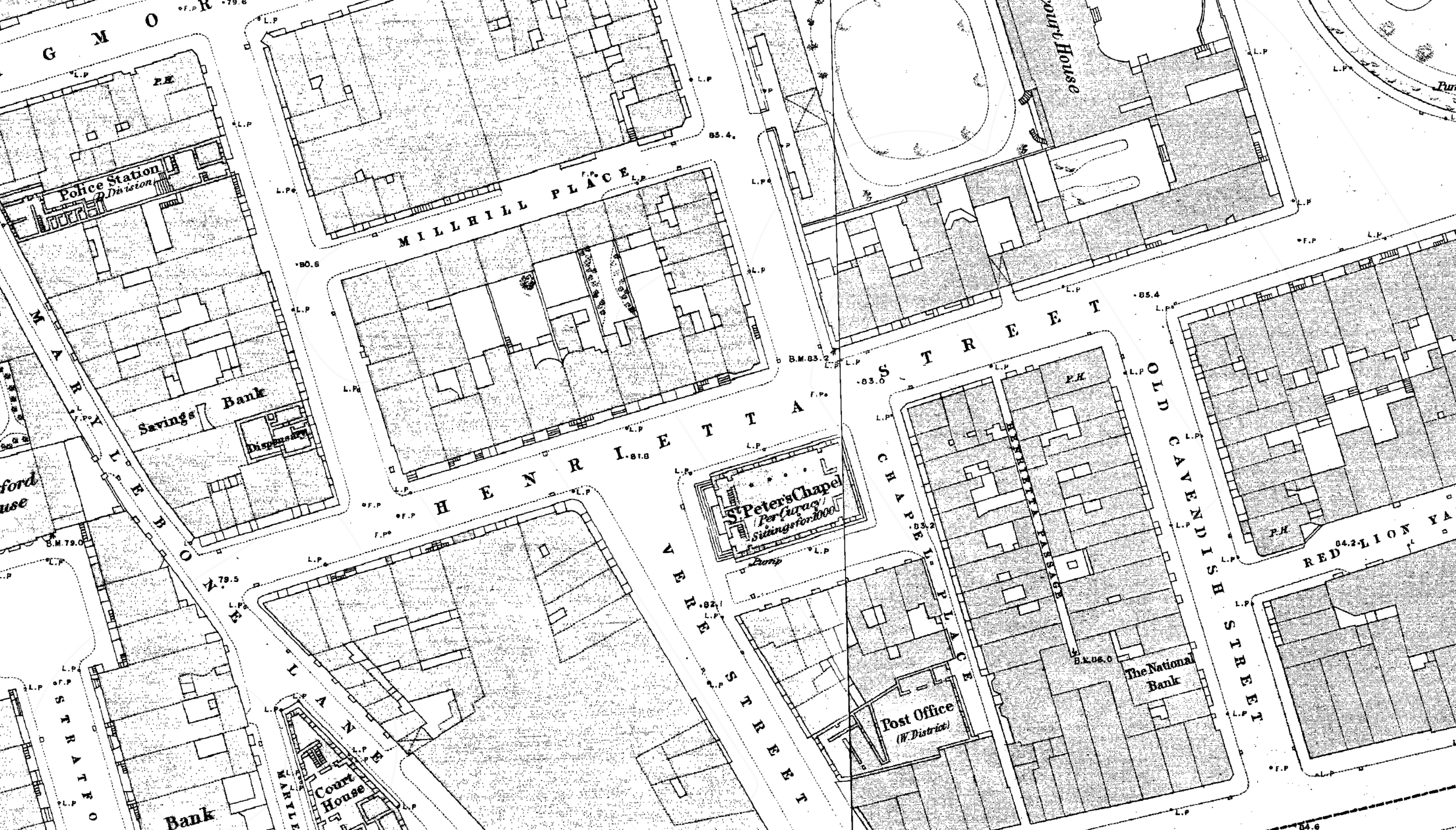
English: Henrietta Place 1870s Ordnance Survey map |
|||
| Date | 1870s | |||
| Source | Scan of original | |||
| Author | Ordnance Survey | |||
| Permission (Reusing this file) |
|

.png)
.png&action=edit&redlink=1)
.png)
File history
Click on a date/time to view the file as it appeared at that time.
| Date/Time | Thumbnail | Dimensions | User | Comment | |
|---|---|---|---|---|---|
| current | 12:26, 10 December 2016 | | 4,685 × 2,672 (7.02 MB) | Philafrenzy | {{Information |Description ={{en|1=Henrietta Place 1870s Ordnance Survey map}} |Source =Scan of original |Author =Ordnance Survey |Date =1870s |Permission ={{PD-UKGov}} |other_versions = }} [[Category:Street maps of Lo... |
File usage
The following pages on the English Wikipedia use this file (pages on other projects are not listed):
.png)