No higher resolution available.
Hanglip.jpg (800 × 600 pixels, file size: 119 KB, MIME type: image/jpeg)
| This is a file from the Wikimedia Commons. Information from its description page there is shown below. Commons is a freely licensed media file repository. You can help. |
Summary
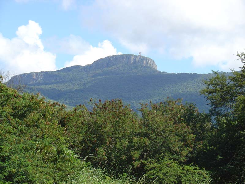
| Description |
Afrikaans: Hanglip en radarstasie in die sentrale Soutpansberg, soos vanaf Louis Trichardt gesien. Op 1 719 m is dit 700 m hoër as die dorp en een van die bergreeks se opvallende hoogtes. Vlamdorings groei in die voorgrond.
English: Hanglip promontory and radar station in the central Soutpansberg, as seen from Louis Trichardt. At 1,719 m, it is 700 m above the town, and one of the range's prominent hights. Flame thorns grow in the foreground. |
| Date | |
| Source | Own work (Original text: self-made) |
| Author | J.J. van Zyl |
| Camera location | | View this and other nearby images on: OpenStreetMap |
|---|
Licensing
Laura SA at the English Wikipedia, the copyright holder of this work, hereby publishes it under the following license:

|
Permission is granted to copy, distribute and/or modify this document under the terms of the GNU Free Documentation License, Version 1.2 or any later version published by the Free Software Foundation; with no Invariant Sections, no Front-Cover Texts, and no Back-Cover Texts. A copy of the license is included in the section entitled GNU Free Documentation License. |
| This file is licensed under the Creative Commons Attribution-Share Alike 3.0 Unported license. | ||
| Attribution: Laura SA at the English Wikipedia | ||
| ||
| This licensing tag was added to this file as part of the GFDL licensing update. |
Original upload log
Transferred from en.wikipedia to Commons by Herzi Pinki using CommonsHelper.
The original description page was here. All following user names refer to en.wikipedia.
- 2007-03-20 17:31 Laura SA 800×600× (121484 bytes) {{Information| |Description = Hanglip |Source = self-made |Date = 2005 |Author = JJ van Zyl |Permission = GFDL }}
File history
Click on a date/time to view the file as it appeared at that time.
| Date/Time | Thumbnail | Dimensions | User | Comment | |
|---|---|---|---|---|---|
| current | 22:14, 22 February 2010 | | 800 × 600 (119 KB) | File Upload Bot (Magnus Manske) | {{BotMoveToCommons|en.wikipedia|year={{subst:CURRENTYEAR}}|month={{subst:CURRENTMONTHNAME}}|day={{subst:CURRENTDAY}}}} {{Information |Description={{en|Hanglip promontory, overlooking Louis Trichardt}} |Source=Transferred from [http://en.wikipedia.org en. |
File usage
The following pages on the English Wikipedia use this file (pages on other projects are not listed):
Global file usage
The following other wikis use this file:
- Usage on af.wikipedia.org
- Usage on arz.wikipedia.org
- Usage on ast.wikipedia.org
- Usage on ca.wikipedia.org
- Usage on ceb.wikipedia.org
- Usage on es.wikipedia.org
- Usage on fr.wikipedia.org
- Usage on lld.wikipedia.org
- Usage on no.wikipedia.org
- Usage on sv.wikipedia.org
- Usage on uk.wikipedia.org
- Usage on www.wikidata.org
- Usage on zh.wikipedia.org