
Size of this PNG preview of this SVG file: 800 × 453 pixels. Other resolutions: 320 × 181 pixels | 640 × 362 pixels | 1,024 × 579 pixels | 1,280 × 724 pixels | 2,560 × 1,449 pixels | 1,267 × 717 pixels.
Original file (SVG file, nominally 1,267 × 717 pixels, file size: 1.12 MB)
| This is a file from the Wikimedia Commons. Information from its description page there is shown below. Commons is a freely licensed media file repository. You can help. |
| Description |
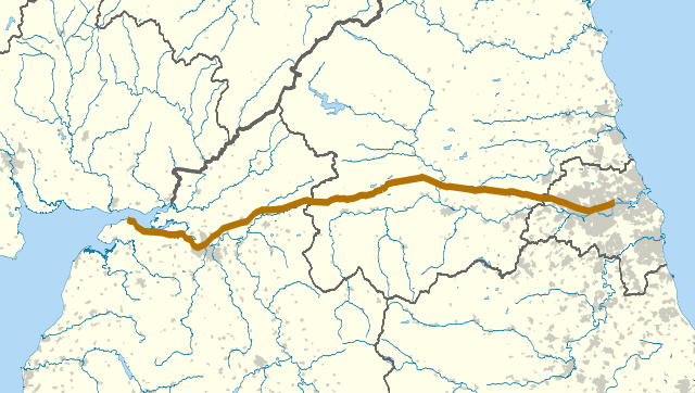
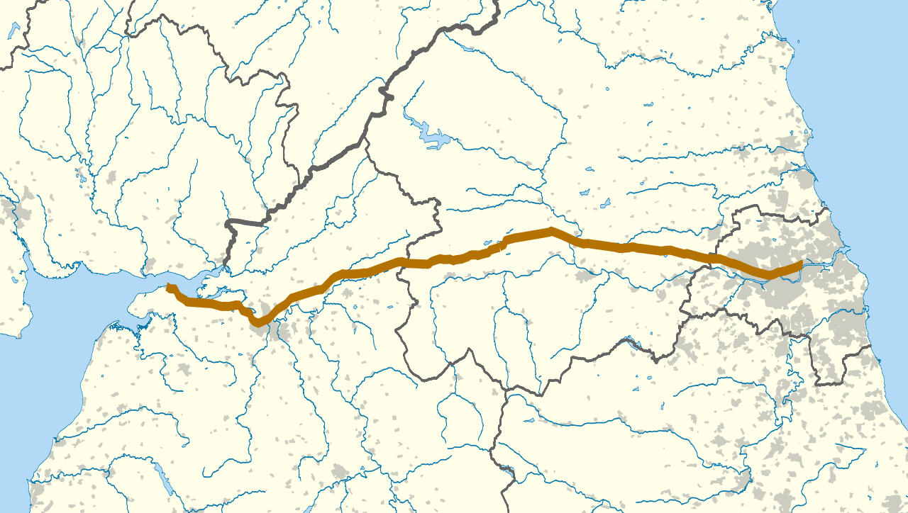
The route of Hadrian's Wall (in brown) in northern England. The background map shows modern counties and urban areas.
Geographic limits:
|
| Date | |
| Source |
|
| Author | Nilfanion |
| Permission (Reusing this file) |
This file is licensed under the Creative Commons Attribution-Share Alike 3.0 Unported license.
|
| Other versions | Derivative works of this file: Hadrian's Wall map A.svg |
File history
Click on a date/time to view the file as it appeared at that time.
| Date/Time | Thumbnail | Dimensions | User | Comment | |
|---|---|---|---|---|---|
| current | 22:06, 22 September 2010 | | 1,267 × 717 (1.12 MB) | Nilfanion | darker urban area, wall thicker |
| 22:00, 22 September 2010 |  | 1,267 × 717 (1.12 MB) | Nilfanion | {{Information |Description=The route of Hadrian's Wall (in brown) in northern England. The background map shows modern counties and urban areas. Equirectangular map projection on WGS 84 datum, with N/S stretched 170% Geographic lim |
File usage
The following pages on the English Wikipedia use this file (pages on other projects are not listed):
Global file usage
The following other wikis use this file:
- Usage on af.wikipedia.org
- Usage on es.wikipedia.org
- Usage on it.wikipedia.org
- Usage on ko.wikipedia.org
- Usage on lv.wikipedia.org
- Usage on mk.wikipedia.org
- Usage on ms.wikipedia.org
- Usage on pt.wikipedia.org
- Usage on ro.wikipedia.org
- Usage on sl.wikipedia.org
- Usage on zh.wikipedia.org