Size of this preview: 459 × 600 pixels. Other resolutions: 183 × 240 pixels | 367 × 480 pixels | 587 × 768 pixels | 783 × 1,024 pixels | 2,048 × 2,677 pixels.
Original file (2,048 × 2,677 pixels, file size: 1.03 MB, MIME type: image/png)
| This is a file from the Wikimedia Commons. Information from its description page there is shown below. Commons is a freely licensed media file repository. You can help. |
Summary
| Description |
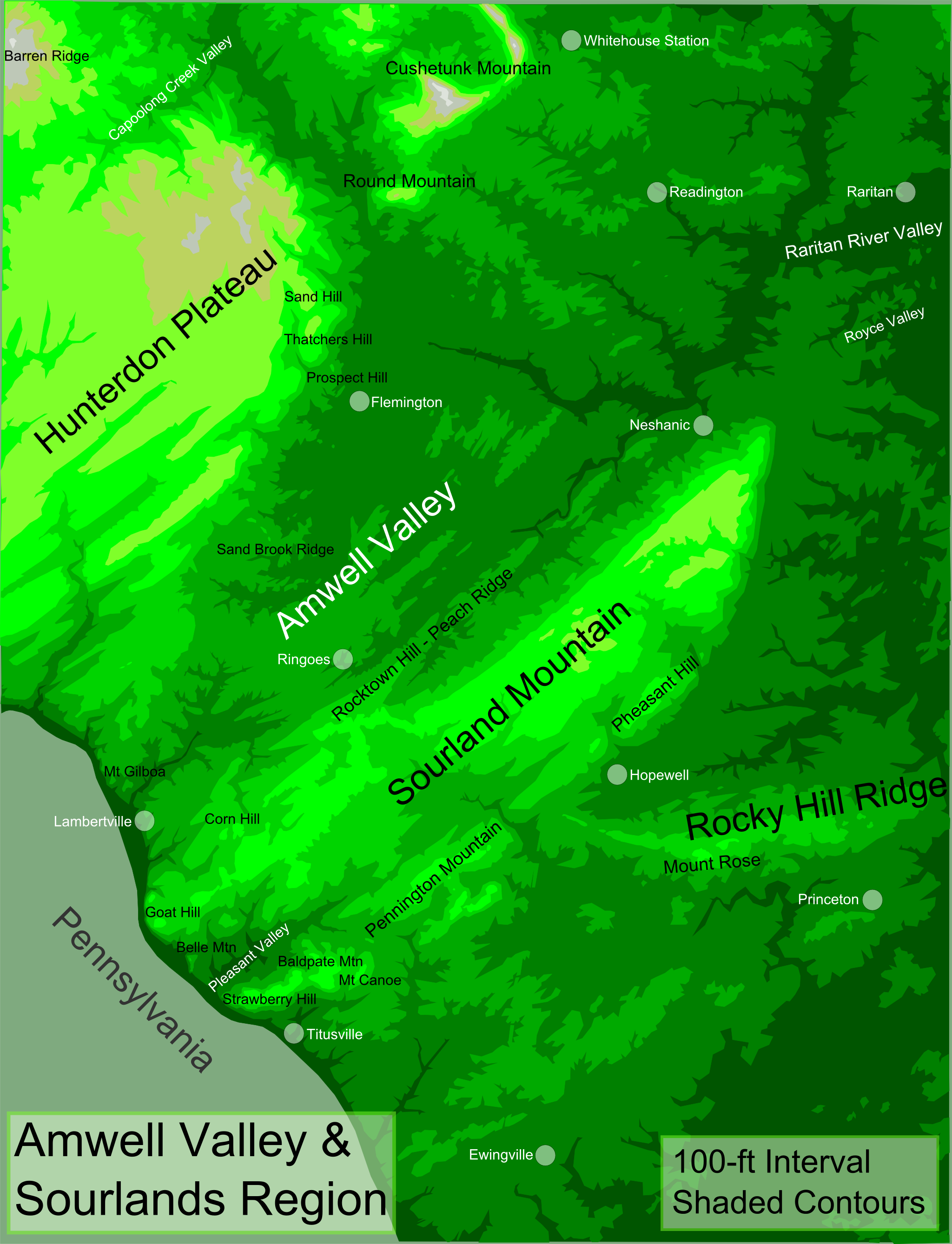
English: Topographic map of Greater Amwell and The Sourlands Region of New Jersey — featuring the Sourland Mountain ridge.
|
| Date | |
| Source | Own work |
| Author | Lithium6ion |
Licensing
| I, the copyright holder of this work, release this work into the public domain. This applies worldwide. In some countries this may not be legally possible; if so: I grant anyone the right to use this work for any purpose, without any conditions, unless such conditions are required by law. |
File history
Click on a date/time to view the file as it appeared at that time.
| Date/Time | Thumbnail | Dimensions | User | Comment | |
|---|---|---|---|---|---|
| current | 19:26, 31 December 2011 | | 2,048 × 2,677 (1.03 MB) | Lithium6ion | {{Information |Description ={{en|1=The map above uses shaded contours at 100-ft intervals to depict topography. Legend:<br> Darkest Green = 0-100 ft<br> Dark Green = 100-200 ft<br> Medium Green = 200-300 ft<br> Light Green = 300-400 ft<br> Lightest Gre |
File usage
The following pages on the English Wikipedia use this file (pages on other projects are not listed):
Global file usage
The following other wikis use this file:
- Usage on www.wikidata.org