Size of this preview: 800 × 556 pixels. Other resolutions: 320 × 222 pixels | 640 × 444 pixels | 1,024 × 711 pixels | 1,316 × 914 pixels.
Original file (1,316 × 914 pixels, file size: 314 KB, MIME type: image/png)
| This is a file from the Wikimedia Commons. Information from its description page there is shown below. Commons is a freely licensed media file repository. You can help. |
Summary
| Description | ||||
| Date | ||||
| Source | NOAA Central Library Data Imaging Project | |||
| Author | NOAA Central Library, Silver Spring, Maryland | |||
| Permission (Reusing this file) |
|
File history
Click on a date/time to view the file as it appeared at that time.
| Date/Time | Thumbnail | Dimensions | User | Comment | |
|---|---|---|---|---|---|
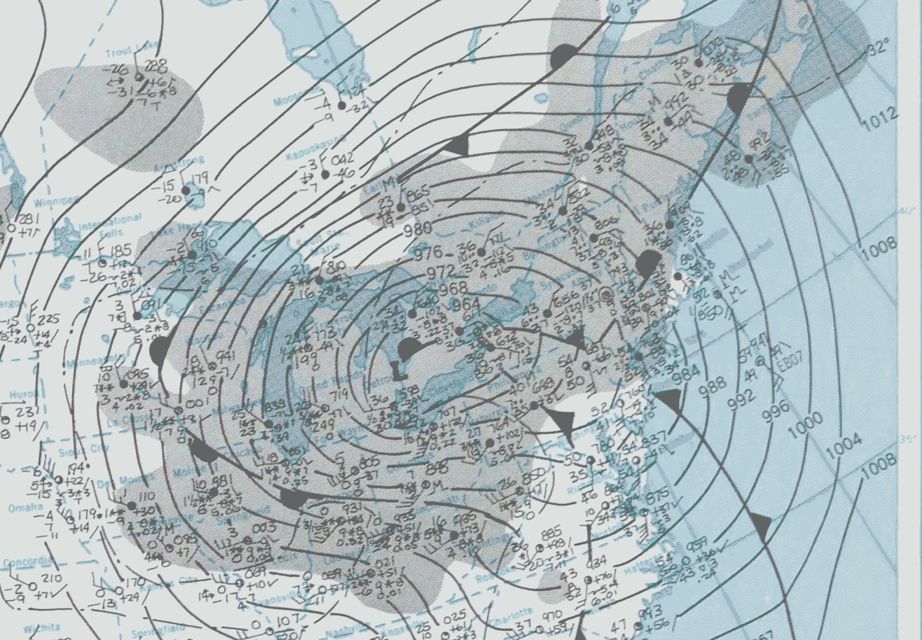
| current | 19:51, 19 January 2007 | | 1,316 × 914 (314 KB) | Dual Freq | {{Information |Description=January 17, 1982 Surface map |Source=Cropped from January 26, 1978 page of [http://docs.lib.noaa.gov/rescue/dwm/1978/19780123-19780129.djvu January 23 - January 29, 1978 weekly weather map] from [http://docs.lib.noaa.gov/rescue/ |
File usage
The following pages on the English Wikipedia use this file (pages on other projects are not listed):
Global file usage
The following other wikis use this file:
- Usage on fr.wikipedia.org
- Usage on is.wikipedia.org
- Usage on ja.wikipedia.org
- Usage on nds.wikipedia.org